MyTopo
Hartford Kentucky US Topo Map
Couldn't load pickup availability
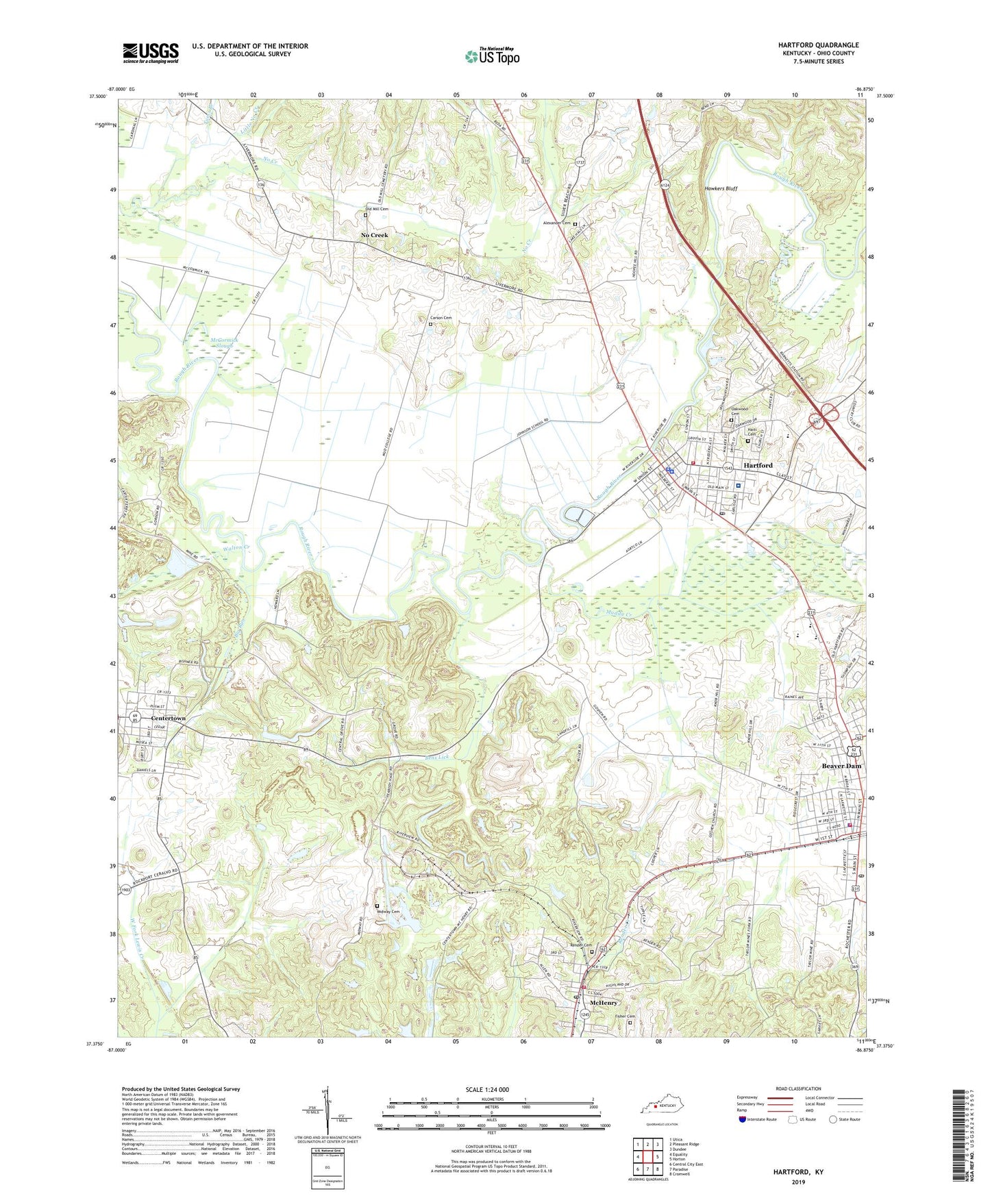
2022 topographic map quadrangle Hartford in the state of Kentucky. Scale: 1:24000. Based on the newly updated USGS 7.5' US Topo map series, this map is in the following counties: Ohio. The map contains contour data, water features, and other items you are used to seeing on USGS maps, but also has updated roads and other features. This is the next generation of topographic maps. Printed on high-quality waterproof paper with UV fade-resistant inks.
Quads adjacent to this one:
West: Equality
Northwest: Utica
North: Pleasant Ridge
Northeast: Dundee
East: Horton
Southeast: Cromwell
South: Paradise
Southwest: Central City East
This map covers the same area as the classic USGS quad with code o37086d8.
Contains the following named places: Alexander Cemetery, Beaver Dam, Beaver Dam Fire Department, Beaver Dam Police Department, Beaver Dam Post Office, Bens Lick, Big Run, Carson Cemetery, Centertown, Central Grove Church, City of Centertown, City of Hartford, City of McHenry, Fisher Cemetery, Goshen Church, Haiti Cemetery, Hartford, Hartford Fire Department, Hartford Police Department, Hartford Post Office, Hawkers Bluff, Little No Creek, McCormick Slough, McHenry, McHenry Fire Department, McHenry Post Office, Midway Cemetery, Muddy Creek, No Creek, North Fork Muddy Creek, Oakwood Cemetery, Ohio County Emergency Medical Services, Ohio County Hospital, Ohio County Sheriff's Office, Old Mill Cemetery, Render Cemetery, Rock House Slough, Sunshine Heliport, Taylor Mines, Taylor Mines Church, Toms Branch, Walton Creek, West Providence Church, WLLS-AM (Hartford), WLLS-FM (Hartford), ZIP Code: 42354