MyTopo
Paradise Kentucky US Topo Map
Couldn't load pickup availability
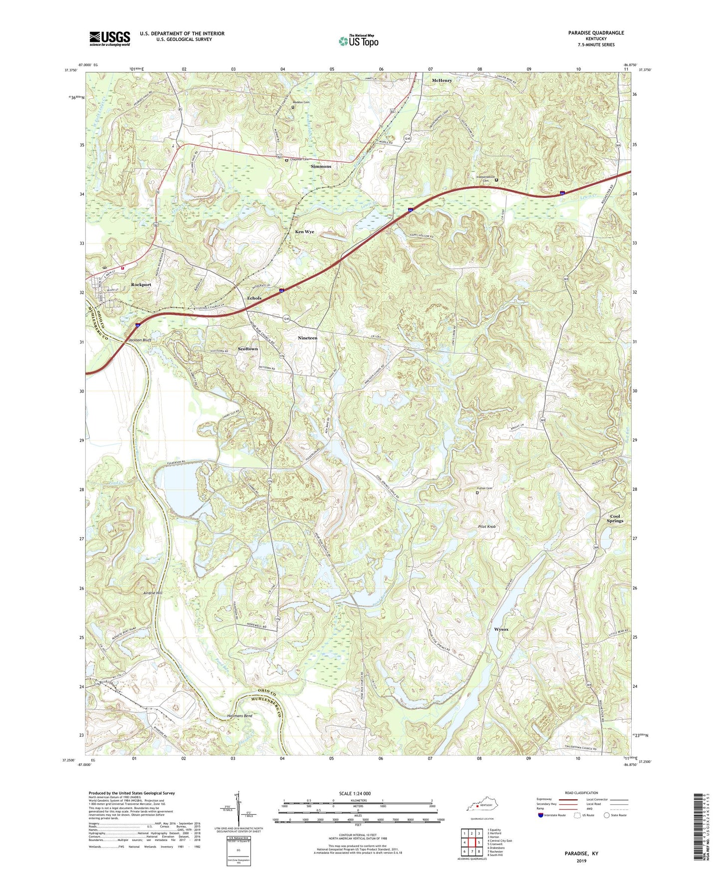
2022 topographic map quadrangle Paradise in the state of Kentucky. Scale: 1:24000. Based on the newly updated USGS 7.5' US Topo map series, this map is in the following counties: Ohio, Muhlenberg. The map contains contour data, water features, and other items you are used to seeing on USGS maps, but also has updated roads and other features. This is the next generation of topographic maps. Printed on high-quality waterproof paper with UV fade-resistant inks.
Quads adjacent to this one:
West: Central City East
Northwest: Equality
North: Hartford
Northeast: Horton
East: Cromwell
Southeast: South Hill
South: Rochester
Southwest: Drakesboro
This map covers the same area as the classic USGS quad with code o37086c8.
Contains the following named places: Airdrie Hill, Airdrie Iron Furnace, Chapman Cemetery, City of Rockport, Cool Springs, Echols, Fulton Cemetery, Hollmans Bend, Hopewell Church, Independence Cemetery, Independence Church, Jackson Bluff, Jacobs Creek, Ken Wye, Maddox Cemetery, McHenry-Rockport Division, Nineteen, Paradise, Pilot Knob, Pond Creek, Pond Run, Pond Run Church, Render Creek, Rockport, Rockport Fire Department, Rockport Post Office, Scottown, Simmons, Southards Creek, Taylortown Church, Wysox