MyTopo
Dundee Kentucky US Topo Map
Couldn't load pickup availability
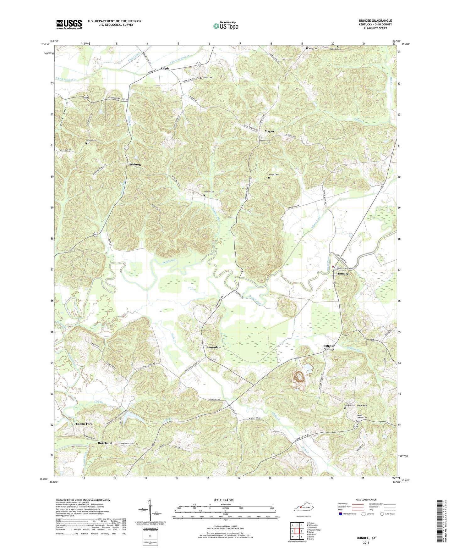
2022 topographic map quadrangle Dundee in the state of Kentucky. Scale: 1:24000. Based on the newly updated USGS 7.5' US Topo map series, this map is in the following counties: Ohio. The map contains contour data, water features, and other items you are used to seeing on USGS maps, but also has updated roads and other features. This is the next generation of topographic maps. Printed on high-quality waterproof paper with UV fade-resistant inks.
Quads adjacent to this one:
West: Pleasant Ridge
Northwest: Philpot
North: Whitesville
Northeast: Fordsville
East: Olaton
Southeast: Rosine
South: Horton
Southwest: Hartford
This map covers the same area as the classic USGS quad with code o37086e7.
Contains the following named places: Adaburg, Adams Fork, Antioch Church, Bean Hill, Beech Valley Church, Clear Run, Combs Ford, Concord Church, Dark Hollow, Dukehurst, Dundee, Dundee Fire Department, Halls Creek, Hedges Run, Humble Valley Church, Kelley Cemetery, Lick Branch, Magan, Marvins Chapel, McCarty Cemetery, MGT Station 2105 Heliport, Midkiff Cemetery, Mill Creek, Mount Vernon Cemetery, Patton Cemetery, Providence Church, Ralph, Ralph Cemetery, Ralph Chapel, Slovers Creek, Sugar Grove Church, Sugar Grove School, Sulphur Run, Sulphur Springs, Sunnydale, Taylor Branch, Wolf Creek, Wolfpen Run, Wright Cemetery, ZIP Code: 42338