MyTopo
Howe Valley Kentucky US Topo Map
Couldn't load pickup availability
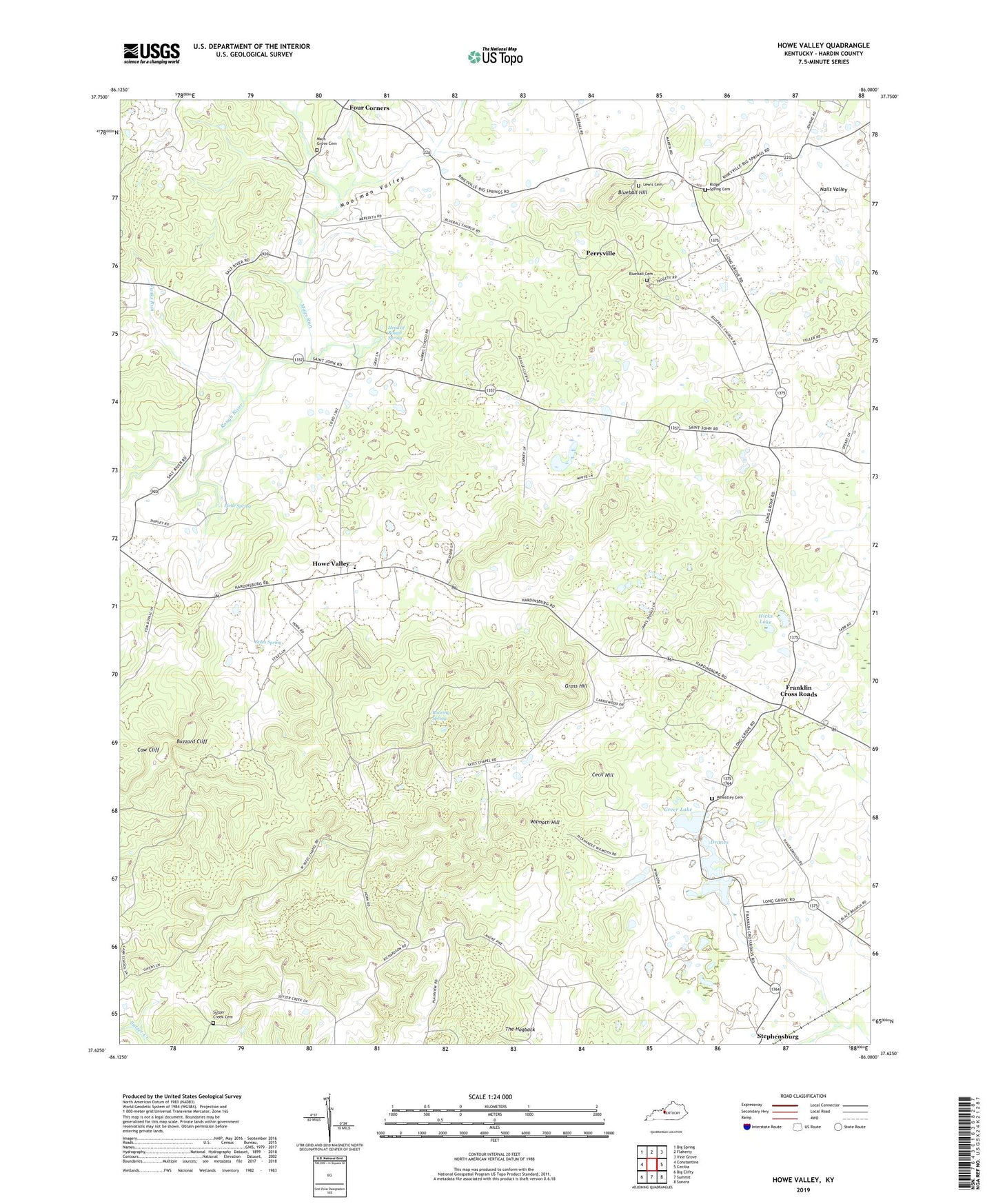
2022 topographic map quadrangle Howe Valley in the state of Kentucky. Scale: 1:24000. Based on the newly updated USGS 7.5' US Topo map series, this map is in the following counties: Hardin. The map contains contour data, water features, and other items you are used to seeing on USGS maps, but also has updated roads and other features. This is the next generation of topographic maps. Printed on high-quality waterproof paper with UV fade-resistant inks.
Quads adjacent to this one:
West: Constantine
Northwest: Big Spring
North: Flaherty
Northeast: Vine Grove
East: Cecilia
Southeast: Sonora
South: Summit
Southwest: Big Clifty
This map covers the same area as the classic USGS quad with code o37086f1.
Contains the following named places: Blue Ball Baptist Cemetery, Blueball Baptist Church, Blueball Hill, Buzzard Cliff, Cecil Hill, Cecilia Division, Cow Cliff, Dranes, Four Corners, Franklin Cross Roads, Funks Run, Greer Lake, Gross Hill, Head of Rough Spring, Hicks Lake, Howe Valley, Howe Valley Church, Lewis Cemetery, Mays Grove Cemetery, Mays Run, Miller Cemetery, Moorman Valley, Nalls Valley, Open Valley Church, Perryville, Pirtle Spring, Ridge Spring United Methodist Church Cemetery, Ridge Springs United Methodist Church, Roaring Spring, Stiles Spring, Sutzer Creek Cemetery, Sutzer Creek Church, The Hogback, Wheatley Cemetery, Wilmoth Hill, Yates Chapel, ZIP Code: 42724