MyTopo
Sonora Kentucky US Topo Map
Couldn't load pickup availability
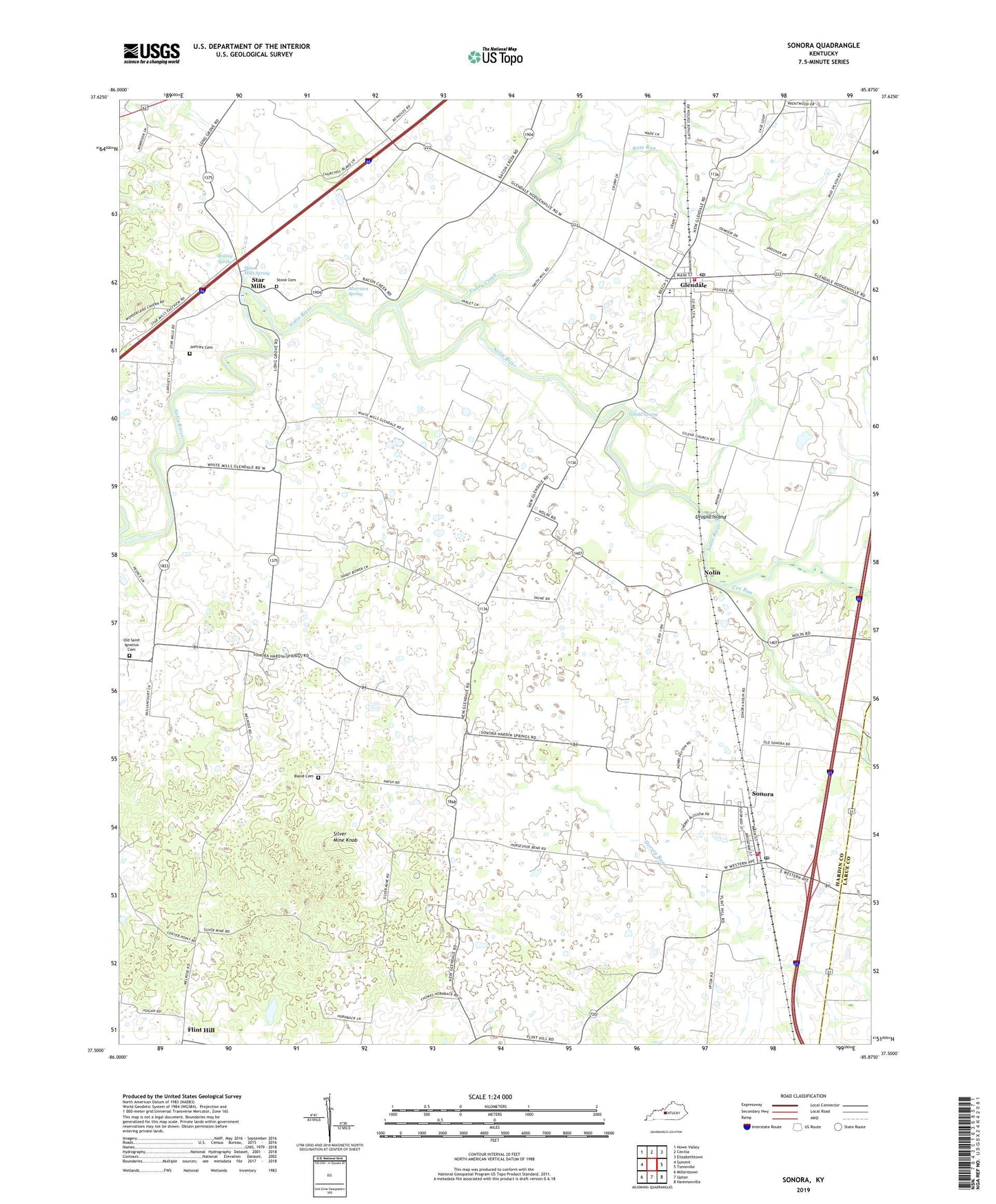
2022 topographic map quadrangle Sonora in the state of Kentucky. Scale: 1:24000. Based on the newly updated USGS 7.5' US Topo map series, this map is in the following counties: Hardin, Larue. The map contains contour data, water features, and other items you are used to seeing on USGS maps, but also has updated roads and other features. This is the next generation of topographic maps. Printed on high-quality waterproof paper with UV fade-resistant inks.
Quads adjacent to this one:
West: Summit
Northwest: Howe Valley
North: Cecilia
Northeast: Elizabethtown
East: Tonieville
Southeast: Hammonville
South: Upton
Southwest: Millerstown
This map covers the same area as the classic USGS quad with code o37085e8.
Contains the following named places: Arrow Spring, Blacks Branch, Bland Cemetery, Boiling Spring, Cherokee Spring, City of Sonora, Cox Run, Dorsey Run, East Hardin High School, Gilead Baptist Church, Gilead Spring, Glen Dale Childrens Home, Glendale, Glendale Post Office, Glendale Volunteer Fire Department, Jeffries Family Cemetery, Little Zion Church, Morrison Spring, Nolin, Old Saint Ignatius Cemetery, Old Stone Church Cemetery, Olive Hill Church, Rose Run, Saint Ignatius Church, Silver Mine Knob, Skees Spring, Sonora, Sonora Division, Sonora Fire Department, Sonora Post Office, Star Mills, Star Mills Spring, Taylors Bend Park, Utopia Island, Valley Creek, ZIP Codes: 42740, 42776