MyTopo
Summit Kentucky US Topo Map
Couldn't load pickup availability
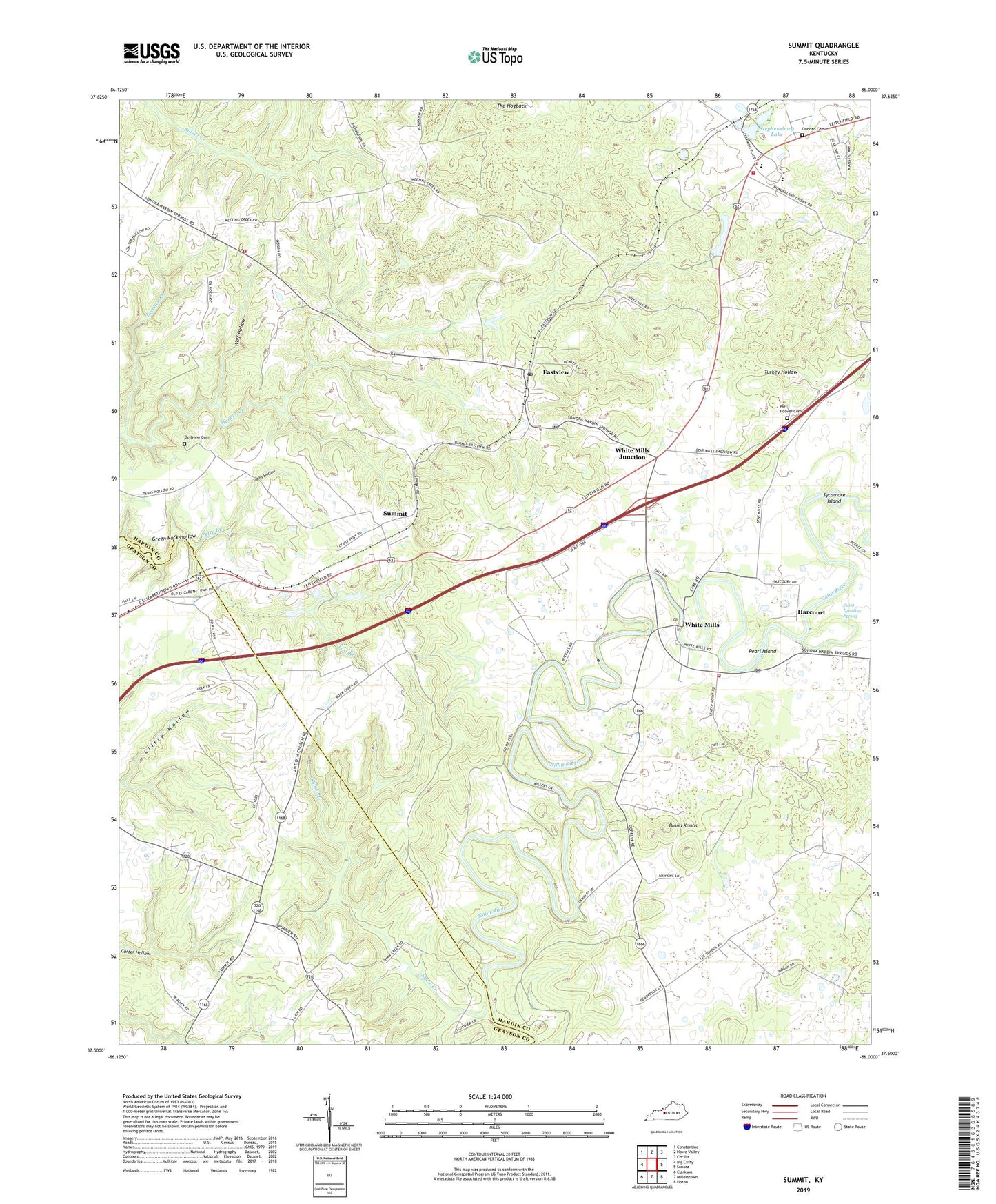
2022 topographic map quadrangle Summit in the state of Kentucky. Scale: 1:24000. Based on the newly updated USGS 7.5' US Topo map series, this map is in the following counties: Hardin, Grayson. The map contains contour data, water features, and other items you are used to seeing on USGS maps, but also has updated roads and other features. This is the next generation of topographic maps. Printed on high-quality waterproof paper with UV fade-resistant inks.
Quads adjacent to this one:
West: Big Clifty
Northwest: Constantine
North: Howe Valley
Northeast: Cecilia
East: Sonora
Southeast: Upton
South: Millerstown
Southwest: Clarkson
This map covers the same area as the classic USGS quad with code o37086e1.
Contains the following named places: Antioch Church, Beecher Branch, Bland Knobs, Center Point Church, Dellview Cemetery, Duncan Cemetery, Eastview, Eastview Post Office, Fairfield Church, Harcourt, Hoover Creek, Horns Place, Lee, Lilmay, Lost Branch, Lynnvale School, Meeting Creek Baptist Church, New Hope Church, Oak Ridge, Old Stephensburg, Parr - Hoover Cemetery, Pearl Island, Saint Ignatius Spring, Shaw Creek, Stephensburg, Stephensburg Fire Department, Stephensburg Lake, Summit, Sycamore Island, Tabbs Hollow, Turkey Hollow, West 84 Volunteer Fire Department Station 2, West Hardin High School, White Mills, White Mills Junction, White Mills Post Office, White Mills Volunteer Fire Department, Wolf Hollow, ZIP Codes: 42712, 42788