MyTopo
Kingswood Kentucky US Topo Map
Couldn't load pickup availability
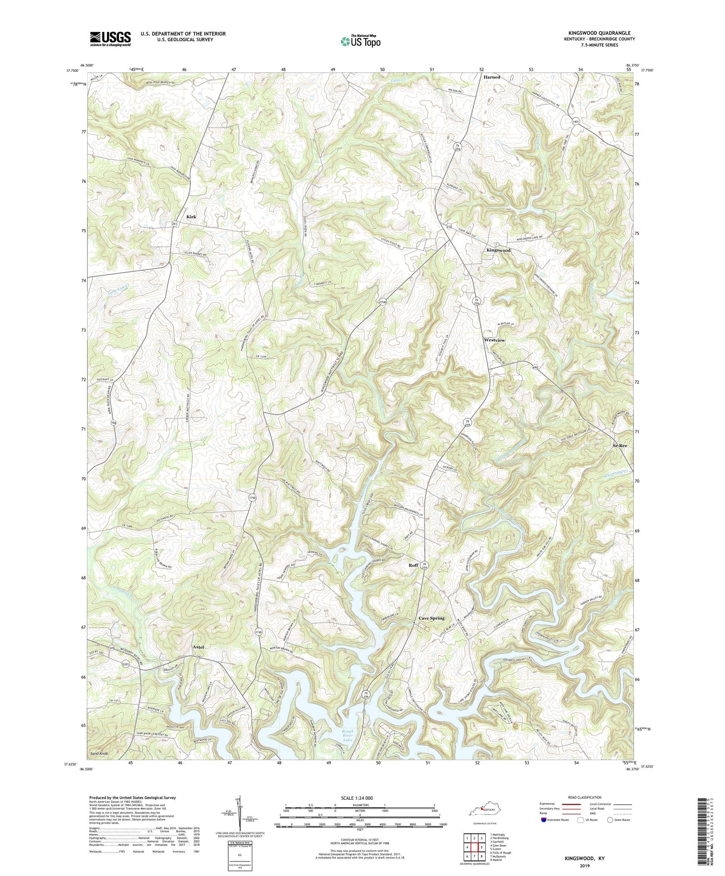
2022 topographic map quadrangle Kingswood in the state of Kentucky. Scale: 1:24000. Based on the newly updated USGS 7.5' US Topo map series, this map is in the following counties: Breckinridge. The map contains contour data, water features, and other items you are used to seeing on USGS maps, but also has updated roads and other features. This is the next generation of topographic maps. Printed on high-quality waterproof paper with UV fade-resistant inks.
Quads adjacent to this one:
West: Glen Dean
Northwest: Mattingly
North: Hardinsburg
Northeast: Garfield
East: Custer
Southeast: Madrid
South: McDaniels
Southwest: Falls of Rough
This map covers the same area as the classic USGS quad with code o37086f4.
Contains the following named places: Axtel, Buffalo Creek, Calamese Creek, Cave Spring, Cave Spring Church, Kingswood, Kirk, Mount Zion Church, Picnic Area Site 5, Roff, Saint Anthonys School, Sand Knob, Sand Knob Church, Se Ree, Tuckers Branch, Tules Creek, Westview, White Oak Creek, ZIP Code: 40178