MyTopo
Mattingly Kentucky US Topo Map
Couldn't load pickup availability
Also explore the Mattingly Forest Service Topo of this same quad for updated USFS data
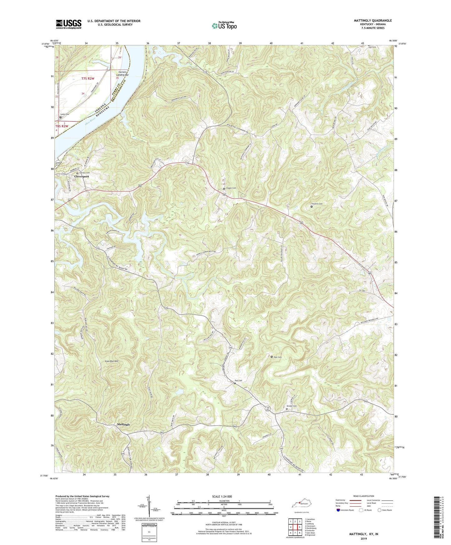
2022 topographic map quadrangle Mattingly in the states of Kentucky, Indiana. Scale: 1:24000. Based on the newly updated USGS 7.5' US Topo map series, this map is in the following counties: Breckinridge, Perry. The map contains contour data, water features, and other items you are used to seeing on USGS maps, but also has updated roads and other features. This is the next generation of topographic maps. Printed on high-quality waterproof paper with UV fade-resistant inks.
Quads adjacent to this one:
West: Cloverport
Northwest: Cannelton
North: Rome
Northeast: Lodiburg
East: Hardinsburg
Southeast: Kingswood
South: Glen Dean
Southwest: Fordsville
This map covers the same area as the classic USGS quad with code o37086g5.
Contains the following named places: Bear Run, Beech Fork, Bens Hole Branch, Bricker Cemetery, Bushlick Branch, Calvary Cemetery, Calvary Temple, Caney Creek, Carter Landing, Carters Landing Bar, Chapin Cemetery, Cloverport Division, First Coal Oil Production Historical Marker, Goehagan Creek, Hall Cemetery Number 1, Hawkins Cemetery, Hites Run, Hites Run Church, Iron Ore Hill, Lamb Cemetery, Little Beech Fork, Mattingly, New Bethel Church, New Clover Creek Church, Pate Cemetery, Pisgah Baptist Church, Sheep Falls Branch, Springlick Branch, Tar Fork, Taul Cemetery, Wildwood Chapel, ZIP Code: 40143