MyTopo
Oak Level Kentucky US Topo Map
Couldn't load pickup availability
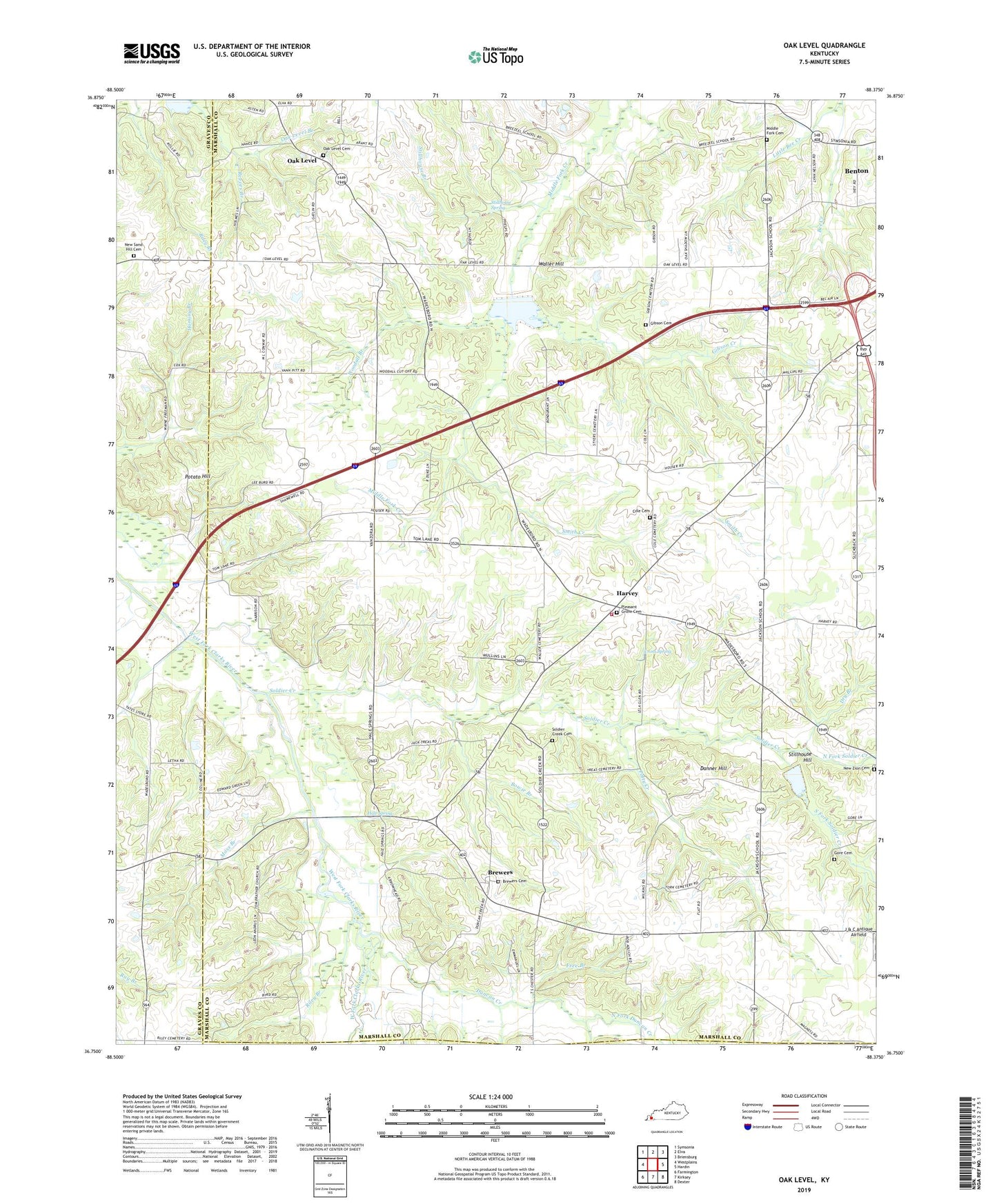
2022 topographic map quadrangle Oak Level in the state of Kentucky. Scale: 1:24000. Based on the newly updated USGS 7.5' US Topo map series, this map is in the following counties: Marshall, Graves, Calloway. The map contains contour data, water features, and other items you are used to seeing on USGS maps, but also has updated roads and other features. This is the next generation of topographic maps. Printed on high-quality waterproof paper with UV fade-resistant inks.
Quads adjacent to this one:
West: Westplains
Northwest: Symsonia
North: Elva
Northeast: Briensburg
East: Hardin
Southeast: Dexter
South: Kirksey
Southwest: Farmington
This map covers the same area as the classic USGS quad with code o36088g4.
Contains the following named places: Benton Division, Bowie Branch, Brewers, Brewers Cemetery, Caney Branch, Cole Cemetery, Cross Spring, Danner Hill, Dry Branch, Duncan Creek, Free Branch, Gibson Cemetery, Gibson Creek, Gore Cemetery, Graves County Line, Hale Spring, Harvey, Harvey Brewers Fire Station, J & C Antique Airfield, Jackson, Little Bee Creek, Middle Fork, Middle Fork Cemetery, Middle Fork Church, Moss Branch, New Bethel Baptist Church, New Home Church, New Sand Hill Cemetery, New Zion Cemetery, North Fork Duncan Creek, North Fork Soldier Creek, Oak Level, Oak Level Branch, Oak Level Cemetery, Patty Creek, Pleasant Grove Cemetery, Pleasant Grove Church, Pleasant Valley, Potato Hill, Reeves Branch, Riley Branch, Sand Hill Church, Smith Creek, Soldier Creek, Soldier Creek Cemetery, Soldier Creek Primitive Baptist Church, South Fork Duncan Creek, South Fork Soldier Creek, Stillhouse Branch, Stillhouse Hill, Stillhouse Spring, Vanzora, Vanzora Church, Waller Hill, Woodall, Woodall Branch