MyTopo
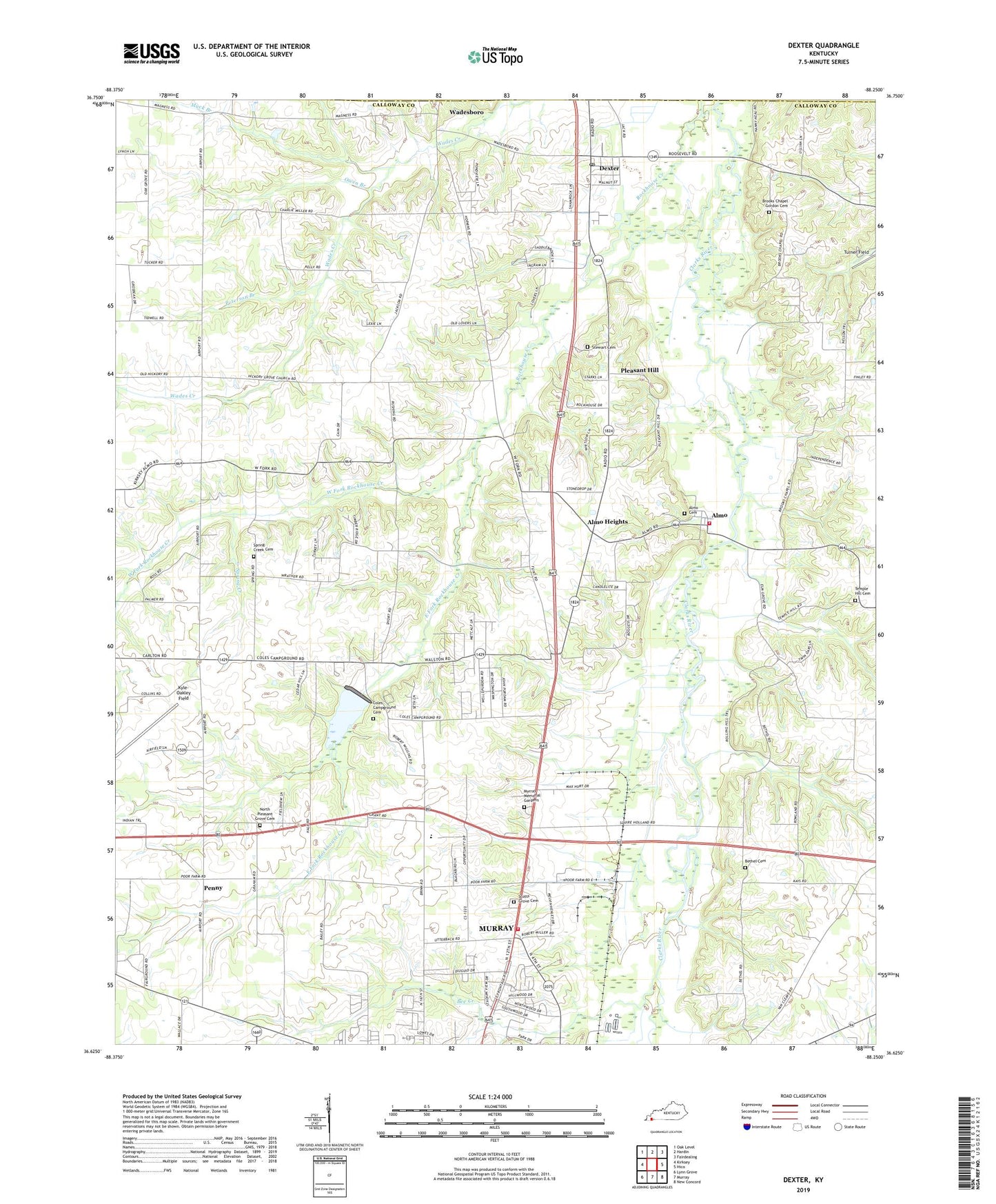
Dexter Kentucky US Topo Map
Couldn't load pickup availability
2022 topographic map quadrangle Dexter in the state of Kentucky. Scale: 1:24000. Based on the newly updated USGS 7.5' US Topo map series, this map is in the following counties: Calloway, Marshall. The map contains contour data, water features, and other items you are used to seeing on USGS maps, but also has updated roads and other features. This is the next generation of topographic maps. Printed on high-quality waterproof paper with UV fade-resistant inks.
Quads adjacent to this one:
West: Kirksey
Northwest: Oak Level
North: Hardin
Northeast: Fairdealing
East: Hico
Southeast: New Concord
South: Murray
Southwest: Lynn Grove
This map covers the same area as the classic USGS quad with code o36088f3.
Contains the following named places: Almo, Almo Cemetery, Almo Church, Almo Heights, Bee Creek, Bethel, Bethel Cemetery, Bethel Church, Blakely, Brooks Chapel, Brooks Chapel - Gordon Cemetery, Calloway County Fire and Rescue Station 4, Coles Campground Cemetery, Coles Campground Church, Dexter, Dexter Census Designated Place, Dexter Hardin Church, Dexter Post Office, East Fork Rockhouse Creek, Flint, Flint Church, Hickory Grove Church, Kyle-Oakley Field, Muck Branch, Murray Memorial Gardens, North Pleasant Grove Cemetery, North Pleasant Grove Church, Northside Church, Oak Grove Church, Owen Branch, Owen Chapel, Penny, Peterson Branch, Pleasant Hill, Rockhouse Creek, Scotts Grove Cemetery, Scotts Grove Church, Spring Creek, Spring Creek Cemetery, Spring Creek Church, Stewart Cemetery, Temple Hill, Temple Hill Cemetery, Temple Hill Church, Turner Field, Union Grove Church, Utterback, Wadesboro, West Fork Rockhouse Creek, WNBS-AM (Murray), WSJP-AM (Murray), WSPH-TV (Murray), ZIP Code: 42020