MyTopo
Symsonia Kentucky US Topo Map
Couldn't load pickup availability
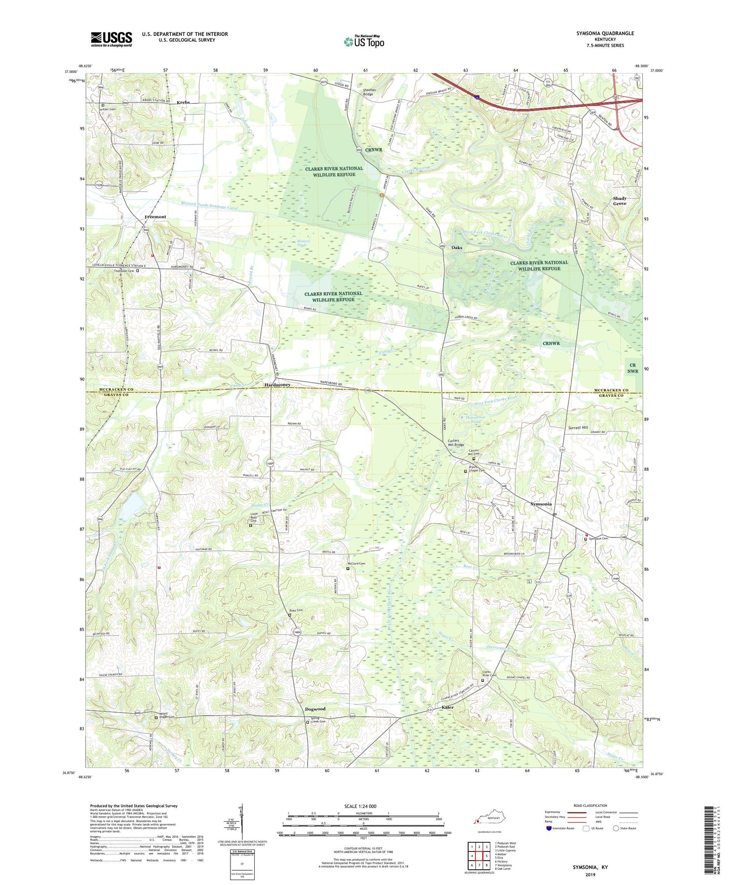
2022 topographic map quadrangle Symsonia in the state of Kentucky. Scale: 1:24000. Based on the newly updated USGS 7.5' US Topo map series, this map is in the following counties: Graves, McCracken. The map contains contour data, water features, and other items you are used to seeing on USGS maps, but also has updated roads and other features. This is the next generation of topographic maps. Printed on high-quality waterproof paper with UV fade-resistant inks.
Quads adjacent to this one:
West: Melber
Northwest: Paducah West
North: Paducah East
Northeast: Little Cypress
East: Elva
Southeast: Oak Level
South: Westplains
Southwest: Hickory
This map covers the same area as the classic USGS quad with code o36088h5.
Contains the following named places: Arnold Branch, Bear Creek, Black Cat, Blizzard Ponds, Blizzard Ponds Drainage Canal, Boaz Cemetery, Camp Creek, Carters Mill Bridge, Carters Mill Cemetery, Clarks River Cemetery, Clarks River Church, Concrete Church, Dogwood, Freemont, Freemont Fire Station, Freemont School, Garrett, Hardmoney, Hardmoney Church, Hodge Creek, Horseshoe Pond, Hurricane Branch, Kaler, Krebs, Little Boaz Cemetery, McClure Cemetery, Mount Pisgah Cemetery, Mount Pisgah Church, Mount Pleasant Church, Neece Chapel, North Graves Fire Station, Oak Grove Church, Oaks, Pryors Chapel Cemetery, Saint Johns-Freemont Division, Shady Grove, Sheehan Bridge, South Fork Camp Creek, Spring Creek Cemetery, Spring Creek Church, Sugar Creek, Sunny Slope, Sunny Slope Church of Christ, Surrett Hill, Switzer Cemetery, Symsonia, Symsonia Cemetery, Symsonia Census Designated Place, Symsonia Fire Department, Symsonia Post Office, Thompson Cemetery, West Fork Clarks River, West Kentucky Airpark, Woods, ZIP Code: 42082