MyTopo
Offutt Kentucky US Topo Map
Couldn't load pickup availability
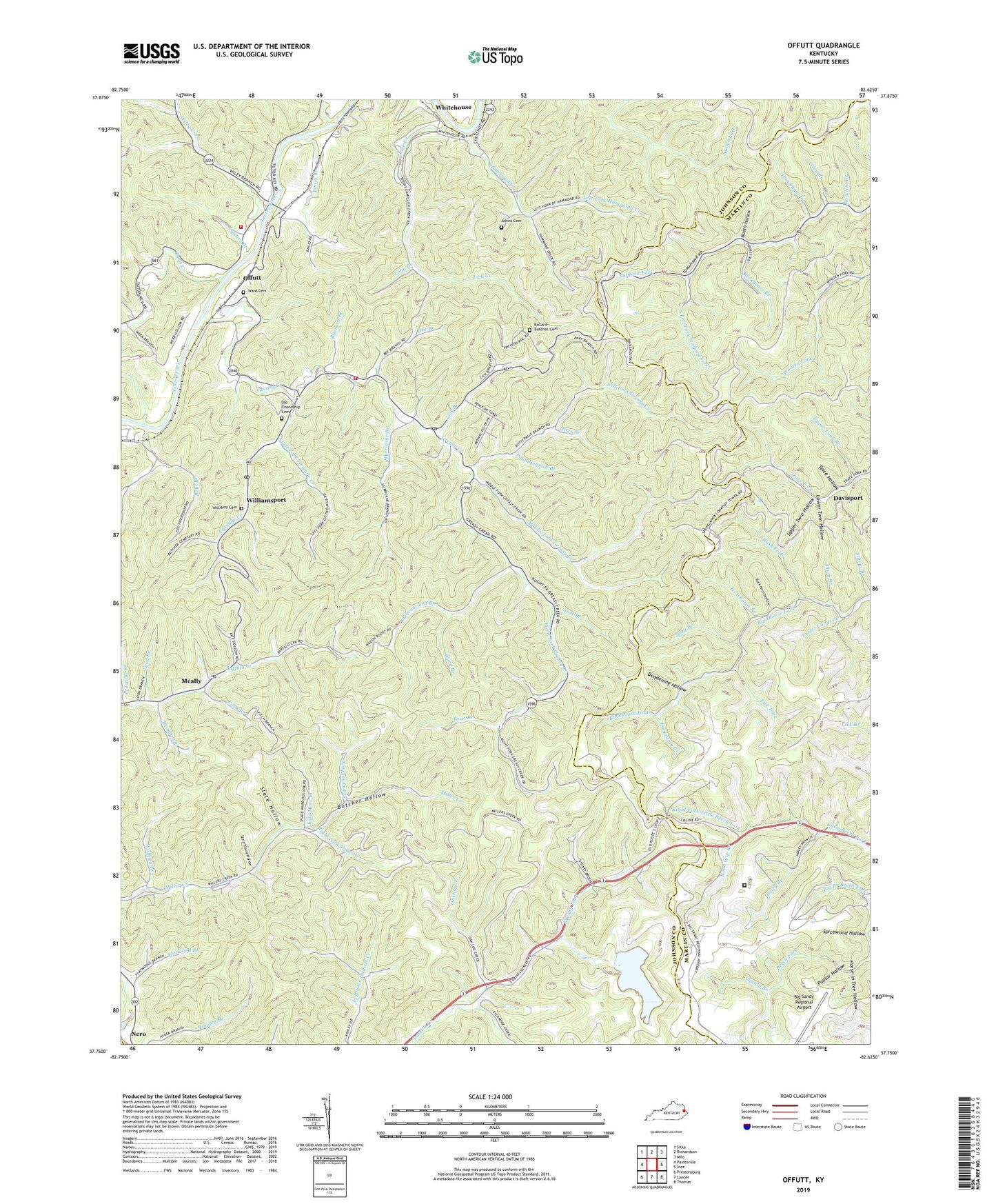
2022 topographic map quadrangle Offutt in the state of Kentucky. Scale: 1:24000. Based on the newly updated USGS 7.5' US Topo map series, this map is in the following counties: Johnson, Martin, Floyd. The map contains contour data, water features, and other items you are used to seeing on USGS maps, but also has updated roads and other features. This is the next generation of topographic maps. Printed on high-quality waterproof paper with UV fade-resistant inks.
Quads adjacent to this one:
West: Paintsville
Northwest: Sitka
North: Richardson
Northeast: Milo
East: Inez
Southeast: Thomas
South: Lancer
Southwest: Prestonsburg
This map covers the same area as the classic USGS quad with code o37082g6.
Contains the following named places: Atkins Cemetery, Ballard - Butcher Cemetery, Banjo Branch, Barkcamp Branch, Bear Branch, Bee Branch, Berry Branch, Bobs Branch, Boons Camp, Boons Camp Post Office, Booth Hollow, Brushy Fork, Buck Horn Hollow, Buffalo School, Buffalo United Baptist Church, Butcher Hollow, Butcher Hollow School, Buzzard Branch, Coon Branch, Daniels Branch, Deadening Branch, Deadening Hollow, Deadfall Branch, Fitch Branch, Greasy Creek, Greer Branch Little Beech Fork, Ground Hog Branch, Hammond Creek, Handmaul Branch, Haven of Rest, Head of Greasy School, Head of Rockhouse School, Hi Wooten Branch, Hog Branch Little Beech Fork, Holly Bush Branch, Honey Branch, Honey Branch Regional Industrial Park, Horse In Tree Hollow, Hurricane Branch, Hurricane Greasy School, Jade More Branch, Lackey Branch, Left Fork Greasy Creek, Left Fork Hammond Creek, Left Fork Lick Branch, Left Fork Stafford Fork, Left Fork Twomile Creek, Lick Branch, Lick Creek, Lick Fork, Little Friendship Church, Little Mission Church, Long Branch, Loon Branch, Lower Right Fork Long Branch, Lower Twin Hollow, Meade Memorial High School, Meally, Middle Fork Greasy Creek, Oaklog Creek, Odds, Offutt, Old Friendship Cemetery, Old Friendship Church, Otter Branch, Pea Vine Branch, Phillip Cove Church, Pigeonroost Branch, Pigeonroost School, Plum Branch, Poplar Hollow, Porter Camp Branch, Poundingmill Branch, Prestons Branch, Riches of Jesus Independent Baptist Church, Right Fork Bobs Branch, Right Fork Daniels Creek, Right Fork Greasy Creek, Right Fork Lick Branch, Right Fork Little Beech Fork, Right Fork Miller Creek, Right Fork Rush Fork, River, River Volunteer Fire Department, Road Gap Branch, Rockhouse Branch, Rocklick Branch, Rush Fork, Shanty Branch, Slate Hollow, Spears Branch, Spice Hollow, Spicewood Hollow, Spring Branch, Spring Knob Lookout Tower, Spruce Pin Branch, Stonecoal Fork, Store House Hollow, Stump Branch, Three Forks Greasy School, Toms Creek, Twomile Creek, United States Penetentary at Big Sandy, United States Penitentiary Big Sandy, Upper Daniels Creek School, Upper Long Branch, Upper Twin Hollow, Ward Branch, Ward Cemetery, Wells Chapel, Whitehouse, Wiley Creek, Williams Cemetery, Williamsport, Williamsport Post Office, Williamsport Volunteer Fire Department, Wolfpen Branch, Yost Branch, ZIP Codes: 41204, 41214, 41234, 41262, 41271


