MyTopo
Rosine Kentucky US Topo Map
Couldn't load pickup availability
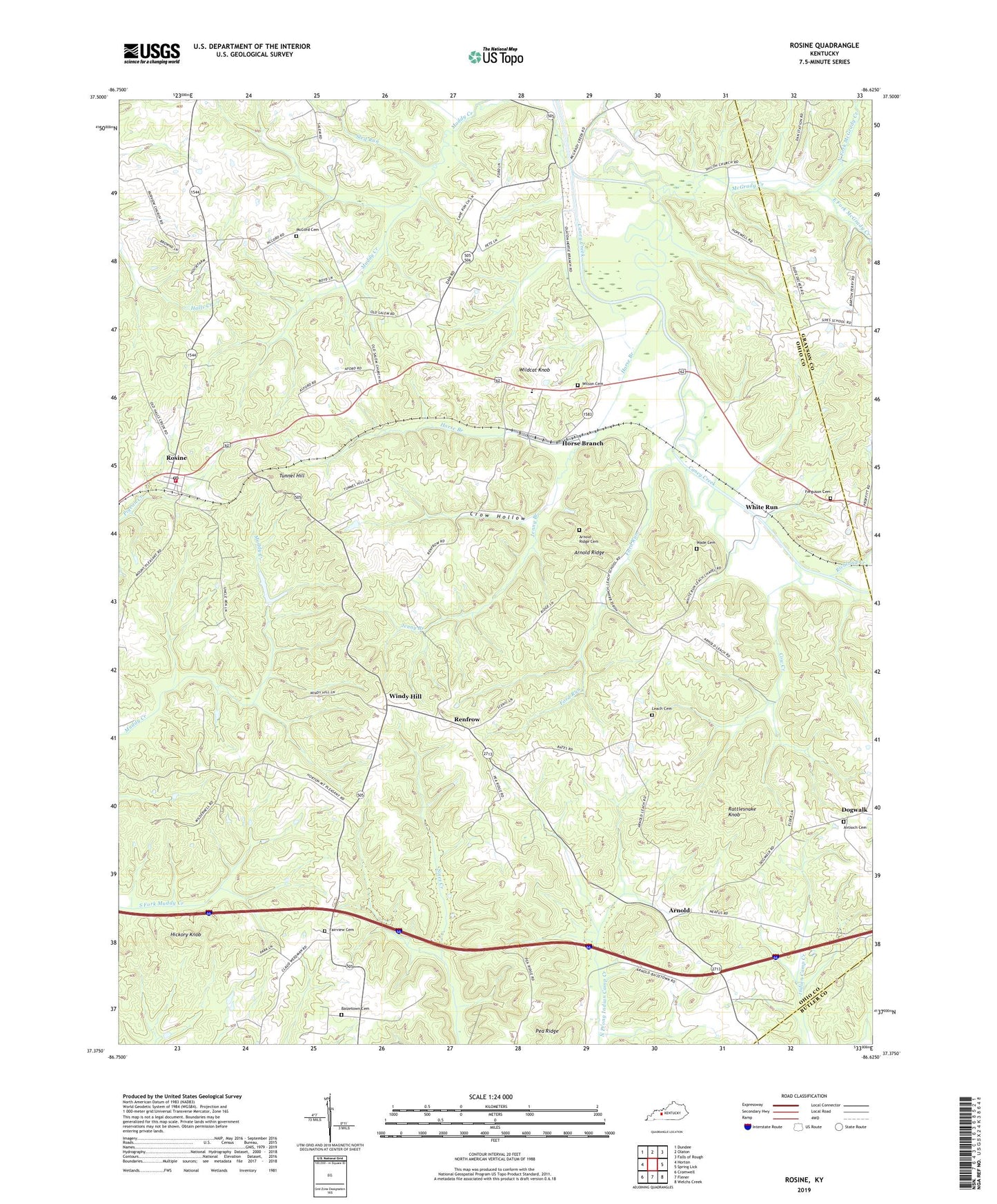
2022 topographic map quadrangle Rosine in the state of Kentucky. Scale: 1:24000. Based on the newly updated USGS 7.5' US Topo map series, this map is in the following counties: Ohio, Grayson, Butler. The map contains contour data, water features, and other items you are used to seeing on USGS maps, but also has updated roads and other features. This is the next generation of topographic maps. Printed on high-quality waterproof paper with UV fade-resistant inks.
Quads adjacent to this one:
West: Horton
Northwest: Dundee
North: Olaton
Northeast: Falls of Rough
East: Spring Lick
Southeast: Welchs Creek
South: Flener
Southwest: Cromwell
This map covers the same area as the classic USGS quad with code o37086d6.
Contains the following named places: Antioch Cemetery, Antioch Church, Arnold, Arnold Ridge, Arnold Ridge Cemetery, Baizetown Cemetery, Cane Run Church, Cow Creek, Crow Hollow, Dan, Dogwalk, East Fork McGrady Creek, Fairview Cemetery, Fairview Church, Ferguson Cemetery, Ford Run, Hickory Knob, Hopewell Church, Horse Branch, Horse Branch Division, Jenny Branch, Leach Cemetery, Leach Chapel, McCord Cemetery, McGrady Creek, North Fork McGrady Creek, Pea Ridge, Rattlesnake Knob, Renfrow, Richland Creek, Rosine, Rosine Census Designated Place, Rosine Fire Department, Rosine Post Office, Salem Church, Shiloh Church, Sled Run, Tunnel Hill, Wade Cemetery, White Run, Wildcat Knob, Wilson Cemetery, Windy Hill, ZIP Codes: 42349, 42370