MyTopo
Olaton Kentucky US Topo Map
Couldn't load pickup availability
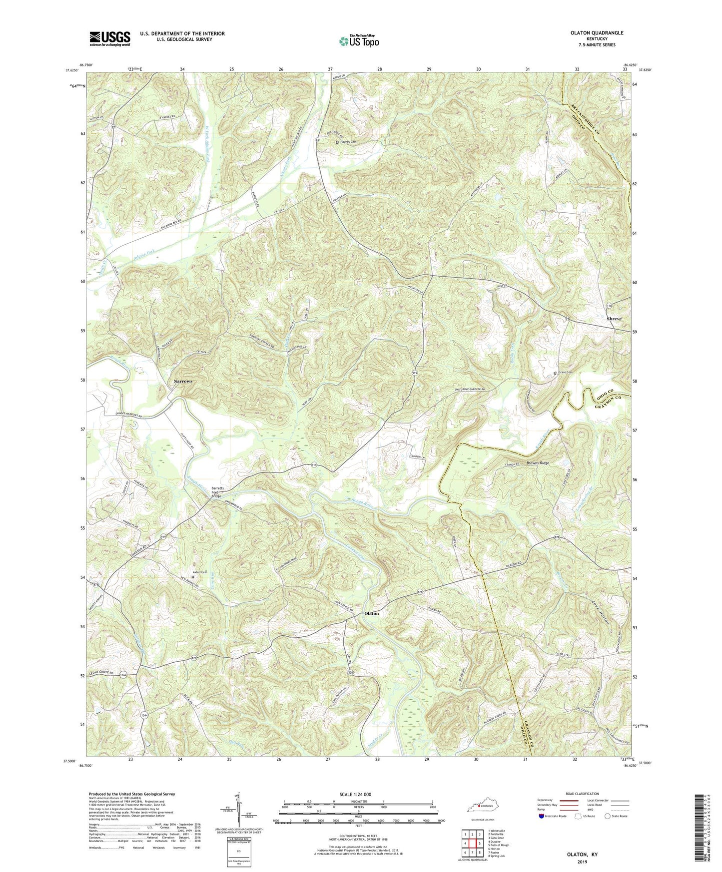
2022 topographic map quadrangle Olaton in the state of Kentucky. Scale: 1:24000. Based on the newly updated USGS 7.5' US Topo map series, this map is in the following counties: Ohio, Grayson, Breckinridge. The map contains contour data, water features, and other items you are used to seeing on USGS maps, but also has updated roads and other features. This is the next generation of topographic maps. Printed on high-quality waterproof paper with UV fade-resistant inks.
Quads adjacent to this one:
West: Dundee
Northwest: Whitesville
North: Fordsville
Northeast: Glen Dean
East: Falls of Rough
Southeast: Spring Lick
South: Rosine
Southwest: Horton
This map covers the same area as the classic USGS quad with code o37086e6.
Contains the following named places: Axton Cemetery, Barretts Ford Bridge, Browns Creek, Browns Ridge, Brush Run, Cane Run, Caney Creek, Cedar Grove Church, Cove Hollow, Davidson Station, Fallen Rock School, Grant Cemetery, Haynes Cemetery, Huff Creek, Huff Creek Church, Long Spring Branch, McGrady Creek Church, Muddy Creek, Narrows, New Baymus Church, Olaton, Payton School, Pleasant Grove Church, Rocky Fork, Saint Johns Church, Shreve, Smith Creek, West Fork Adams Fork, ZIP Code: 42361