MyTopo
Salvisa Kentucky US Topo Map
Couldn't load pickup availability
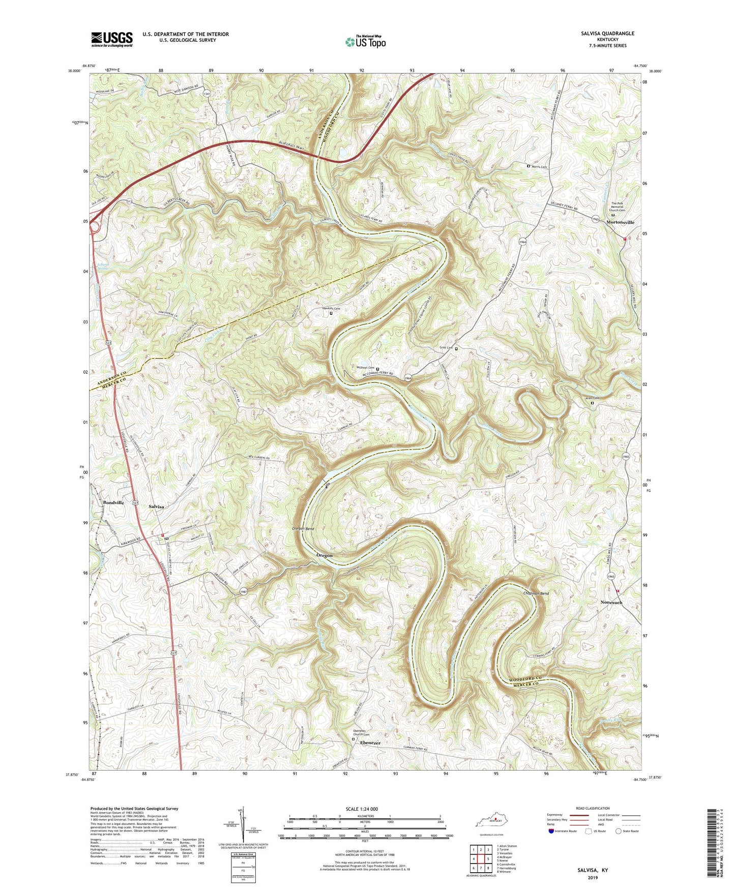
2022 topographic map quadrangle Salvisa in the state of Kentucky. Scale: 1:24000. Based on the newly updated USGS 7.5' US Topo map series, this map is in the following counties: Woodford, Mercer, Anderson. The map contains contour data, water features, and other items you are used to seeing on USGS maps, but also has updated roads and other features. This is the next generation of topographic maps. Printed on high-quality waterproof paper with UV fade-resistant inks.
Quads adjacent to this one:
West: McBrayer
Northwest: Alton Station
North: Tyrone
Northeast: Versailles
East: Keene
Southeast: Wilmore
South: Harrodsburg
Southwest: Cornishville
This map covers the same area as the classic USGS quad with code o37084h7.
Contains the following named places: Allen Cemetery, Bondville, Bondville Post Office, Brushy Run, Camp Otonk, Chapman Bend, Clay Lick Church, Clay Lick Creek, Clear Creek, Cottage Home Farm, Craig Creek, Cummins Ferry, Daniel Brewers Mill, Ebenezer, Ebenezer Church Cemetery, Ebenezer Church of Christ, Ebenezer Post Office, Gilbert Creek, Gray Cemetery, Hawkins Cemetery, Hebron Church, Hillsborough Church, Houchin, Landing Run, Lillards Ferry, Lillards Spring, Lock Number 6, McCalls Spring Historical Marker, McCouns Ferry, Morris Cemetery, Mortonsville, Mortonsville Elementary School, Mortonsville Post Office, Mount Edwin Church, New Providence Presbyterian Church, Nonesuch, Nonesuch Post Office, Nonesuch School, Oregon, Oregon Bend, Salvisa, Salvisa Census Designated Place, Salvisa Fire Department, Salvisa Post Office, Salvisa Railroad Station, Salvisa School, Scotts Ferry, Sellers Mill, Tanners Creek, The Polk Memorial Church Cemetery, Warwick Ferry, Warwick Post Office, Willhoyt Cemetery, Woodford County Fire Department Station 3, Woodford County Fire Department Station 5