MyTopo
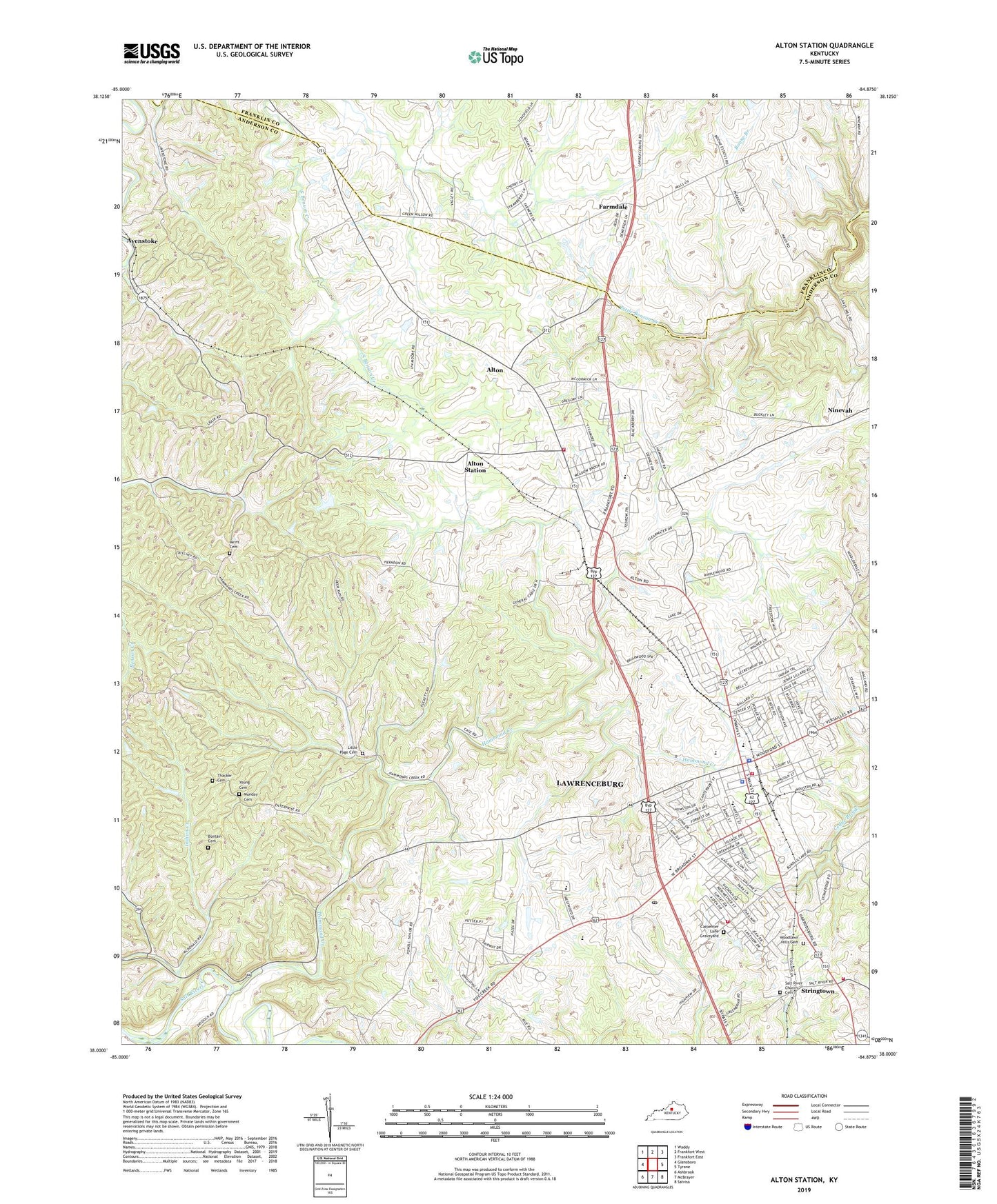
Alton Station Kentucky US Topo Map
Couldn't load pickup availability
2022 topographic map quadrangle Alton Station in the state of Kentucky. Scale: 1:24000. Based on the newly updated USGS 7.5' US Topo map series, this map is in the following counties: Anderson, Franklin. The map contains contour data, water features, and other items you are used to seeing on USGS maps, but also has updated roads and other features. This is the next generation of topographic maps. Printed on high-quality waterproof paper with UV fade-resistant inks.
Quads adjacent to this one:
West: Glensboro
Northwest: Waddy
North: Frankfort West
Northeast: Frankfort East
East: Tyrone
Southeast: Salvisa
South: McBrayer
Southwest: Ashbrook
This map covers the same area as the classic USGS quad with code o38084a8.
Contains the following named places: Akins Cemetery, Alton, Alton Church, Alton Post Office, Alton Railroad Station, Alton School, Alton Station, Alton Station Post Office, Anderson County, Anderson County Emergency Medical Services, Anderson County Fire District Station 1, Anderson County Fire District Station 2, Anderson County Sheriff's Office, Anna Mac Clarke Historical Marker, Arnold Spring, Boone Branch, Buckberry College, Buntain Cemetery, Carpenter Lane Graveyard, City of Lawrenceburg, Farmdale, Farmdale Post Office, Farmers Store, Fellowship Church, Franklin County Childrens Home, Franklin County Farm, Grafton Post Office, Gudgel, Gudgel Post Office, Hammond Creek, Heritage Church, Huffmans Distillery, James Beauchamp Clark Historical Marker, Lanes Mill, Lawrenceburg, Lawrenceburg Division, Lawrenceburg Fire and Rescue Department Station 1, Lawrenceburg Fire Rescue Station 2, Lawrenceburg Police Department, Lawrenceburg Post Office, Little Page Cemetery, Morgans First Kentucky Raid Historical Marker, Ninevah, Nineveh Post Office, Providence Church, Salt River Church, Salt River Church Cemetery, Salt River Church Historical Marker, Sand Spring Church, Sand Spring School, Stringtown, Thacker - Munday Cemetery, Thacker Cemetery, Victory Chapel, William H Townsend Historical Marker, Woodlawn Hills Cemetery, Young Cemetery


