MyTopo
McBrayer Kentucky US Topo Map
Couldn't load pickup availability
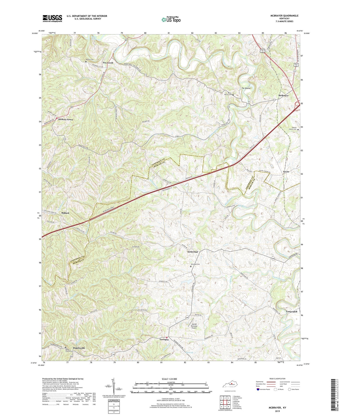
2022 topographic map quadrangle McBrayer in the state of Kentucky. Scale: 1:24000. Based on the newly updated USGS 7.5' US Topo map series, this map is in the following counties: Mercer, Anderson. The map contains contour data, water features, and other items you are used to seeing on USGS maps, but also has updated roads and other features. This is the next generation of topographic maps. Printed on high-quality waterproof paper with UV fade-resistant inks.
Quads adjacent to this one:
West: Ashbrook
Northwest: Glensboro
North: Alton Station
Northeast: Tyrone
East: Salvisa
Southeast: Harrodsburg
South: Cornishville
Southwest: Cardwell
This map covers the same area as the classic USGS quad with code o37084h8.
Contains the following named places: Alford Post Office, Anderson County Fire District Station 5, Ballard, Ballard Baptist Church, Ballard Post Office, Battle of Perryville Hisorical Marker, Boiling Spring, Bond - McCoy Cemetery, Buchanan Creek, Dugansville, Dugansville Post Office, Fairview School, Floyd Post Office, Forsythe Mill, Fox Creek, Fox Creek Christian Church, Fox Creek Post Office, Fox Creek School, Goshen Baptist Church, Harold Reynolds Airport, Hebron Church Cemetery, Hebron School, Hettie Post Office, Hickory Grove, Hickorynut Creek, John W. Finnells Mill, Kirkwood, Kirkwood Baptist Church, Kirkwood Cemetery, Kirkwood Post Office, Lucto, Lucton, Lyons Branch, McBrayer, McBrayer Post Office, McBrayer Railroad Station, Mount Hebron Cemetery, Mount Hebron United Methodist Church, Mullins Cemetery, Nevin, Nevin Post Office, Nevin Railroad Station, Rices Mill, Ripyville Post Office, Ripyville School, Salvisa-McAfee Division, Sidney, Sidney Post Office, Terrapin, Terrapin - Dugansville Fire Department, The Mound, Vanarsdell, Vanarsdell Post Office, Vanarsdell Railroad Station, Young School, ZIP Codes: 40342, 40372