MyTopo
Sulphur Lick Kentucky US Topo Map
Couldn't load pickup availability
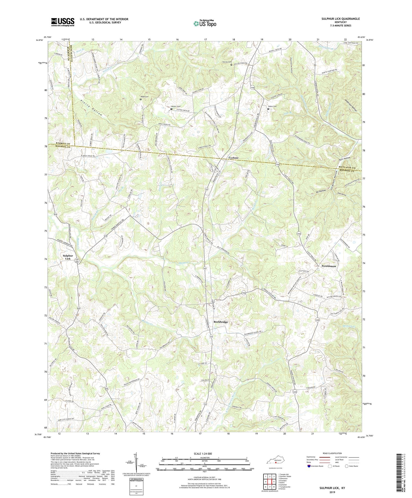
2022 topographic map quadrangle Sulphur Lick in the state of Kentucky. Scale: 1:24000. Based on the newly updated USGS 7.5' US Topo map series, this map is in the following counties: Monroe, Metcalfe, Barren. The map contains contour data, water features, and other items you are used to seeing on USGS maps, but also has updated roads and other features. This is the next generation of topographic maps. Printed on high-quality waterproof paper with UV fade-resistant inks.
Quads adjacent to this one:
West: Freedom
Northwest: Temple Hill
North: Summer Shade
Northeast: Edmonton
East: Dubre
Southeast: Vernon
South: Tompkinsville
Southwest: Gamaliel
This map covers the same area as the classic USGS quad with code o36085g6.
Contains the following named places: Belcher Creek, Bowman School, Branstetter Park, Bray School, Corinth Church, Cyclone, Dry Branch, Dubree Cemetery, Fergusson Hollow, Flood Catcher Hollow, Gee - Harvey Cemetery, Goodson School, Goose Creek, Hamilton School, Hurt Hollow, Ivy Hill School, Jobe Branch, Marietta School, Merryville School, Mosier Cemetery, Muncie Branch, Persimmon, Philippi Church, Piercy Hollow, Pleasant Hill Church, Red Hill Church, Rockbridge, Rockbridge School, Sal Hollow, Shop Hollow, Skaggs Creek Church, Stillhouse Branch, Sulphur Lick, Union Hill School, Wade Cemetery, White Church, White School, Willow Springs School, ZIP Code: 42124