MyTopo
Vernon Kentucky US Topo Map
Couldn't load pickup availability
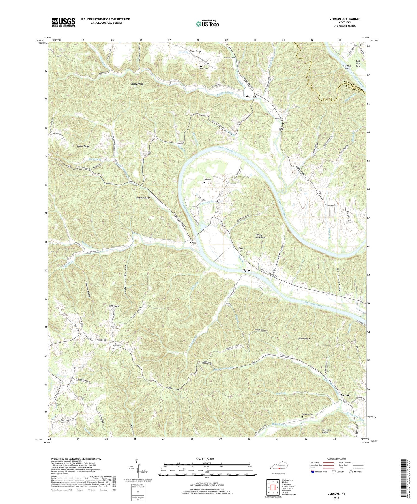
2022 topographic map quadrangle Vernon in the state of Kentucky. Scale: 1:24000. Based on the newly updated USGS 7.5' US Topo map series, this map is in the following counties: Monroe, Cumberland. The map contains contour data, water features, and other items you are used to seeing on USGS maps, but also has updated roads and other features. This is the next generation of topographic maps. Printed on high-quality waterproof paper with UV fade-resistant inks.
Quads adjacent to this one:
West: Tompkinsville
Northwest: Sulphur Lick
North: Dubre
Northeast: Waterview
East: Blacks Ferry
Southeast: Dale Hollow Dam
South: Celina
Southwest: Union Hill
This map covers the same area as the classic USGS quad with code o36085f5.
Contains the following named places: Anderson Hollow, Andrews Branch, Antioch School, Bailey Branch, Bailey Cemetery, Baxter Branch, Beech Grove School, Blythe, Bradley Springs School, Brown Ridge, Cedar Grove Church, Center Point, Cloyd Ridge, Coe, Coe Hollow, Dyers Branch, Furbush Branch, Gee Cemetery, Herd Branch, Hestand School, Hill Chapel School, Jamerson Hollow, Johnson Hollow, Kings Branch, Kirkpatrick Cemetery, Little McFarland Creek, Little Meshack Creek, Little Sulphur Creek, Locust Hill Church, Long Branch, McMillans Ferry, Meredith Creek, Meshack, Meshack Creek, Mount Carmel School, Muse Hollow, Natural Tunnel, Neds Hollow, New Walnut Grove School, Otia, Pitcock Branch, Poore Branch, Pruitt Ridge, Rock Lick Branch, Salt Lick Bend, Smith Cemetery, Stallcup Island, Stephens Cemetery, Sulphur Creek, Sulphur Ridge, Sulphur Ridge School, Taylors Branch, Tooley Branch, Tooley Ridge, Turkey Neck Bend, Vernon, Ward Branch, White Hill, Williams School, Williams Shoal, ZIP Code: 42151