MyTopo
Summersville Kentucky US Topo Map
Couldn't load pickup availability
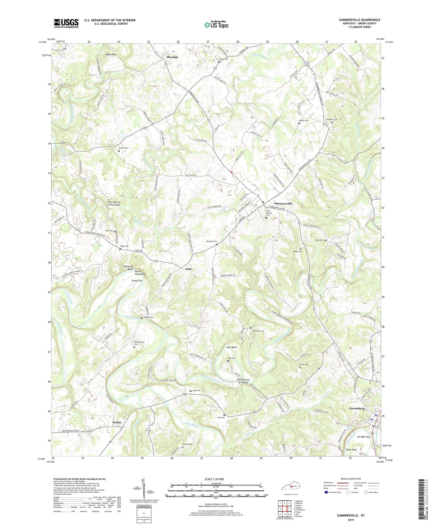
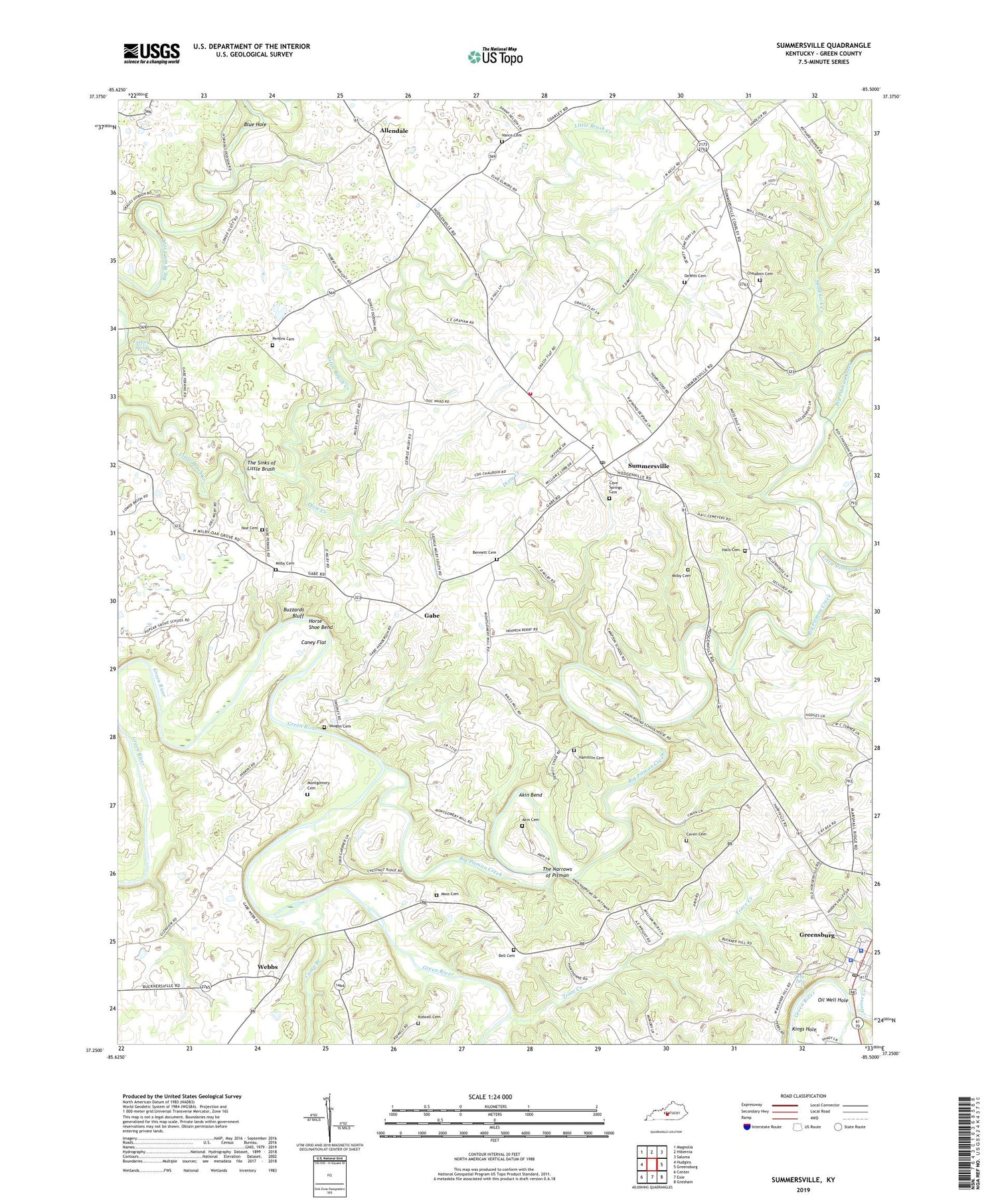
2022 topographic map quadrangle Summersville in the state of Kentucky. Scale: 1:24000. Based on the newly updated USGS 7.5' US Topo map series, this map is in the following counties: Green. The map contains contour data, water features, and other items you are used to seeing on USGS maps, but also has updated roads and other features. This is the next generation of topographic maps. Printed on high-quality waterproof paper with UV fade-resistant inks.
Quads adjacent to this one:
West: Hudgins
Northwest: Magnolia
North: Hibernia
Northeast: Saloma
East: Greensburg
Southeast: Gresham
South: Exie
Southwest: Center
This map covers the same area as the classic USGS quad with code o37085c5.
Contains the following named places: Akin Bend, Allendale, Beaverhouse Hole, Bell Cemetery, Bennett Cemetery, Big Pitman Creek, Bloyds Crossing, Blue Hole, Brush Creek Baptist Church, Buzzards Bluff, Camp Branch, Caney Flat, Carlisle Milby Cemetery, Cave Springs Cemetery, Caven Cemetery, Chaudoin Cemetery, Clover Lick Creek, DeWitt and Loyall Cemetery, Dixie Creek, Factory Spring, Gabe, Glenview School, Goose Creek, Green County, Green County Sheriff's Office, Greensburg Police Department, Greensburg Post Office, Hall Cemetery, Hamilton Cemetery, Hodges Chapel, Horse Shoe Bend, Kidwell Cemetery, Kings Hole, Ladies Chapel, Little Pitman Creek, Milby Cemetery, Montgomery Cemetery Number 2, Moss Cemetery Number 2, Noe Cemetery, Oak Forest Church, Oil Well Hole, Paddy Hole, Perkins Cemetery, Pleasant Ridge Church, Rockhouse Hole, Sam Akin Cemetery, Sand Lick Church, Sand Lick Creek, Summersville, Summersville Census Designated Place, Summersville Division, Summersville Post Office, Summersville Volunteer Fire Department, The Drip, The Narrows of Pitman, The Sinks of Little Brush, Trace Creek, Vance Cemetery, Vaughn Cemetery, WAKY-AM (Greensburg), Webbs, WGRK-FM (Greensburg)