MyTopo
Hibernia Kentucky US Topo Map
Couldn't load pickup availability
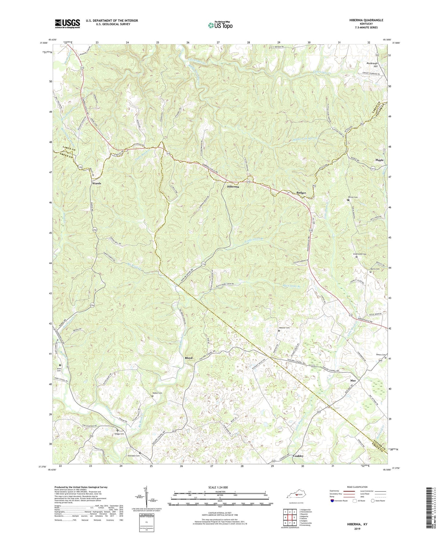
2022 topographic map quadrangle Hibernia in the state of Kentucky. Scale: 1:24000. Based on the newly updated USGS 7.5' US Topo map series, this map is in the following counties: Taylor, Green, Larue. The map contains contour data, water features, and other items you are used to seeing on USGS maps, but also has updated roads and other features. This is the next generation of topographic maps. Printed on high-quality waterproof paper with UV fade-resistant inks.
Quads adjacent to this one:
West: Magnolia
Northwest: Hodgenville
North: Howardstown
Northeast: Raywick
East: Saloma
Southeast: Greensburg
South: Summersville
Southwest: Hudgins
This map covers the same area as the classic USGS quad with code o37085d5.
Contains the following named places: Badger, Ball Hollow Prong, Beams Cemetery, Bell Cemetery, Black Snake Branch, Bloyd, Brush Creek, Brushy Fork, Coakley, Corinth Missionary Baptist Church, Dewitt Cemetery, East Fork Otter Creek, Hibernia, Hibernia Post Office, Jones Cemetery, Liberty Church, Mac, Malt, Malt Post Office, Maple, Meadow Branch, Middle Fork Otter Creek, Morris Cemetery, Mount Union Church, Oak Ridge Church, Otter Creek Church, Otter Creek Mill, Pleasant Ridge Church, Pleasant Valley Church, Poplar Grove Branch, Poplar Grove Church, Poteet School, School Number Eleven, Skaggs Cemetery, Taylor Chapel, Underwood Cemetery, Union Church, Upper Brush Creek, Walker Cemetery, Wards, Webster Cemetery, Zion Separate Baptist Church, ZIP Codes: 42716, 42764