
MyTopo
Saloma Kentucky US Topo Map
Couldn't load pickup availability
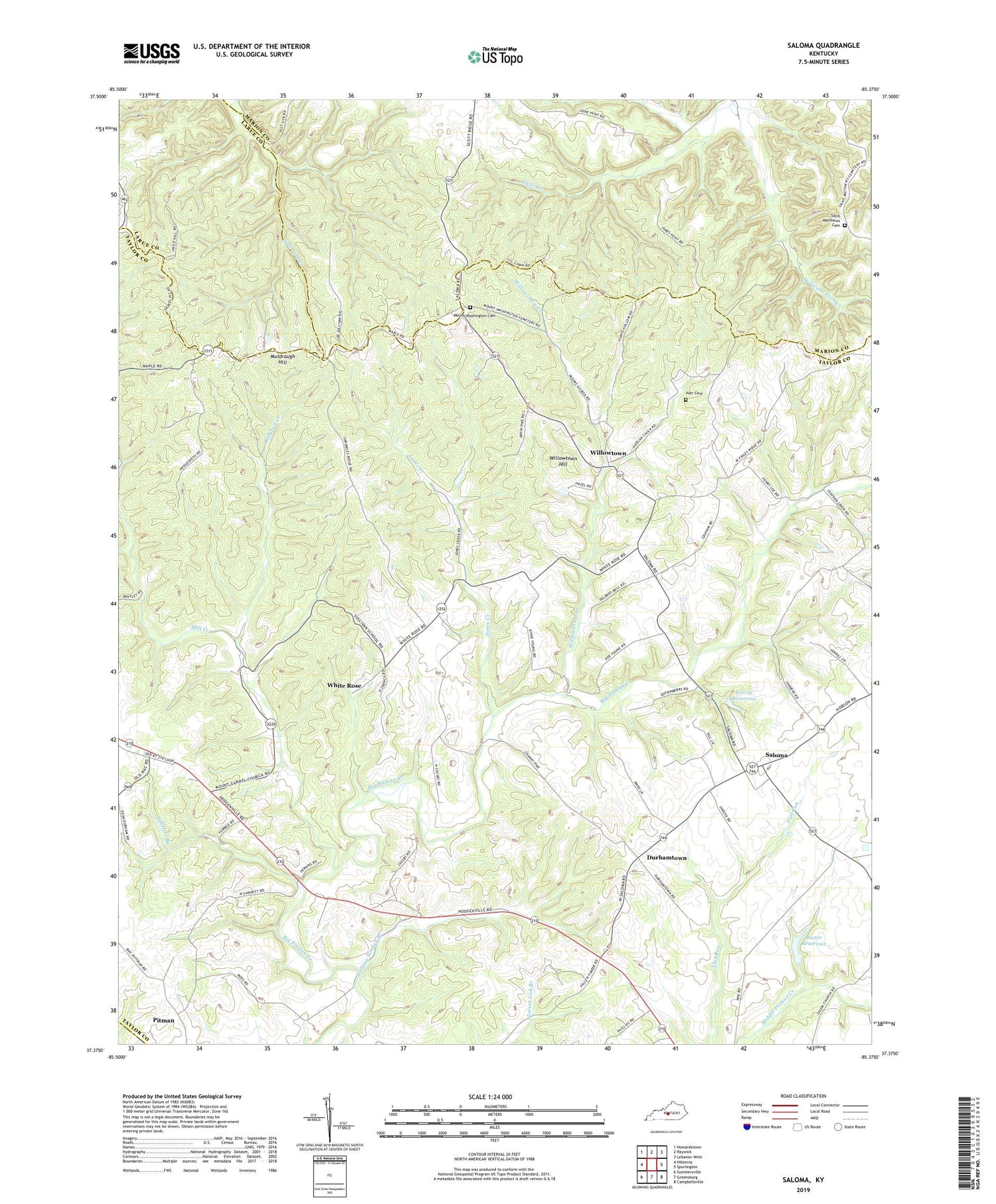
2022 topographic map quadrangle Saloma in the state of Kentucky. Scale: 1:24000. Based on the newly updated USGS 7.5' US Topo map series, this map is in the following counties: Taylor, Marion, Larue, Green. The map contains contour data, water features, and other items you are used to seeing on USGS maps, but also has updated roads and other features. This is the next generation of topographic maps. Printed on high-quality waterproof paper with UV fade-resistant inks.
Quads adjacent to this one:
West: Hibernia
Northwest: Howardstown
North: Raywick
Northeast: Lebanon West
East: Spurlington
Southeast: Campbellsville
South: Greensburg
Southwest: Summersville
This map covers the same area as the classic USGS quad with code o37085d4.
Contains the following named places: Bull Tail Creek, Clear Creek, Durhamtown, Falling Timber Branch, Ferrill Reservoir, Gilboa, Good Hope Baptist Church, Jones Creek, Kerr Cemetery, McFarland Branch, Mill Creek, Mount Carmel Church, Mount Gilboa Church, Mount Gilboa Lookout Tower, Mount Roberts Church, Mount Washington Cemetery, Mount Washington Church, Muldraughs Mill Creek, Pitman, Pleasant Union Church, Porter Reservoir, Saint Matthews Catholic Church, Saint Matthews Cemetery, Saloma, Saloma Division, Splatter Branch, Sullivans Prong, TGP Heliport, White Rose, Willowtown, Willowtown Creek, Willowtown Hill


