MyTopo
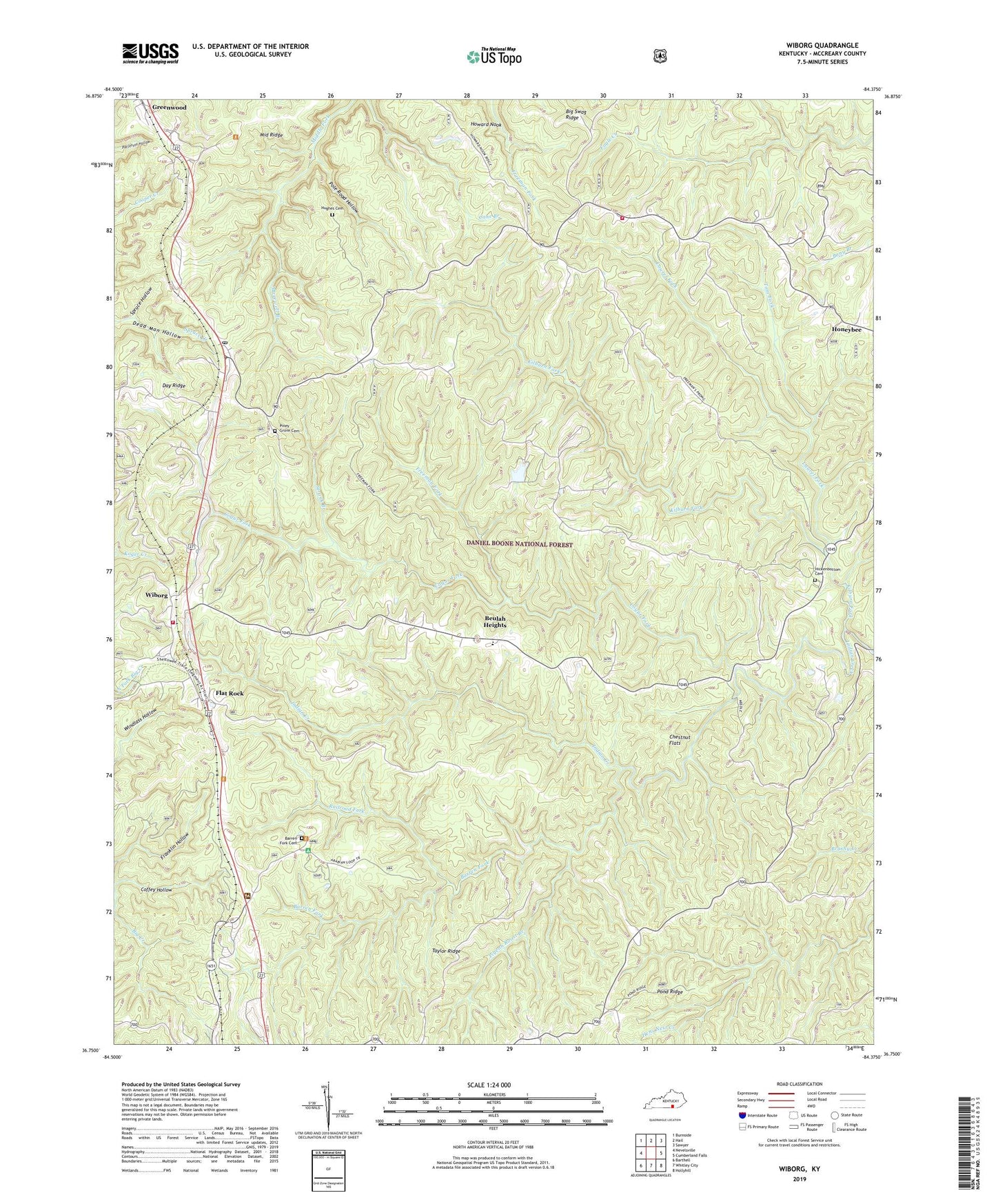
Wiborg Kentucky US Topo Map
Couldn't load pickup availability
Also explore the Wiborg Forest Service Topo of this same quad for updated USFS data
2022 topographic map quadrangle Wiborg in the state of Kentucky. Scale: 1:24000. Based on the newly updated USGS 7.5' US Topo map series, this map is in the following counties: McCreary. The map contains contour data, water features, and other items you are used to seeing on USGS maps, but also has updated roads and other features. This is the next generation of topographic maps. Printed on high-quality waterproof paper with UV fade-resistant inks.
Quads adjacent to this one:
West: Nevelsville
Northwest: Burnside
North: Hail
Northeast: Sawyer
East: Cumberland Falls
Southeast: Hollyhill
South: Whitley City
Southwest: Barthell
This map covers the same area as the classic USGS quad with code o36084g4.
Contains the following named places: Barren Fork, Barren Fork Cemetery, Beulah Heights, Big Swag Ridge, Chestnut Flats, Coffey Hollow, Cogur Fork, Daniel Boone National Forest Stearns Ranger District, Dead Man Hollow, Eagle - Sawyer Fire Protection District Station 2, Eagle School, Flat Rock, Four-H Camp, Franklin Hollow, Freeman Fork, Greenwood, Hickenbottom Cemetery, Hughes Cemetery, Indian Creek Church, Kilburn Fork, Laurel Fork, Maxewell Branch, Middle Ridge, Parkers Lake, Parkers Lake Division, Parkers Lake Post Office, Pigeon Roost Branch, Piney Grove Cemetery, Pleasant Knob Church, Pole Road Hollow, Pond Ridge, Railroad Fork, Roberts Chapel, Sand Hill Church, Spruce Hollow, Stearns District Ranger Office, Strunk Branch, Taylor Ridge, Taylor Ridge Church, Tom Fork, Wiborg, Wiborg Fire Station, ZIP Codes: 42634, 42653