MyTopo
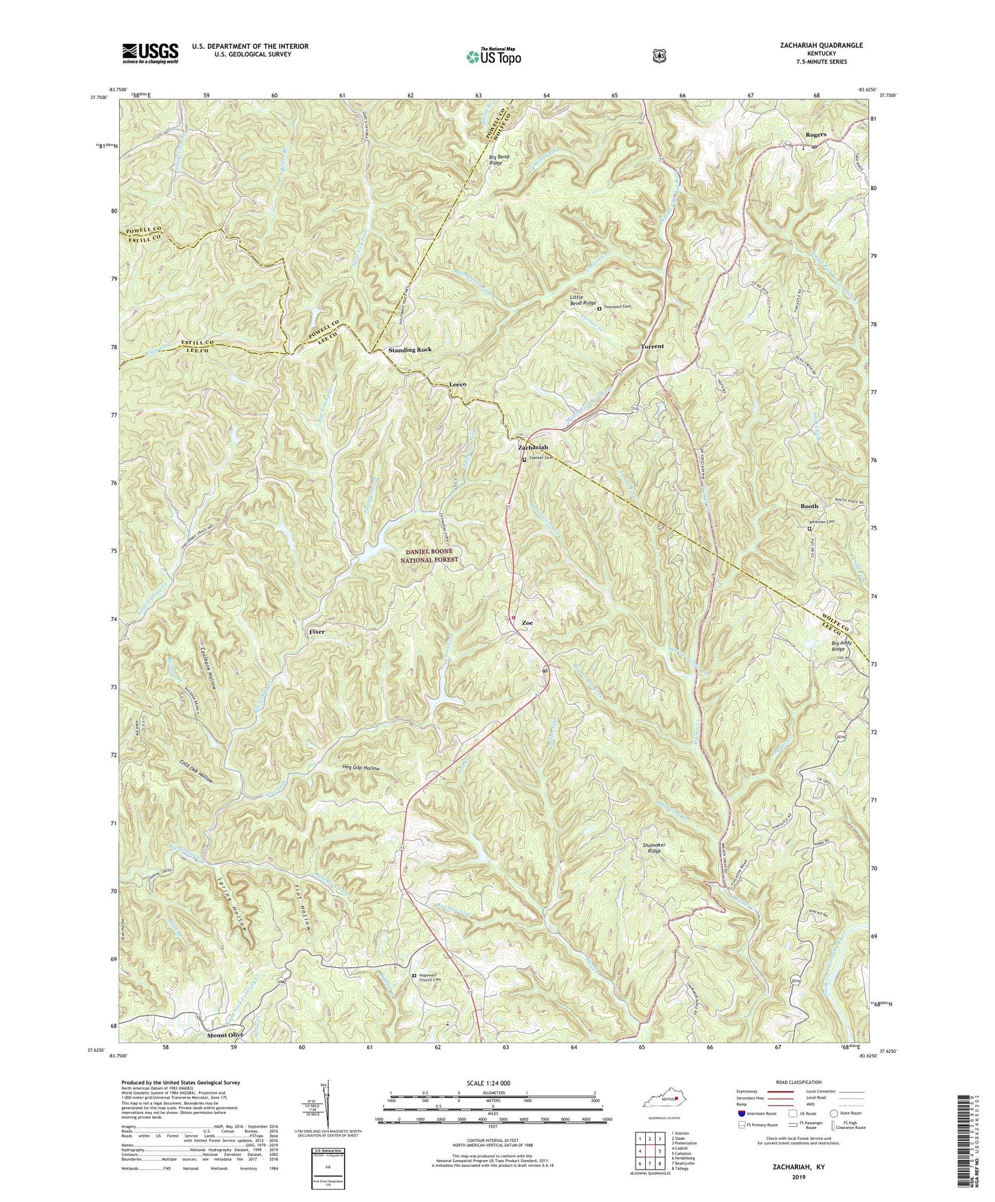
Zachariah Kentucky US Topo Map
Couldn't load pickup availability
Also explore the Zachariah Forest Service Topo of this same quad for updated USFS data
2022 topographic map quadrangle Zachariah in the state of Kentucky. Scale: 1:24000. Based on the newly updated USGS 7.5' US Topo map series, this map is in the following counties: Lee, Wolfe, Powell, Estill. The map contains contour data, water features, and other items you are used to seeing on USGS maps, but also has updated roads and other features. This is the next generation of topographic maps. Printed on high-quality waterproof paper with UV fade-resistant inks.
Quads adjacent to this one:
West: Cobhill
Northwest: Stanton
North: Slade
Northeast: Pomeroyton
East: Campton
Southeast: Tallega
South: Beattyville
Southwest: Heidelberg
This map covers the same area as the classic USGS quad with code o37083f6.
Contains the following named places: Bald Rock Fork, Barker Branch, Beattyville Division, Beech Stand Fork, Bethlehem Church, Big Andy Ridge, Big Bend Ridge, Boonesboro Fork, Booth, Booth Post Office, Bowman Fork, Buckner Branch, Caves Fork, Chester Creek, Coalbank Hollow, Cold Oak Hollow, Cowan Fork, Crow Drive Creek, El Park, Fincastle, Fincastle Church, Fixer, Flat Hollow, Harris, Hauk Branch, Hell for Certain Creek, Hog Gap Hollow, Hopewell Church, Hopewell Church Cemetery, Huff Cave Branch, Leeco, Little Bend Ridge, Miller Fork, Moreland Hollow, Mount Paran School, Naomi Baptist Church, Peddler Creek, Rogers, Rogers Baptist Church, Rogers Elementary School, Rogers Post Office, Shumaker Ridge, Sinking Fork, Spring Hollow, Standing Rock, Thacker Cemetery, Torrent, Torrent Church of God, Torrent Creek, Torrent Post Office, Townsend Cemetery, Townsend Fork, Tri - Community Fire Department, Whisman Cemetery, Zachariah, Zachariah Fork, Zachariah Post Office, Zoe, Zoe Post Office, ZIP Codes: 41365, 41397