MyTopo
Ada Louisiana US Topo Map
Couldn't load pickup availability
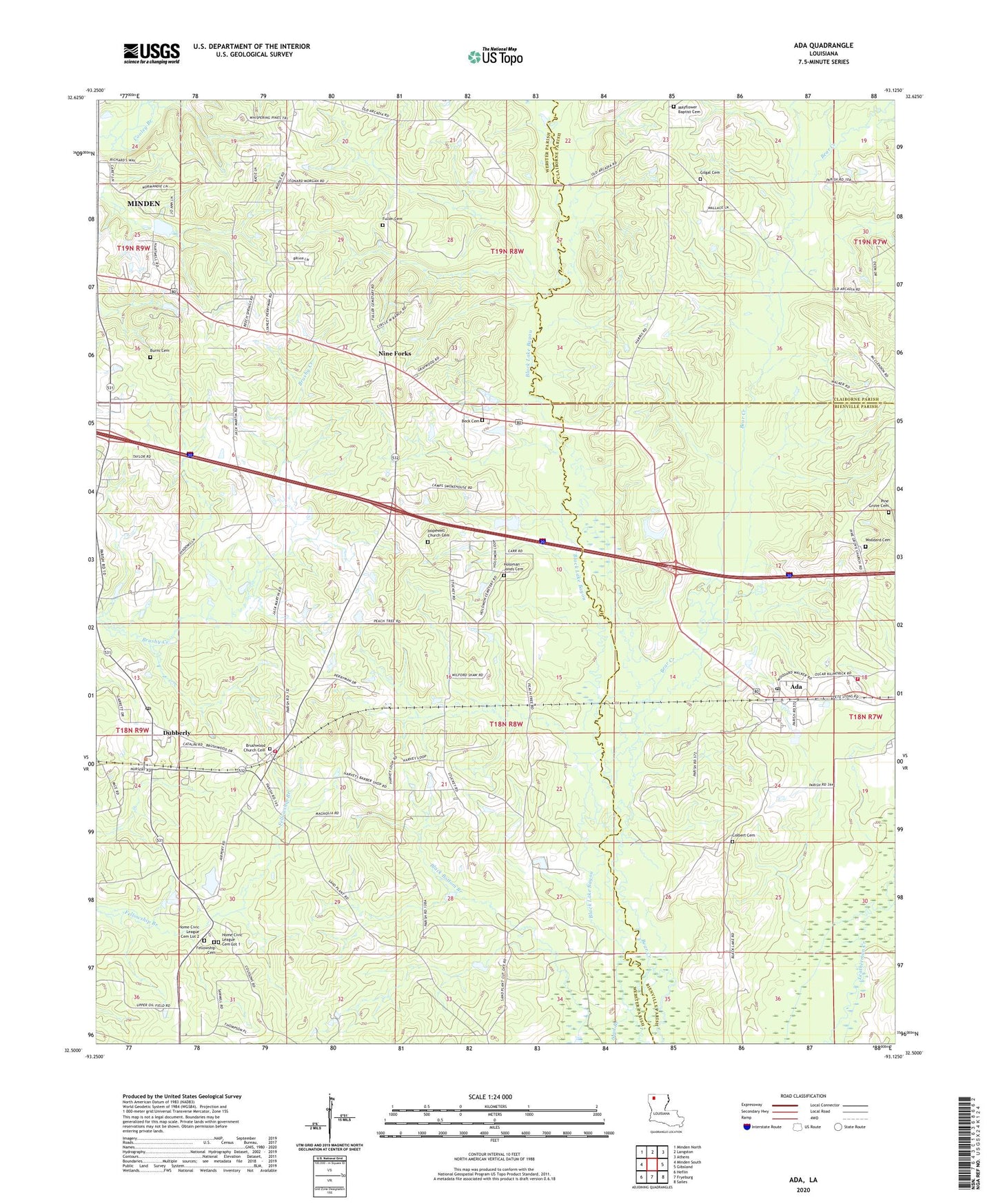
2024 topographic map quadrangle Ada in the state of Louisiana. Scale: 1:24000. Based on the newly updated USGS 7.5' US Topo map series, this map is in the following counties: Webster, Bienville, Claiborne. The map contains contour data, water features, and other items you are used to seeing on USGS maps, but also has updated roads and other features. This is the next generation of topographic maps. Printed on high-quality waterproof paper with UV fade-resistant inks.
Quads adjacent to this one:
West: Minden South
Northwest: Minden North
North: Langston
Northeast: Athens
East: Gibsland
Southeast: Sailes
South: Fryeburg
Southwest: Heflin
This map covers the same area as the classic USGS quad with code o32093e2.
Contains the following named places: Ada, Bear Creek, Beck Cemetery, Beech Springs Baptist Church, Black Bottom Branch, Brushwood School, Brushwood United Methodist Church, Burns Cemetery, Colbert Cemetery, Dubberly, Dubberly Post Office, Fellowship Baptist Church, Fellowship Cemetery, Fuller Cemetery, Gilgal Cemetery, Gilgal Church, Holoman - Jones Cemetery, Hopewell School, Nine Forks, North Bienville Fire Protection District Station 7, Pine Grove Cemetery, Piney Grove Church, Pleasant Grove School, Smith Pond Number Three Dam, Talton School, Taylor Baptist Church, Turners School, Turners Store, Village of Dubberly, Webster Parish Fire Protection District 4, Woodard Cemetery