MyTopo
Heflin Louisiana US Topo Map
Couldn't load pickup availability
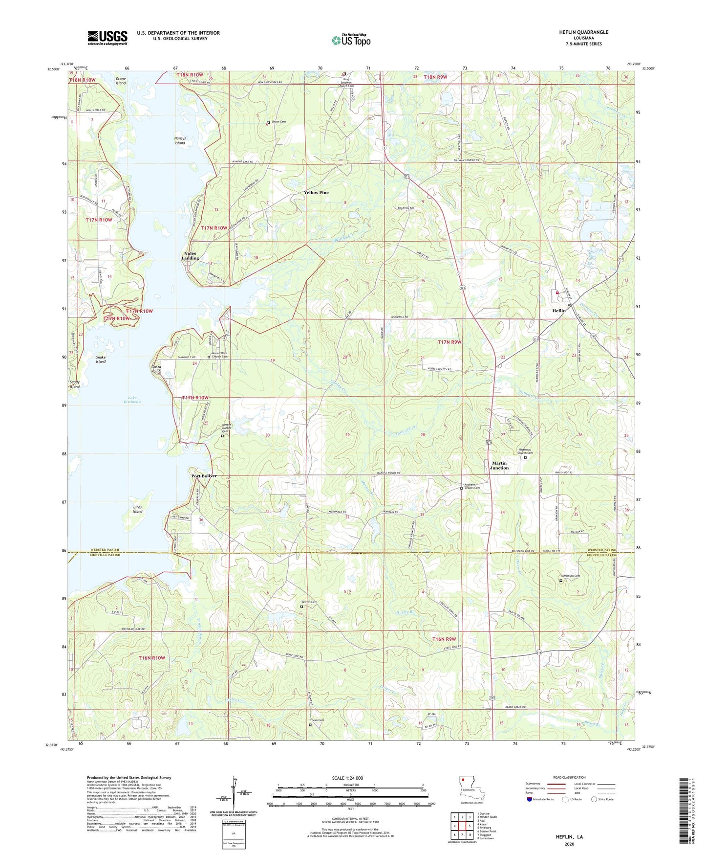
2024 topographic map quadrangle Heflin in the state of Louisiana. Scale: 1:24000. Based on the newly updated USGS 7.5' US Topo map series, this map is in the following counties: Webster, Bienville, Bossier. The map contains contour data, water features, and other items you are used to seeing on USGS maps, but also has updated roads and other features. This is the next generation of topographic maps. Printed on high-quality waterproof paper with UV fade-resistant inks.
Quads adjacent to this one:
West: Koran
Northwest: Doyline
North: Minden South
Northeast: Ada
East: Fryeburg
Southeast: Jamestown
South: Ringgold
Southwest: Bossier Point
This map covers the same area as the classic USGS quad with code o32093d3.
Contains the following named places: Adams Church, Adams School, Andrew Chapel, Andrews Chapel Cemetery, Armistead, Beard Branch, Birds Island, Bistineau Baptist Church, Bistineau Compressor Station, Bistineau Gasoline Plant, Brushy Creek, Buckhorn, Carter Chapel, Carter Creek, Cooley Creek, Crane Island, Gray Pit, Gusta Point, Harkness School, Heflin, Heflin Elementary School, Heflin Post Office, Heflin Volunteer Fire Department, Hope Church, Hope Creek, Hurley Branch, John M Robinson Pond Dam, Juben Gravel Pit, King Solomon Church, Lake Bistineau Gas Field, Martin Junction, Mount Ealm Church, Nancys Island, Noles Landing, Ogden Spur, Parish Governing Authority District 11, Petes Ferry, Port Boliver, Reeves Cemetery, Saint Johns Church, Sandy Island, Sibley Gas and Oil Field, Snake Island, Swift, Tanyard Creek, Theus Cemetery, Thomas, Tillman Church, Tomlinson Cemetery, Toulon Bayou, Union Cemetery, Union Church, Village of Heflin, Yellow Pine, ZIP Code: 71039