MyTopo
Fryeburg Louisiana US Topo Map
Couldn't load pickup availability
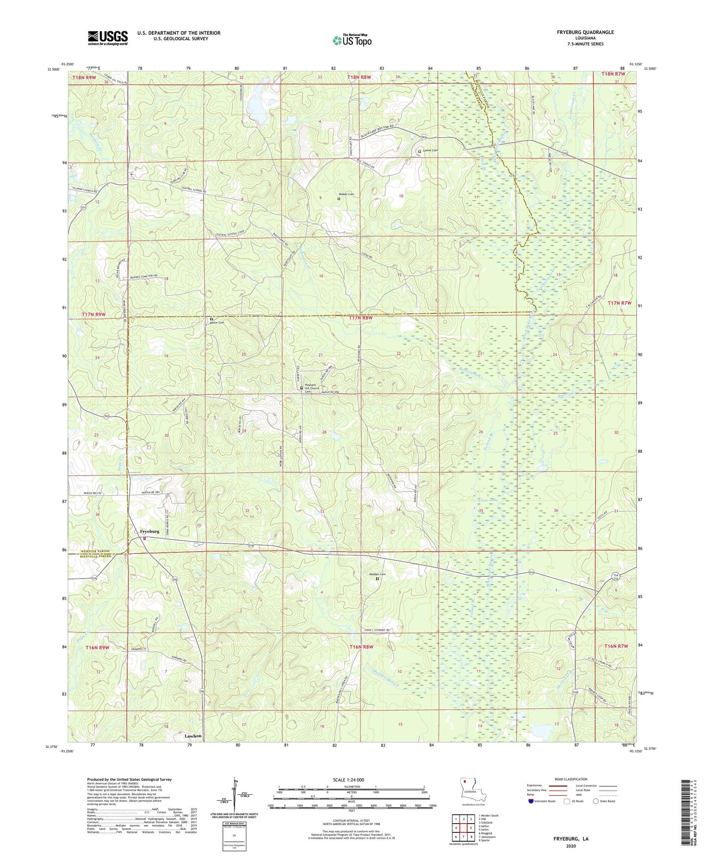
2024 topographic map quadrangle Fryeburg in the state of Louisiana. Scale: 1:24000. Based on the newly updated USGS 7.5' US Topo map series, this map is in the following counties: Bienville, Webster. The map contains contour data, water features, and other items you are used to seeing on USGS maps, but also has updated roads and other features. This is the next generation of topographic maps. Printed on high-quality waterproof paper with UV fade-resistant inks.
Quads adjacent to this one:
West: Heflin
Northwest: Minden South
North: Ada
Northeast: Gibsland
East: Sailes
Southeast: Sparta
South: Jamestown
Southwest: Ringgold
This map covers the same area as the classic USGS quad with code o32093d2.
Contains the following named places: Ada Oil and Gas Field, Bashaway Creek, Bienville Parish Fire Protection District Wards 4 and 5 Station 2, Brushy Creek, Central Elementary School, Charlie Airport, Clear Lake, Dubberly Elementary School, Evergreen Church, Fryeburg, Galilee School, Gamel Cemetery, Horse Lot Branch, Jamestown Gas Field, Lawhon, Leatherman Creek, Madden Church, Madden School, Mount Nebo Church, Mud Branch, Pleasant Hill School, Poland Branch, Walker Cemetery, ZIP Code: 71024