MyTopo
Barataria Pass Louisiana US Topo Map
Couldn't load pickup availability
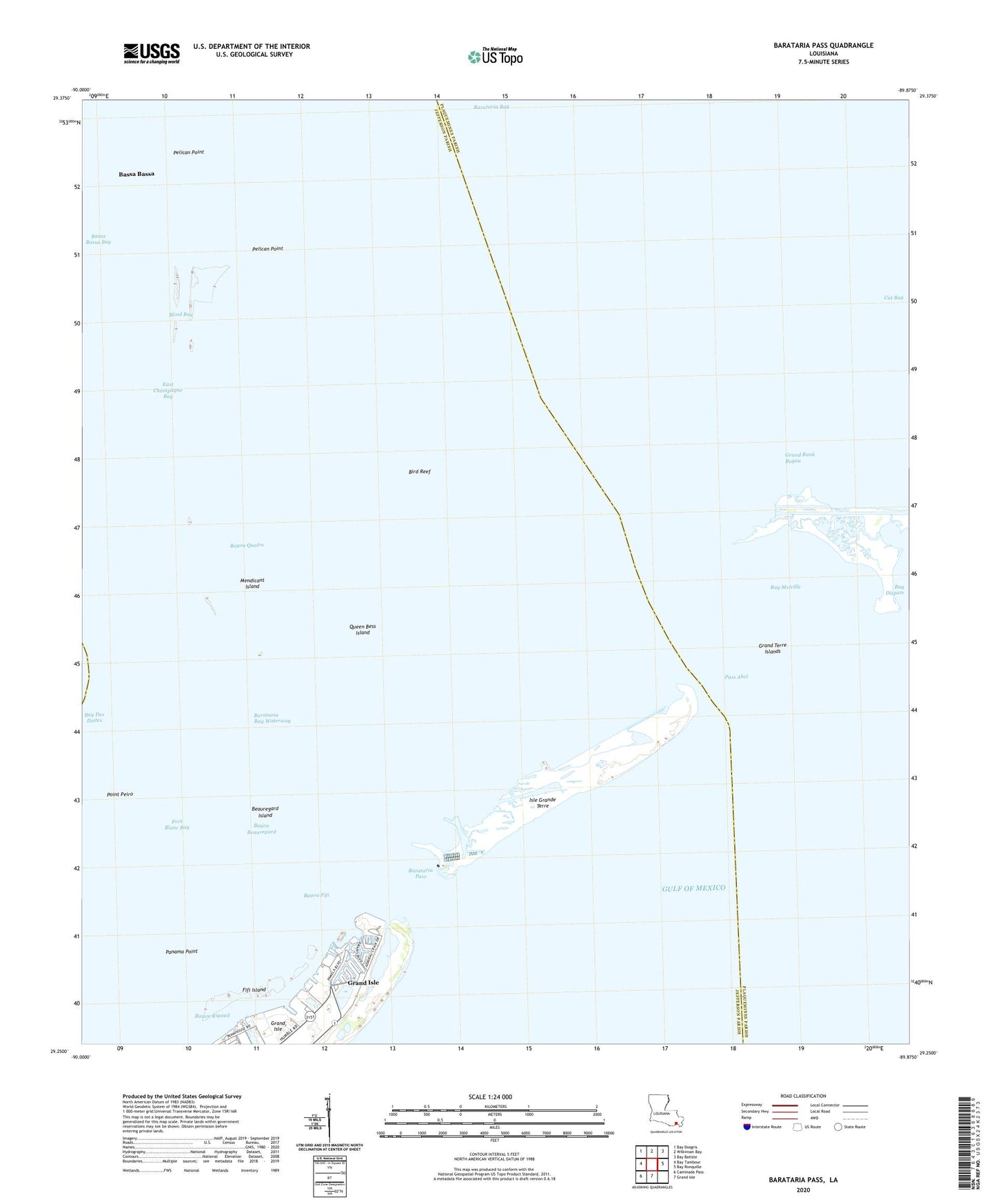
2025 topographic map quadrangle Barataria Pass in the state of Louisiana. Scale: 1:24000. Based on the newly updated USGS 7.5' US Topo map series, this map is in the following counties: Jefferson, Plaquemines, Lafourche. The map contains contour data, water features, and other items you are used to seeing on USGS maps, but also has updated roads and other features. This is the next generation of topographic maps. Printed on high-quality waterproof paper with UV fade-resistant inks.
Quads adjacent to this one:
West: Bay Tambour
Northwest: Bay Dosgris
North: Wilkinson Bay
Northeast: Bay Batiste
East: Bay Ronquille
South: Grand Isle
Southwest: Caminada Pass
This map covers the same area as the classic USGS quad with code o29089c8.
Contains the following named places: Barataria Bay, Barataria Pass, Bassa Bassa, Bassa Bassa Bay, Bay Des Ilettes, Bay Melville, Bayou Beauregard, Bayou Fifi, Bayou Quatre, Bayou Rigaud, Beauregard Island, Bird Reef, Blind Bay, Cat Bay, Coast Guard Station Grand Isle, Conoco Incorporated Heliport, East Champagne Bay, Exxon Heliport, Fifi Island, Fort Blanc Bay, Freeport Sulphur Heliport, Grand Bank Bayou, Grand Isle Seaplane Base, Grand Isle State Park, Grand Terre Islands, Isle Grande Terre, Medicant Island Heliport, Mendicant Island, Panama Point, Pass Abel, Pelican Island, Pelican Point, Point Peiro, Queen Bess Island, Queen Bess Island Oil and Gas Field, Shell Rock