MyTopo
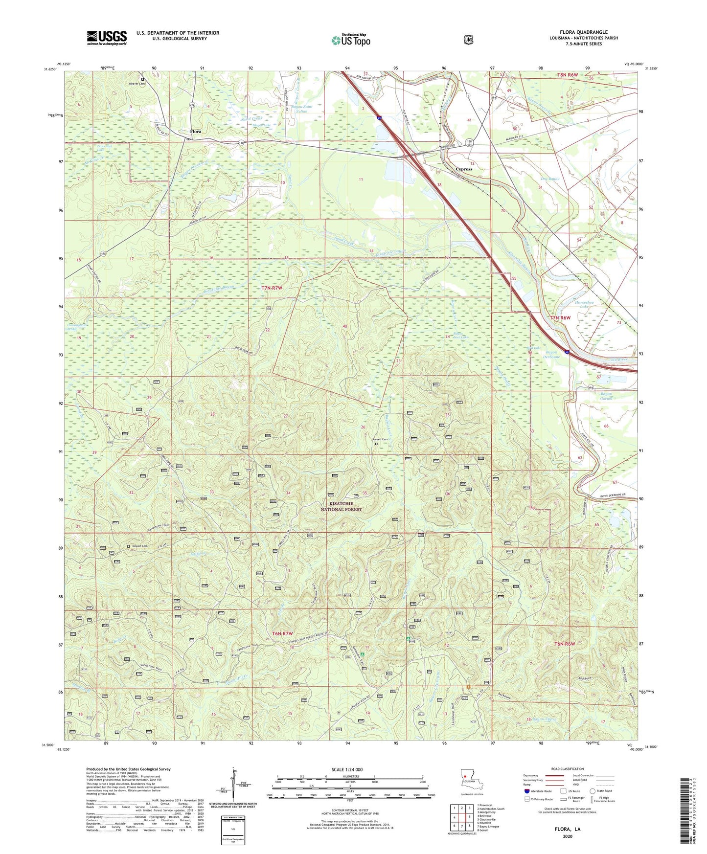
Flora Louisiana US Topo Map
Couldn't load pickup availability
Also explore the Flora Forest Service Topo of this same quad for updated USFS data
2024 topographic map quadrangle Flora in the state of Louisiana. Scale: 1:24000. Based on the newly updated USGS 7.5' US Topo map series, this map is in the following counties: Natchitoches. The map contains contour data, water features, and other items you are used to seeing on USGS maps, but also has updated roads and other features. This is the next generation of topographic maps. Printed on high-quality waterproof paper with UV fade-resistant inks.
Quads adjacent to this one:
West: Bellwood
Northwest: Provencal
North: Natchitoches South
Northeast: Montgomery
East: Cloutierville
Southeast: Gorum
South: Bayou Livrogne
Southwest: Kisatchie
This map covers the same area as the classic USGS quad with code o31093e1.
Contains the following named places: Antioch Church, Bayou Blue, Bayou Derbonne, Bayou Gorum, Bayou Luce, Bayou Luce Lake, Bayou Luce Overlook, Bayou Platte, Bayou Provencal, Bayou Saint Julian, Bird Lake, Blague Lake, Cypress, Cypress Post Office, Dowen Cemetery, Dry Bayou, Flora, Flora Post Office, Flora School, Good Hope Church, Good Hope School, Horseshoe Lake, Kisatchie Bayou, Laird Branch, McKims Creek, Melrose Overlook, Parish Governing Authority District 10, Pentecost Church, Pole Branch, Provencal Lake, Red Dirt, Russell Cemetery, Russell School, Saint Marys Church, Sand Creek, Ward Four, Weaver Cemetery