MyTopo
Branch Louisiana US Topo Map
Couldn't load pickup availability
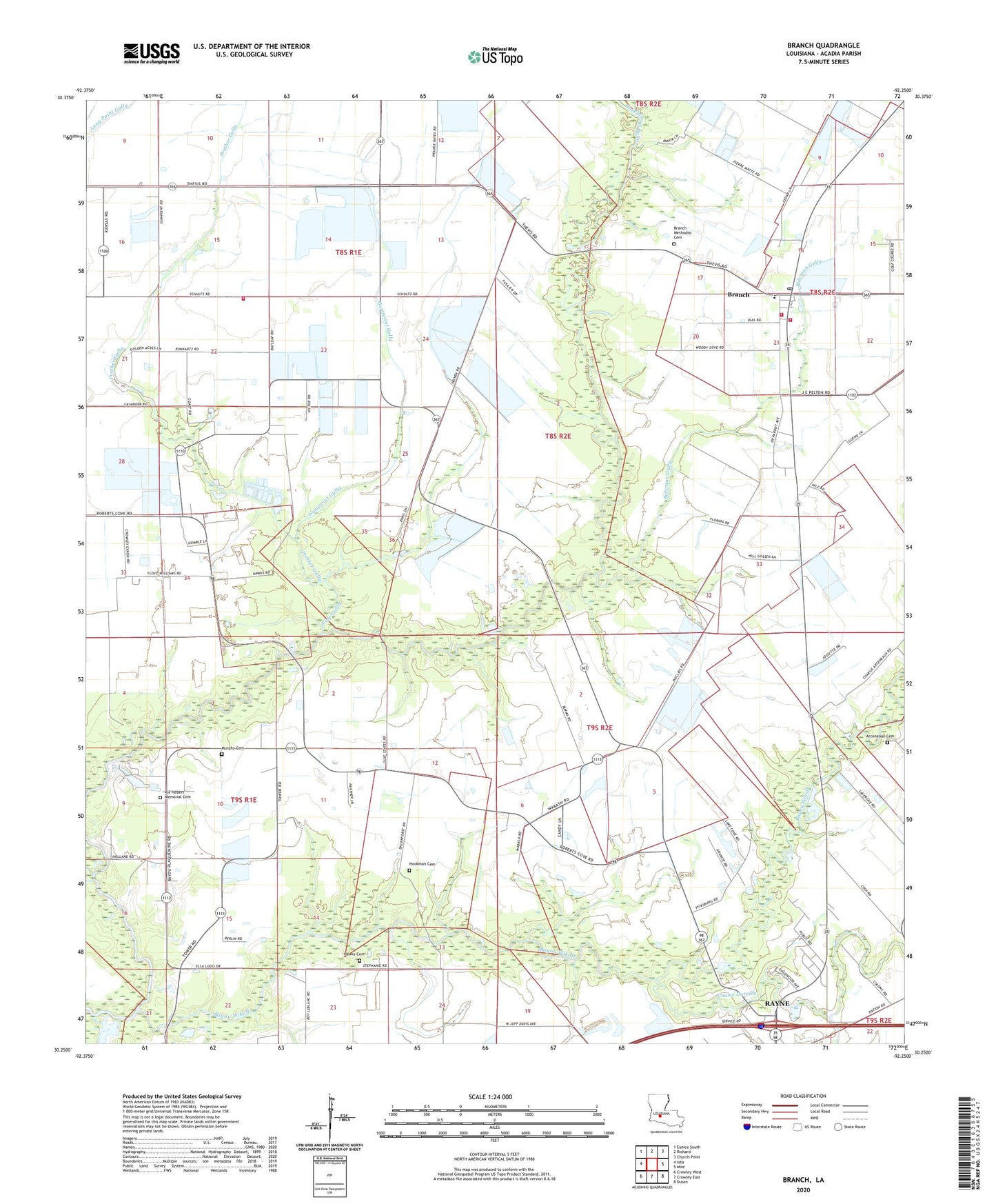
2024 topographic map quadrangle Branch in the state of Louisiana. Scale: 1:24000. Based on the newly updated USGS 7.5' US Topo map series, this map is in the following counties: Acadia. The map contains contour data, water features, and other items you are used to seeing on USGS maps, but also has updated roads and other features. This is the next generation of topographic maps. Printed on high-quality waterproof paper with UV fade-resistant inks.
Quads adjacent to this one:
West: Iota
Northwest: Eunice South
North: Richard
Northeast: Church Point
East: Mire
Southeast: Duson
South: Crowley East
Southwest: Crowley West
This map covers the same area as the classic USGS quad with code o30092c3.
Contains the following named places: Abundant Life Assembly of God Church, Arceneaux Cemetery, Bayou Wikoff, Bideman Gully, Branch, Branch Census Designated Place, Branch Elementary School, Branch Methodist Cemetery, Branch Post Office, Branch Volunteer Fire Department, Branch Volunteer Fire Department Substation 1, Branch Volunteer Fire Department Substation 2, Church of Jesus Christ, Cole Gully, Coles Gully School, Coulee Duralde, Elizabeth Church, Falcon School, Gum Point School, Gumpoint Gully, Habetz Landing Strip, Habetz School, Hawks Cemetery, Hazelwood Gully, Hensgens Strip, Hookman Cemetery, Kie Hebert Memorial Cemetery, Long Point Gully, Louisiana Noname 106 Dam, Maryland Church, Mid South Flying Service Landing Strip, Mount Calvary Church, Murphy Cemetery, North Crowley Oil and Gas Field, Northwest Branch Oil and Gas Field, Parish Governing Authority District 11, Prather Gully, Prather Landing Strip, Rayne Christian Child Care Center, Roberts Cove, Roberts Cove Church of Christ, Saint Leo Church, Ward Two, ZIP Code: 70516