MyTopo
Mire Louisiana US Topo Map
Couldn't load pickup availability
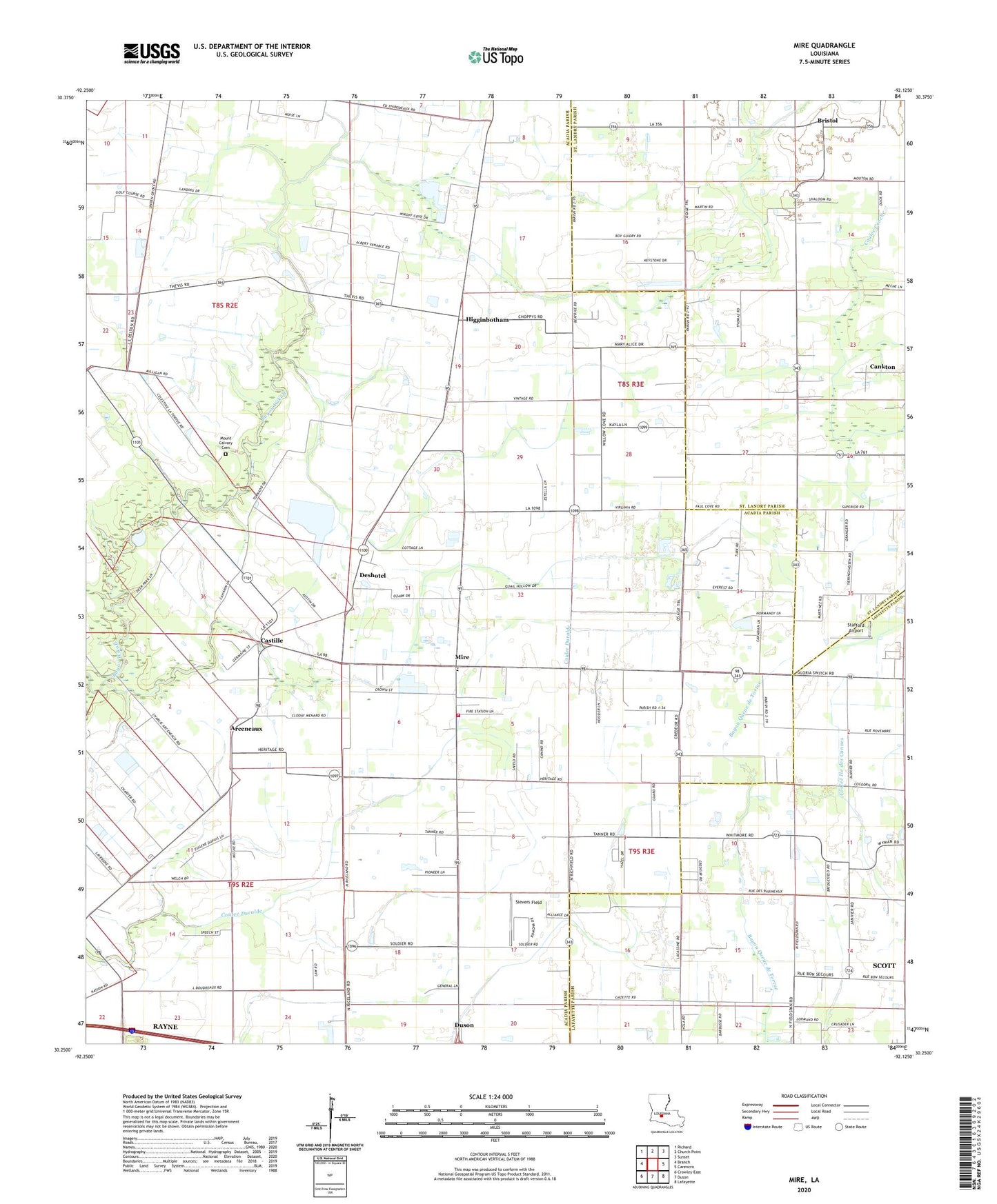
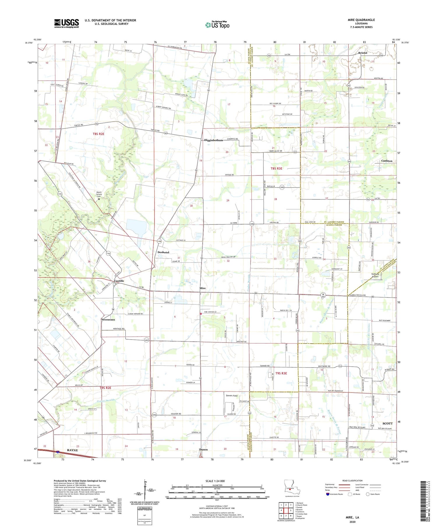
2024 topographic map quadrangle Mire in the state of Louisiana. Scale: 1:24000. Based on the newly updated USGS 7.5' US Topo map series, this map is in the following counties: Acadia, St. Landry, Lafayette. The map contains contour data, water features, and other items you are used to seeing on USGS maps, but also has updated roads and other features. This is the next generation of topographic maps. Printed on high-quality waterproof paper with UV fade-resistant inks.
Quads adjacent to this one:
West: Branch
Northwest: Richard
North: Church Point
Northeast: Sunset
East: Carencro
Southeast: Lafayette
South: Duson
Southwest: Crowley East
This map covers the same area as the classic USGS quad with code o30092c2.
Contains the following named places: Arceneaux, Arseneaux School, Bosco Oil Field, Branch Gas Field, Bristol, Castille, Church of the Assumption, Coulee Croche, Cozy Acres Mobile Home Park, Deshotel, Deshotel School, Higginbotham, KADN-TV (Lafayette), KRVS-FM (Lafayette), KSMB-FM (Lafayette), Mire, Mire Elementary School, Mire Volunteer Fire Department District 7, Mount Calvary Cemetery, North Rayne Oil and Gas Field, Parish Governing Authority District 10, Parish Governing Authority District 5, Parish Governing Authority District 6, Sievers Field, South Bosco Oil and Gas Field, South Church Point Oil and Gas Field, Stafford Airport, Sunrise Church