MyTopo
Browns Lake Louisiana US Topo Map
Couldn't load pickup availability
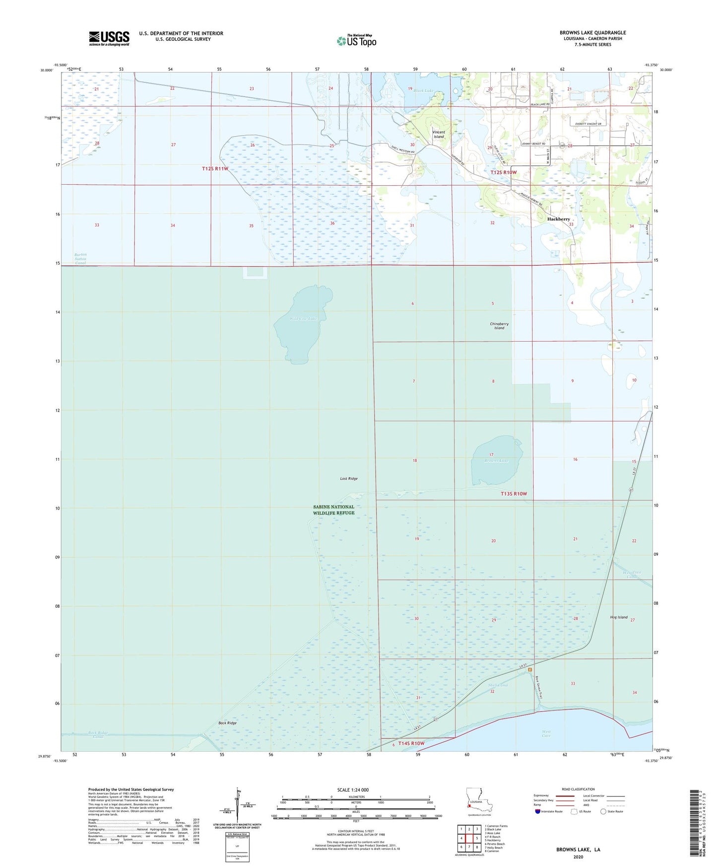
2024 topographic map quadrangle Browns Lake in the state of Louisiana. Scale: 1:24000. Based on the newly updated USGS 7.5' US Topo map series, this map is in the following counties: Cameron. The map contains contour data, water features, and other items you are used to seeing on USGS maps, but also has updated roads and other features. This is the next generation of topographic maps. Printed on high-quality waterproof paper with UV fade-resistant inks.
Quads adjacent to this one:
West: F-R Ranch
Northwest: Cameron Farms
North: Black Lake
Northeast: Moss Lake
East: Hackberry
Southeast: Cameron
South: Holly Beach
Southwest: Peveto Beach
This map covers the same area as the classic USGS quad with code o29093h4.
Contains the following named places: Back Ridge, Back Ridge Canal, Browns Lake, Chinaberry Island, Hackberry Census Designated Place, Hackberry Recreation Area, Hog Island, Hog Island Gully, Lost Ridge, Parish Governing Authority District 2, Shell Canal, Starks North Canal, Vincent Island, West Hackberry Strategic Petroleum Reserve, Wild Cow Lake, ZIP Code: 70645