MyTopo
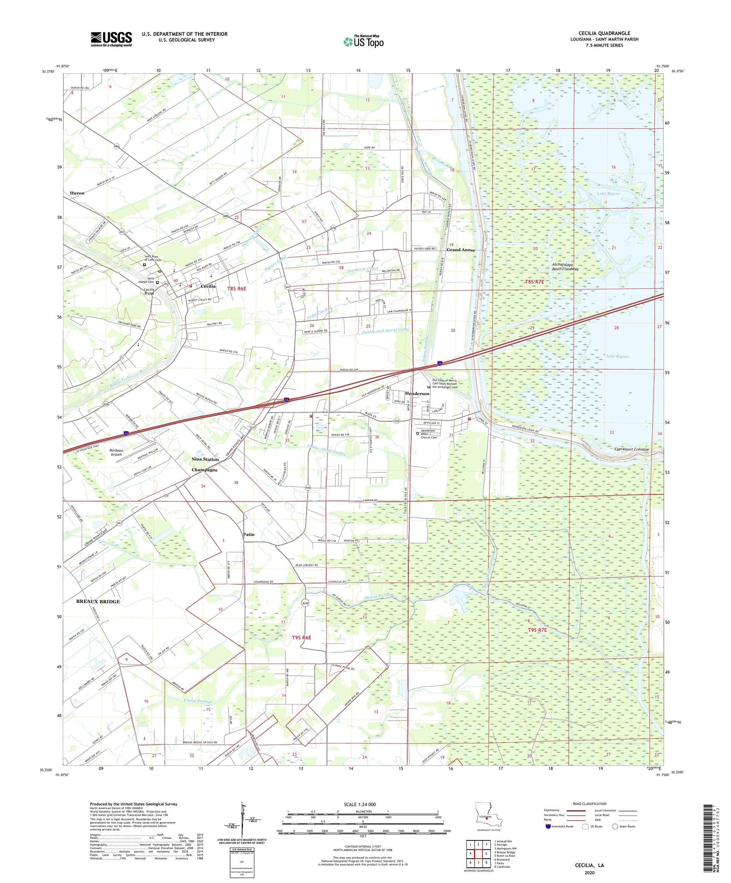
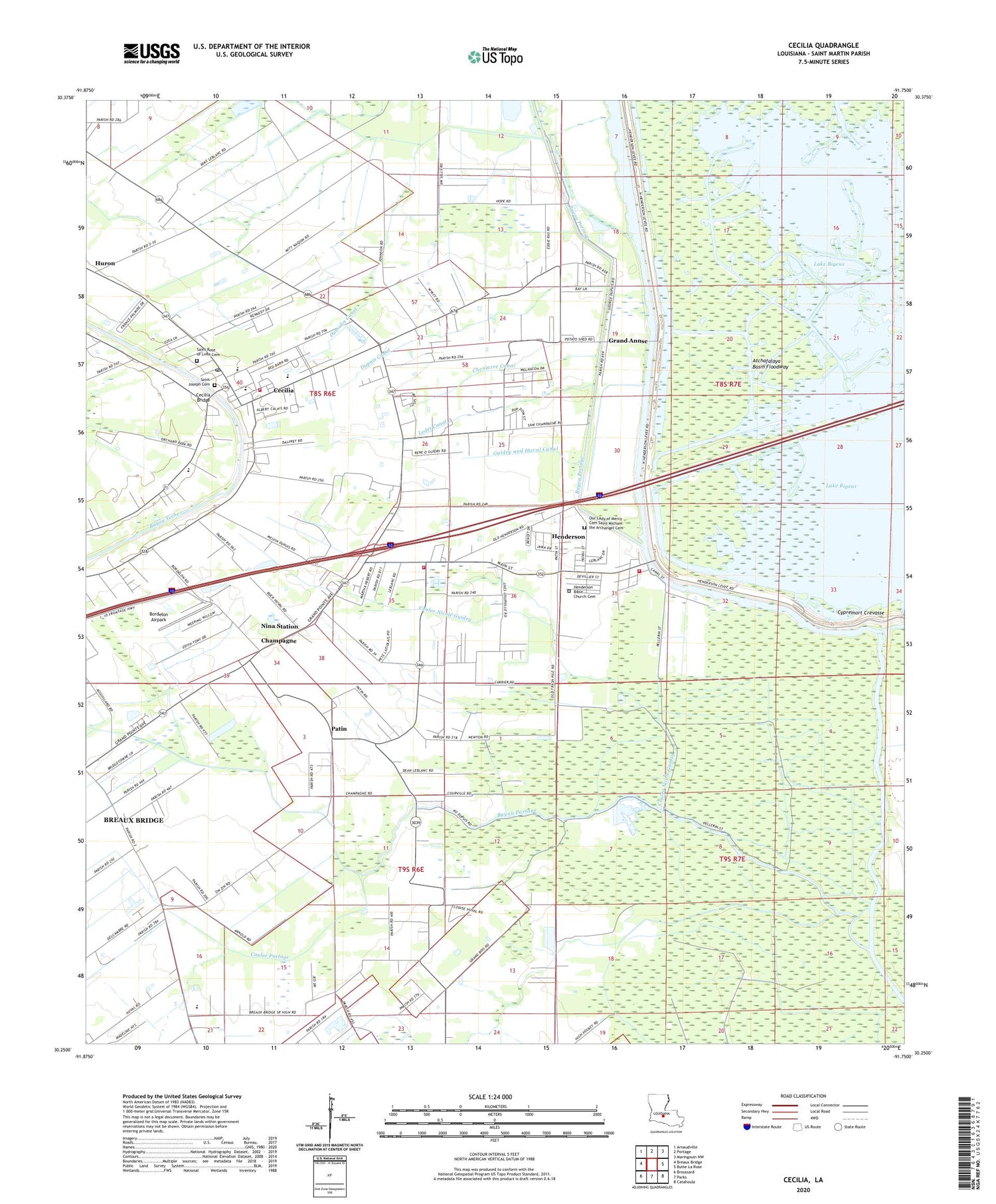
Cecilia Louisiana US Topo Map
Couldn't load pickup availability
2024 topographic map quadrangle Cecilia in the state of Louisiana. Scale: 1:24000. Based on the newly updated USGS 7.5' US Topo map series, this map is in the following counties: St. Martin. The map contains contour data, water features, and other items you are used to seeing on USGS maps, but also has updated roads and other features. This is the next generation of topographic maps. Printed on high-quality waterproof paper with UV fade-resistant inks.
Quads adjacent to this one:
West: Breaux Bridge
Northwest: Arnaudville
North: Portage
Northeast: Maringouin NW
East: Butte La Rose
Southeast: Catahoula
South: Parks
Southwest: Broussard
This map covers the same area as the classic USGS quad with code o30091c7.
Contains the following named places: Bayou Fusilier of the Swamps, Bayou Portage, Bordelon Airpark, Breaux Bridge High School, Cecilia, Cecilia Bridge, Cecilia Census Designated Place, Cecilia High School, Cecilia Junior High School, Cecilia Oil Field, Cecilia Post Office, Cecilia Primary School, Cecilia Volunteer Fire Department, Champagne, Chenierre Canal, Coulee Nicole Guidry, Coulee Portage, Cypremort Crevasse, Dumolin Canal, Dupuis Canal, Grand Annse, Guidry and Huval Canal, Henderson, Henderson Bible Church, Henderson Contract Postal Unit, Henderson Police Department, Henderson Volunteer Fire Department, Henderson Volunteer Fire Department Nina Substation, Henderson Wastewater Treatment Plant, Hope, Huron, Lake Bigeux, Ledet Canal, Little Platte Canal, Nina Station, Our Lady of Mercy Cemetery Saint Michael the Archangel Cemetery, Our Lady of Mercy Church, Patin, Plumb Bob Oil and Gas Field, Saint Joseph Church, Saint Martin Parish Library Cecilia Branch, Saint Martin Parish Police Jury, Saint Rose of Lima Church, Teche Elementary School, Town of Henderson, True Canal, Union Bayou School, Ward Five, ZIP Code: 70517