MyTopo
Maringouin NW Louisiana US Topo Map
Couldn't load pickup availability
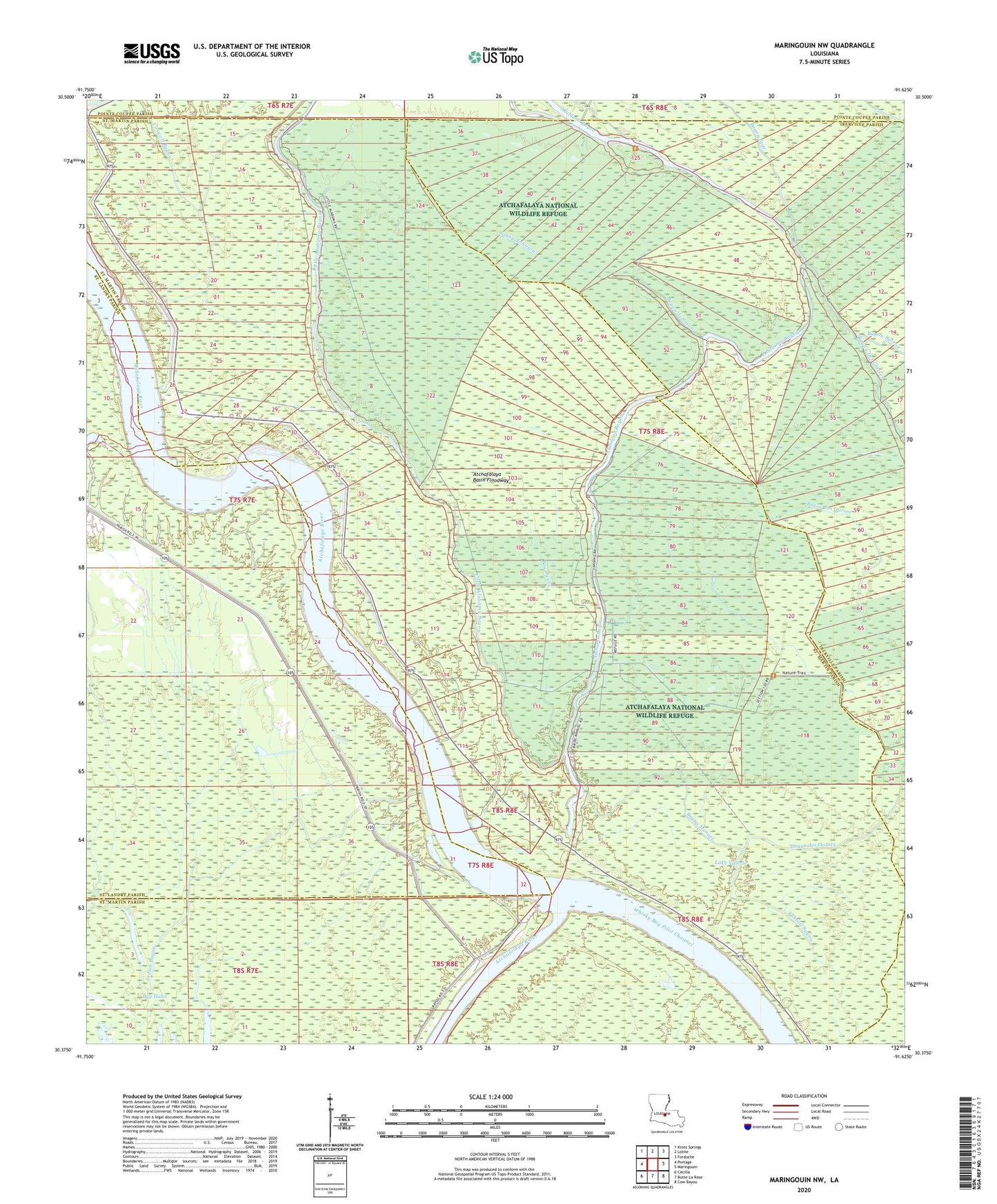
2024 topographic map quadrangle Maringouin NW in the state of Louisiana. Scale: 1:24000. Based on the newly updated USGS 7.5' US Topo map series, this map is in the following counties: St. Martin, Iberville, St. Landry, Pointe Coupee. The map contains contour data, water features, and other items you are used to seeing on USGS maps, but also has updated roads and other features. This is the next generation of topographic maps. Printed on high-quality waterproof paper with UV fade-resistant inks.
Quads adjacent to this one:
West: Portage
Northwest: Krotz Springs
North: Lottie
Northeast: Fordoche
East: Maringouin
Southeast: Cow Bayou
South: Butte La Rose
Southwest: Cecilia
This map covers the same area as the classic USGS quad with code o30091d6.
Contains the following named places: Alabama Bayou Gas Field, Atchafalaya National Wildlife Refuge, Bay Denny, Bayou Courtableau, Bayou des Ourses, Bayou Johnson, Bayou Manuel, Bayou Stiff, Bobtail Bayou, Coswell Bayou, Happytown Oil and Gas Field, Indian Bayou, Lake Comeaux, Lake Valerie, Lake Valerie Oil Field, Parish Governing Authority District 8, Sherburne Wildlife Management Area, South Happytown Oil and Gas Field