MyTopo
Butte La Rose Louisiana US Topo Map
Couldn't load pickup availability
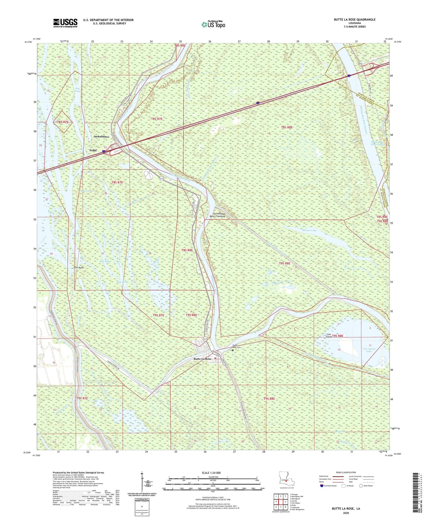
2024 topographic map quadrangle Butte La Rose in the state of Louisiana. Scale: 1:24000. Based on the newly updated USGS 7.5' US Topo map series, this map is in the following counties: St. Martin, Iberville. The map contains contour data, water features, and other items you are used to seeing on USGS maps, but also has updated roads and other features. This is the next generation of topographic maps. Printed on high-quality waterproof paper with UV fade-resistant inks.
Quads adjacent to this one:
West: Cecilia
Northwest: Portage
North: Maringouin NW
Northeast: Maringouin
East: Cow Bayou
Southeast: Lake Mongoulois
South: Catahoula
Southwest: Parks
This map covers the same area as the classic USGS quad with code o30091c6.
Contains the following named places: Atchafalaya, Atchafalaya River, Atchasalauga Acres Mobile Home Park, Bay A'Bot, Bay Farine, Bay Haha, Bay Sirius, Bayou Berard Canal, Bayou La Rose, Bayou Loin, Bayou Malboeuf, Bayou Perry, Begnard Bay, Butte La Rose, Butte La Rose Bay, Butte La Rose Cemetery, Butte La Rose Cutoff, Butte Larose Volunteer Fire Department, Cow Island, Cow Island Lake, Crusel, Davis Roadside Park, Des Ours Mill, Five Point, Gin Slough, Lake Pelba, Little Bayou Des Ourses, Lost Lake, Opelousas Bay, Pelba, Warner Lake