MyTopo
Chatham SE Louisiana US Topo Map
Couldn't load pickup availability
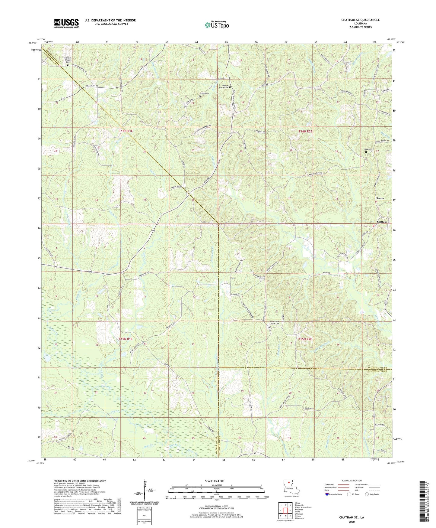
2024 topographic map quadrangle Chatham SE in the state of Louisiana. Scale: 1:24000. Based on the newly updated USGS 7.5' US Topo map series, this map is in the following counties: Jackson, Ouachita, Caldwell. The map contains contour data, water features, and other items you are used to seeing on USGS maps, but also has updated roads and other features. This is the next generation of topographic maps. Printed on high-quality waterproof paper with UV fade-resistant inks.
Quads adjacent to this one:
West: Chatham
Northwest: Eros
North: Cadeville
Northeast: West Monroe South
East: Luna
Southeast: Blankston
South: Vixen
Southwest: Womack
This map covers the same area as the classic USGS quad with code o32092c3.
Contains the following named places: Anabel, Bear Creek, Biles Branch, Cow Creek, Cub Creek, Cypress Baptist Church, Frantom Chapel Cemetery, Frantom Chapel Methodist Church, Frantom Chapel School, Galilee Church, Glade Creek, Head Cemetery, Little Glade Creek, Mount Olive Church, North Vixen Gas Field, Ouachita Parish Fire Protection District 1 Station 14, Pine Grove Church, Tama, Walnut Grove Church