MyTopo
Blankston Louisiana US Topo Map
Couldn't load pickup availability
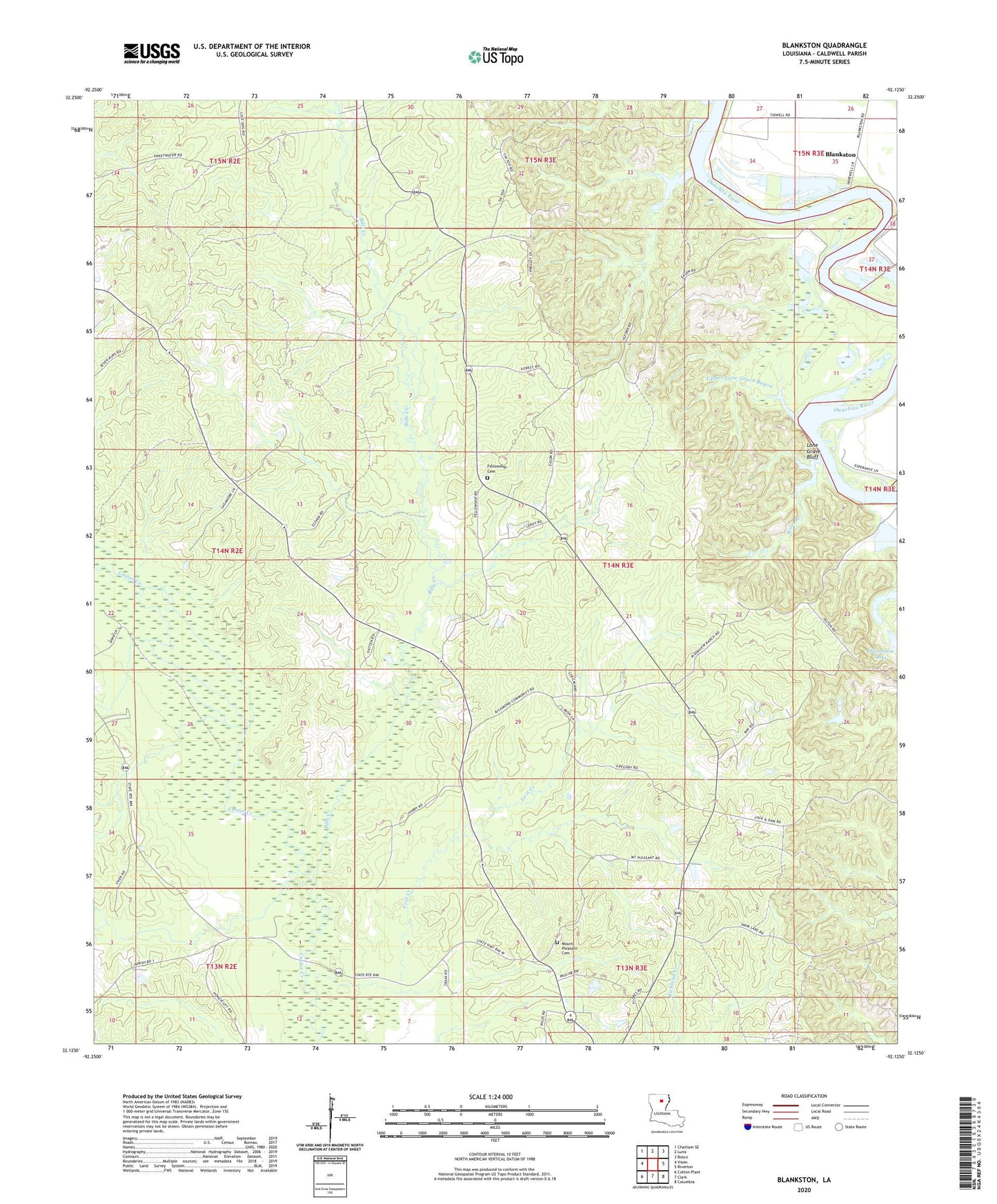
2024 topographic map quadrangle Blankston in the state of Louisiana. Scale: 1:24000. Based on the newly updated USGS 7.5' US Topo map series, this map is in the following counties: Caldwell. The map contains contour data, water features, and other items you are used to seeing on USGS maps, but also has updated roads and other features. This is the next generation of topographic maps. Printed on high-quality waterproof paper with UV fade-resistant inks.
Quads adjacent to this one:
West: Vixen
Northwest: Chatham SE
North: Luna
Northeast: Bosco
East: Riverton
Southeast: Columbia
South: Clark
Southwest: Cotton Plant
This map covers the same area as the classic USGS quad with code o32092b2.
Contains the following named places: Bills Creek, Blankston, Castor Landing, Fellowship Baptist Church, Fellowship Cemetery, KCTO-FM (Columbia), Locust Landing, Lone Grave Bluff, Lost Creek, Lost Creek Gas Field, Montgomery Landing, Mount Pleasant, Mount Pleasant Cemetery, Mount Pleasant Church, New Testament Church, Old Mount Pleasant, Parish Governing Authority District 5, Pinder Branch, Upper Lone Grave Bayou, Ward 5 Church, Ward 5 School, Ward One, Waverly Landing, Winn Branch