MyTopo
Luna Louisiana US Topo Map
Couldn't load pickup availability
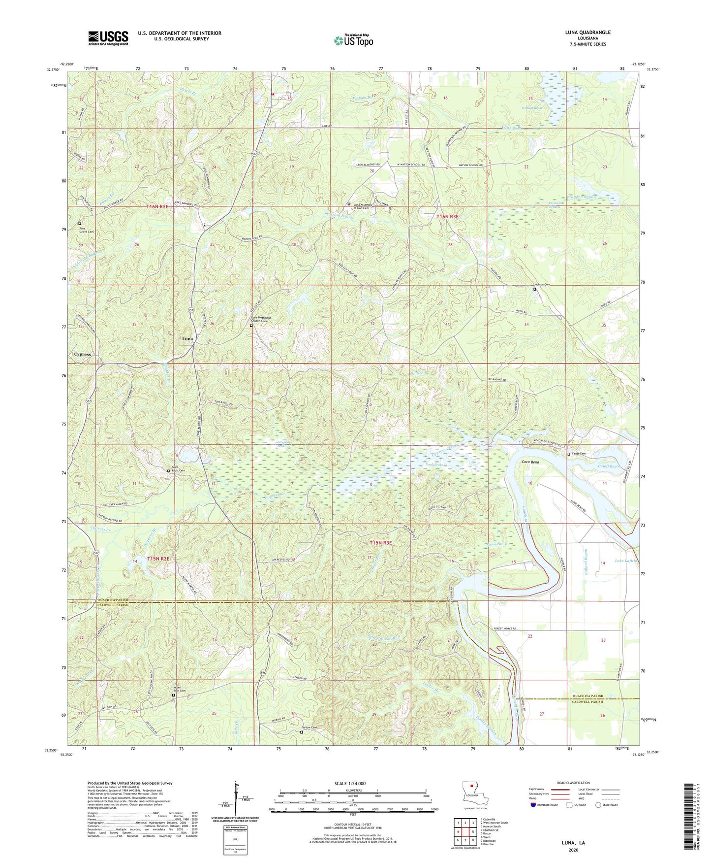
2024 topographic map quadrangle Luna in the state of Louisiana. Scale: 1:24000. Based on the newly updated USGS 7.5' US Topo map series, this map is in the following counties: Ouachita, Caldwell. The map contains contour data, water features, and other items you are used to seeing on USGS maps, but also has updated roads and other features. This is the next generation of topographic maps. Printed on high-quality waterproof paper with UV fade-resistant inks.
Quads adjacent to this one:
West: Chatham SE
Northwest: Cadeville
North: West Monroe South
Northeast: Monroe South
East: Bosco
Southeast: Riverton
South: Blankston
Southwest: Vixen
This map covers the same area as the classic USGS quad with code o32092c2.
Contains the following named places: Alligator Brake, Baygent Branch, Belle Cove Bayou, Claire Branch, Coco Bend, Cypress, Cypress Creek, Faust Cemetery, Forest Home Landing, Furlow Cemetery, Gladden Branch, Hannah Landing, Little Cypress Creek, Luna, Luna Church, Luna Lookout Tower, Mount Zion Cemetery, Mount Zion Church, Noah Brake, Ouachita Parish Fire Protection District 1 Station 10, Pine Bluff Landing, Pine Grove Cemetery, Pinecrest School, Prairion Brake, Ragnall Brake, Roach Landing, Saint Pauls Cemetery, Saint Pauls Church, Tanyard Branch, Vixen Gas Field, Waco Church, Waco Landing, Ward Nine, Watson Brake, Watson Branch, Watson Chapel, Watson School