MyTopo
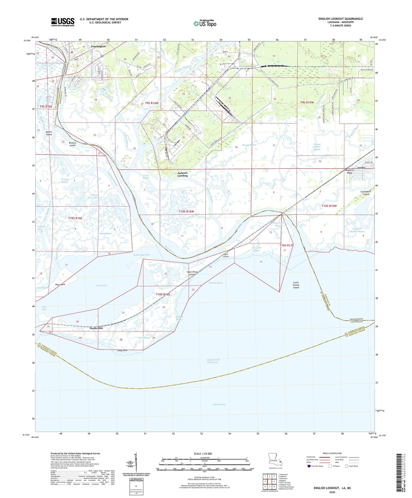
English Lookout Louisiana US Topo Map
Couldn't load pickup availability
2024 topographic map quadrangle English Lookout in the states of Mississippi, Louisiana. Scale: 1:24000. Based on the newly updated USGS 7.5' US Topo map series, this map is in the following counties: St. Tammany, Hancock, St. Bernard. The map contains contour data, water features, and other items you are used to seeing on USGS maps, but also has updated roads and other features. This is the next generation of topographic maps. Printed on high-quality waterproof paper with UV fade-resistant inks.
Quads adjacent to this one:
West: Rigolets
Northwest: Haaswood
North: Logtown
Northeast: Waveland
East: Saint Joe Pass
Southeast: Malheureux Point
South: False Mouth Bayou
Southwest: Alligator Point
Contains the following named places: Baldwin Lodge, Beppo, Browns Ditch, Browns Island, Campbell Island, Campbell Lagoon, Cowan Bayou, Cross Bayou, East Middle River, East Pass, English Lookout, Grand Plains Bayou, Grassy Bayou, J J Waterhouse Claim, Jackson Landing, John B Doby Claim, John Cane Bayou, Johnny Three Bayou, Johns Bayou, Kimmels Bayou, King Bee Bayou, Kopman Bayou, L Boisdore Claim, Little Grassy Island, Little Lake, Little Lake Pass, Long Point, Magnolia Ridge, Middle River, Mulatto Bayou, Mulatto Bayou School, Nancy Collins Claim, North Pass, North Side, Old Pearl River, Pate Bayou, Pearl River, Pearl River Island, Pearl River Light, Pearlington, Pearlington Census Designated Place, Plantation Landing, Poitevants Ditch, Polecat Bend, Port Bienville Industrial Park, Redfish Bayou, Rigolets Gas Field, Sand Bayou, West Hancock Volunteer Fire Department, West Middle River, Whites Bayou, Woody Bayou, Yousan Bayou


