MyTopo
Logtown Mississippi US Topo Map
Couldn't load pickup availability
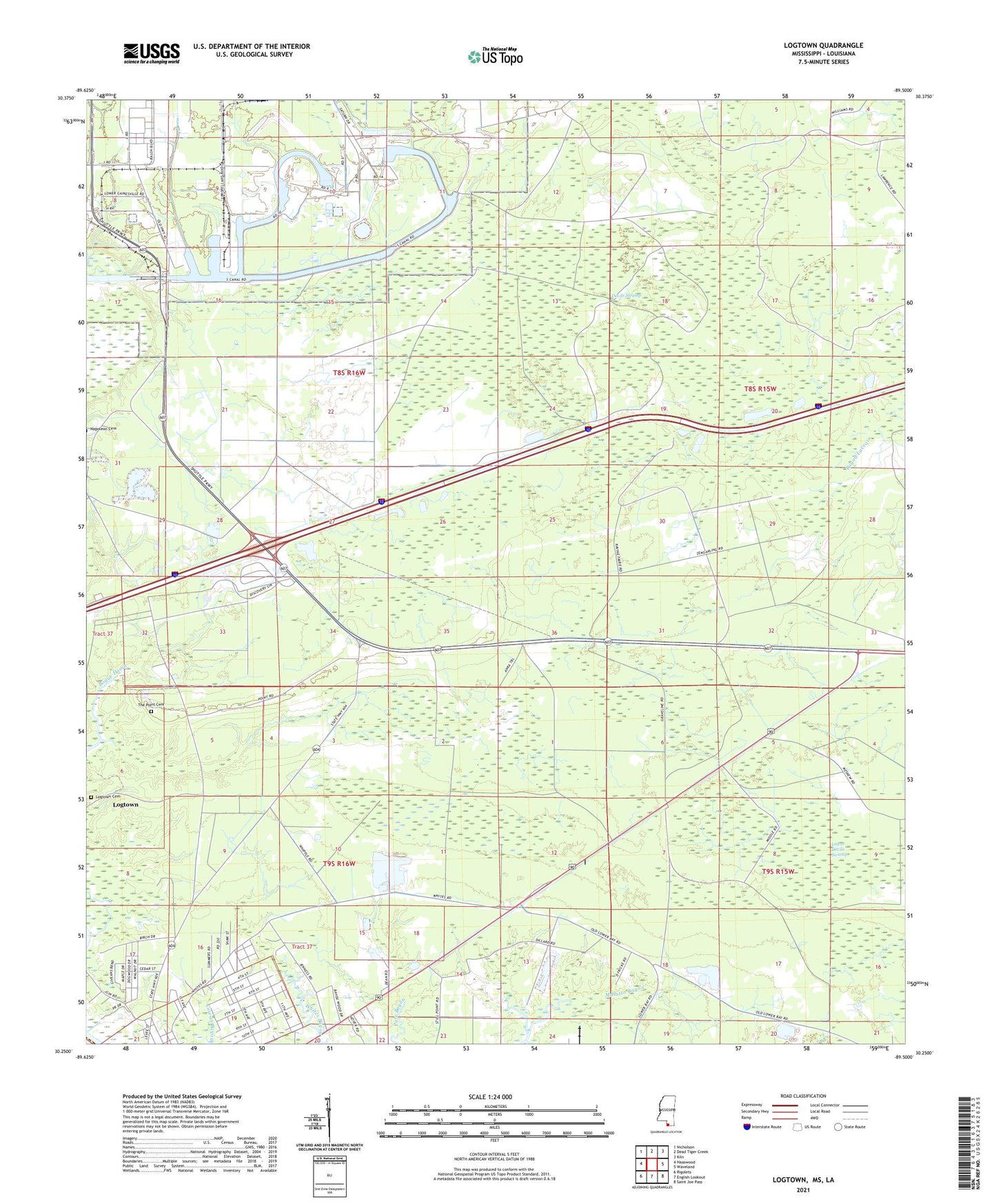
2024 topographic map quadrangle Logtown in the state of Mississippi. Scale: 1:24000. Based on the newly updated USGS 7.5' US Topo map series, this map is in the following counties: Hancock, St. Tammany. The map contains contour data, water features, and other items you are used to seeing on USGS maps, but also has updated roads and other features. This is the next generation of topographic maps. Printed on high-quality waterproof paper with UV fade-resistant inks.
Quads adjacent to this one:
West: Haaswood
Northwest: Nicholson
North: Dead Tiger Creek
Northeast: Kiln
East: Waveland
Southeast: Saint Joe Pass
South: English Lookout
Southwest: Rigolets
This map covers the same area as the classic USGS quad with code o30089c5.
Contains the following named places: Devils Swamp, First Southern Baptist Church, Greater Mount Zion African Methodist Episcopal Church, Holmes Chapel United Methodist Church, Interstate 10 Mississippi Welcome Center, Logtown, Logtown Cemetery, Lower Devils Swamp, Mount Zion Church, New Hope Baptist Church, Point Cemetery, Spring Branch Church, Supervisor District 2, Westonia, Westonia Lookout, ZIP Code: 39572