MyTopo
Packton Louisiana US Topo Map
Couldn't load pickup availability
Also explore the Packton Forest Service Topo of this same quad for updated USFS data
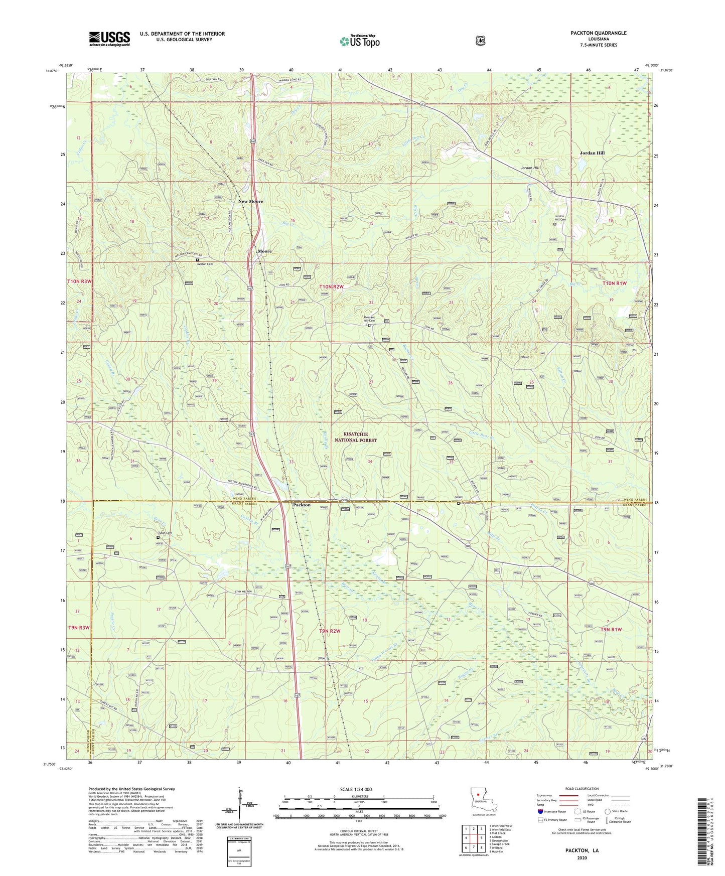
2024 topographic map quadrangle Packton in the state of Louisiana. Scale: 1:24000. Based on the newly updated USGS 7.5' US Topo map series, this map is in the following counties: Winn, Grant. The map contains contour data, water features, and other items you are used to seeing on USGS maps, but also has updated roads and other features. This is the next generation of topographic maps. Printed on high-quality waterproof paper with UV fade-resistant inks.
Quads adjacent to this one:
West: Atlanta
Northwest: Winnfield West
North: Winnfield East
Northeast: Flat Creek
East: Georgetown
Southeast: Mudville
South: Williana
Southwest: Savage Creek
This map covers the same area as the classic USGS quad with code o31092g5.
Contains the following named places: Boggy Branch, Bucker Creek, Caney Branch, Caskey Branch, Corinth Cemetery, Cox Branch, Farmer Branch, Fourmile Branch, Hurricane Creek, Iatt Lookout Tower, Jordan Hill, Jordan Hill Census Designated Place, Jordon Hill Cemetery, Kenny Branch, Killan Creek, Latt Lookout Tower, Little Dry Creek, Melton Cemetery, Mills Branch, Moore, New Moore, Packton, Parish Governing Authority District 7, Piney Woods Branch, Pleasant Hill, Pleasant Hill Cemetery, Tunica, Tyson Cemetery, Ward Nine