MyTopo
Husser Louisiana US Topo Map
Couldn't load pickup availability
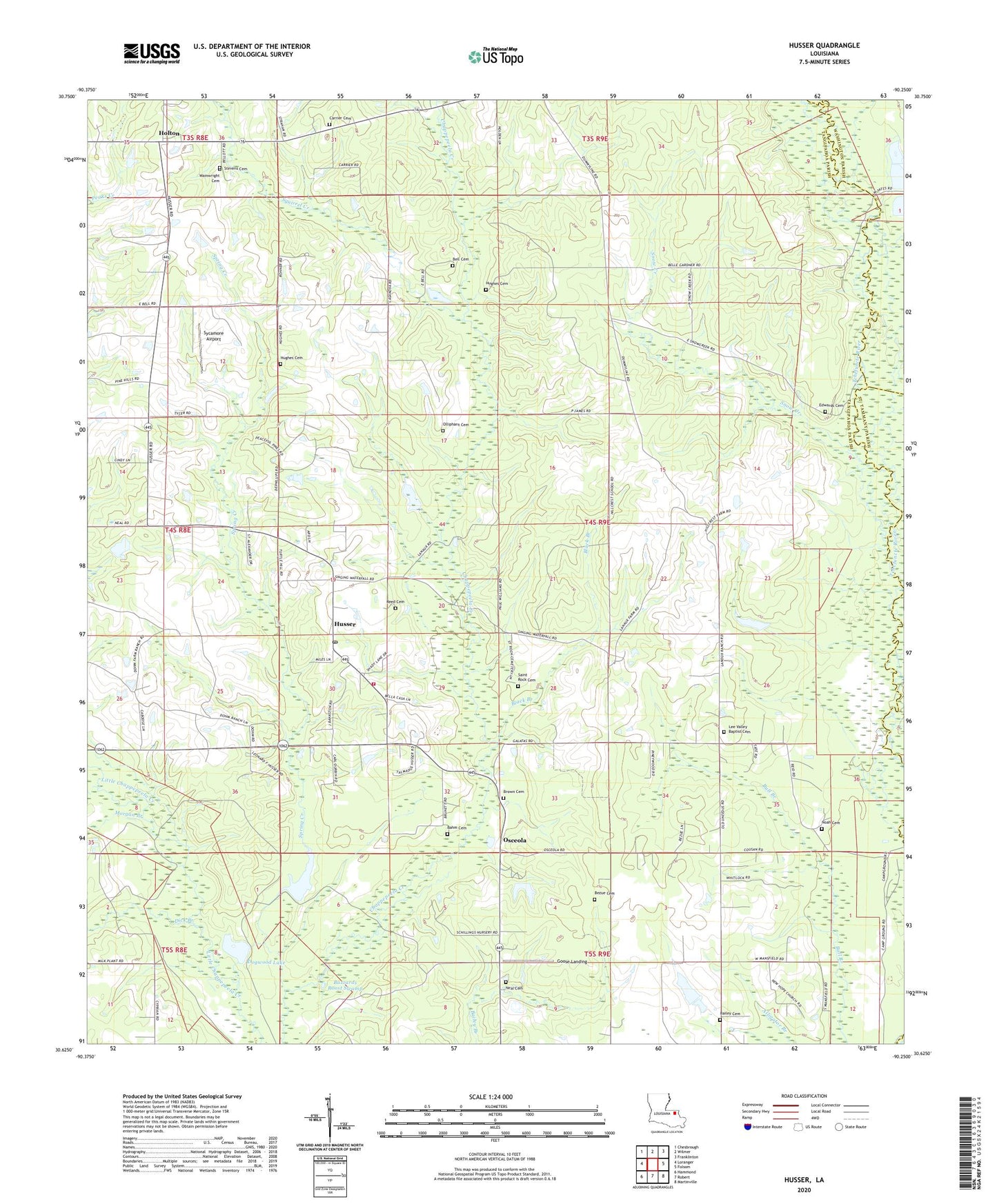
2024 topographic map quadrangle Husser in the state of Louisiana. Scale: 1:24000. Based on the newly updated USGS 7.5' US Topo map series, this map is in the following counties: Tangipahoa, Washington, St. Tammany. The map contains contour data, water features, and other items you are used to seeing on USGS maps, but also has updated roads and other features. This is the next generation of topographic maps. Printed on high-quality waterproof paper with UV fade-resistant inks.
Quads adjacent to this one:
West: Loranger
Northwest: Chesbrough
North: Wilmer
Northeast: Franklinton
East: Folsom
Southeast: Martinville
South: Robert
Southwest: Hammond
This map covers the same area as the classic USGS quad with code o30090f3.
Contains the following named places: Bahm Cemetery, Bailey Cemetery, Baldwin Chapel, Bell Cemetery, Bezue Cemetery, Black Branch, Brown Cemetery, Buzzards Roost Swamp, Carrier Cemetery, Catca Creek, Clark Branch, Dick Branch, Dogwood Lake, Edwards Cemetery, Epney, Goose Landing, Henry City, Hillcrest School, Holton, Holton Church, Hughes Cemetery, Husser, Husser Post Office, Husser Volunteer Fire Department Station 1, Lamaux Ranch, Lee Valley Baptist Church, Loranger Lookout Tower, Mary Branch, Morgan Branch, Mount Zion Church, Neal Cemetery, New Hope Baptist Church, New Sharon Baptist Church, Noah Cemetery, Olliphant Cemetery, Osceola, Parish Governing Authority District 2, Pleasant Valley Church, Reed Cemetery, Saint Dominic Church, Saint Rock Cemetery, Snow Creek, Spring Creek, Spring Creek Lake, Spring Creek Lake Dam, Squirrel Creek, Stevens Cemetery, Sycamore Airport, Tung Oil Lake Number One Dam, Tung Oil Lake Number Two Dam, Union Training School, Viola, Wainwright Cemetery, ZIP Codes: 70442, 70446