MyTopo
Robert Louisiana US Topo Map
Couldn't load pickup availability
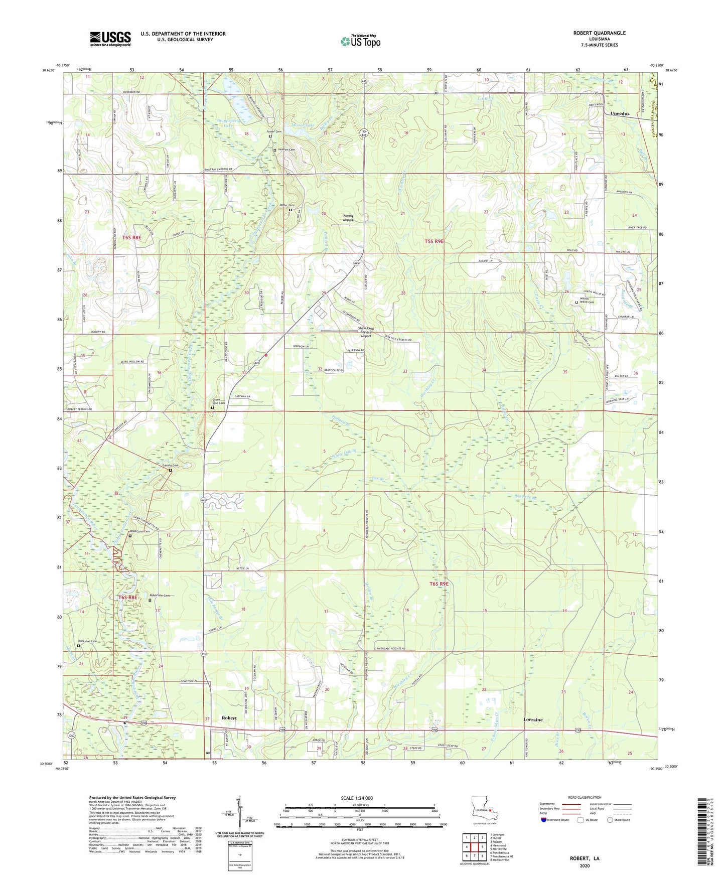
2024 topographic map quadrangle Robert in the state of Louisiana. Scale: 1:24000. Based on the newly updated USGS 7.5' US Topo map series, this map is in the following counties: Tangipahoa, St. Tammany. The map contains contour data, water features, and other items you are used to seeing on USGS maps, but also has updated roads and other features. This is the next generation of topographic maps. Printed on high-quality waterproof paper with UV fade-resistant inks.
Quads adjacent to this one:
West: Hammond
Northwest: Loranger
North: Husser
Northeast: Folsom
East: Martinville
Southeast: Madisonville
South: Ponchatoula NE
Southwest: Ponchatoula
This map covers the same area as the classic USGS quad with code o30090e3.
Contains the following named places: Alligator Branch, Baggage Branch, Bailey Branch, Bankston Cemetery, Bible Covenant Church, Camp Chemekete, Chappepeela Creek, Chappepeela Lake, Chappepeela Lake Dam, Chemekete Recreation Club, Cranky Corner, Creek Side Cemetery, Creekside Baptist Church, First Missionary Church, Fox Branch, Garahy Cemetery, Glenwood Baptist Youth Camp, Hennen Cemetery, Husser Volunteer Fire Department Station 2, Joiner Cemetery, Koenig Airpark, Little Chappepeela Creek, Little Creek, Lorraine, Lorraine Lookout Tower, Louisiana State University Hammond Experimental Station, Mirror Lake, Mirror Lake Dam, Mount Zion Church, Oak Grove Church, Pollard Branch, Regina Coeli Child Development Center, River Oaks, Robert, Robert Church of God, Robert Post Office, Robertson Cemetery, Shaw Crop Service Airport, Skulls Creek, Uneedus, White Oak Branch, Wilson - Willie Cemetery, Zemurray Airport, Zemurray Lodge, ZIP Code: 70455