MyTopo
Martinville Louisiana US Topo Map
Couldn't load pickup availability
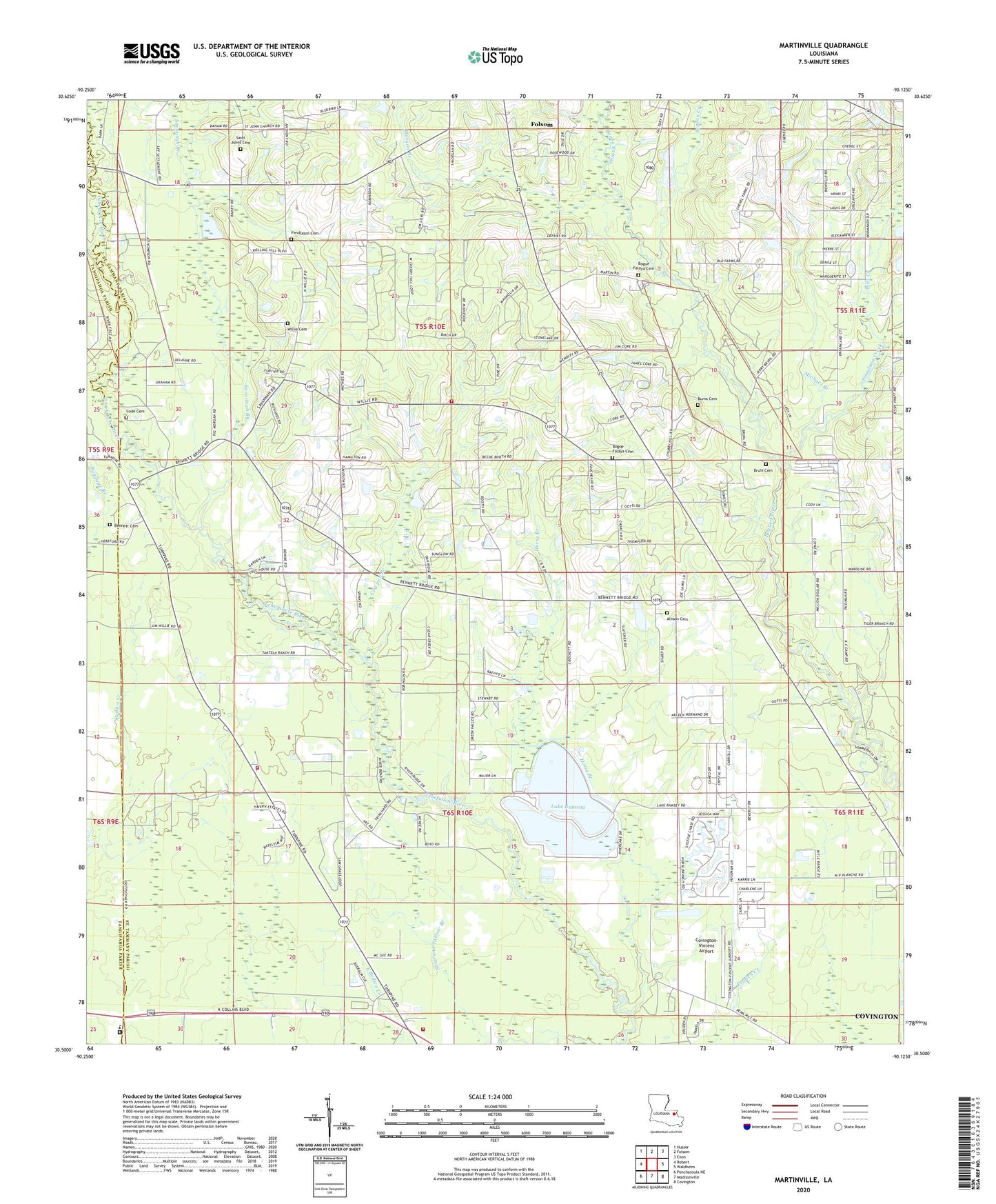
2024 topographic map quadrangle Martinville in the state of Louisiana. Scale: 1:24000. Based on the newly updated USGS 7.5' US Topo map series, this map is in the following counties: St. Tammany, Tangipahoa. The map contains contour data, water features, and other items you are used to seeing on USGS maps, but also has updated roads and other features. This is the next generation of topographic maps. Printed on high-quality waterproof paper with UV fade-resistant inks.
Quads adjacent to this one:
West: Robert
Northwest: Husser
North: Folsom
Northeast: Enon
East: Waldheim
Southeast: Covington
South: Madisonville
Southwest: Ponchatoula NE
This map covers the same area as the classic USGS quad with code o30090e2.
Contains the following named places: Allison Cemetery, Beason Creek, Bennett Cemetery, Bills Creek, Bogue Falaya Baptist Church, Bogue Falaya Cemetery, Bruhl Cemetery, Bull Branch, Burns Cemetery, Camp Covington, Code Cemetery, Covington-Vincent Airport, Cowpen Branch, Fendlason Cemetery, Florida Parishes Juvenile Detention Center, Florida Parishes Juvenile Detention Center Education Facility, Folsom Mission School, Goodbee Fire Protection District 13, Horse Branch, Lake Hills Sewage Treatment Plant, Lake Ramsay, Lake Ramsey Dam, Live Oak Church, Martinville, Michael Branch, Morgan Branch, P+l Ranch Pond Dam, Parish Governing Authority District 3, Pigeon Roost Creek, Ramsay, Red Bluff Baptist Church, Saint Johns Cemetery, Saint Johns Church, Saint Tammany Parish Fire District 13 Station 131, Saint Tammany Parish Fire District 5 Station 3, Savannah Branch, Savannah Branch Church, Simalusa Creek, Spell Pond, Spells Pond Dam, Ward Two, Wardline Church of God, Willie Cemetery, ZIP Code: 70437