MyTopo
Indian Lake Louisiana US Topo Map
Couldn't load pickup availability
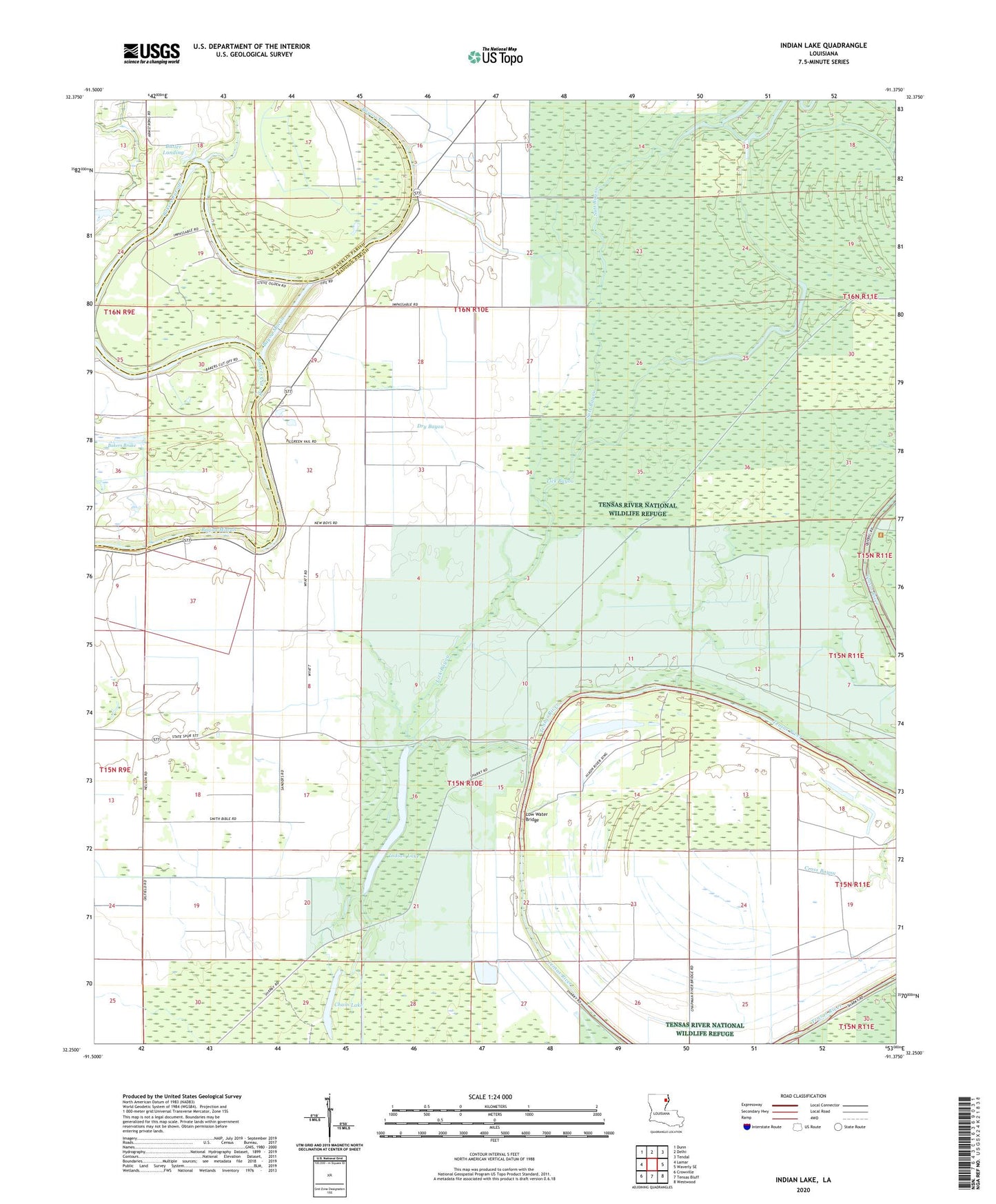
2024 topographic map quadrangle Indian Lake in the state of Louisiana. Scale: 1:24000. Based on the newly updated USGS 7.5' US Topo map series, this map is in the following counties: Madison, Franklin. The map contains contour data, water features, and other items you are used to seeing on USGS maps, but also has updated roads and other features. This is the next generation of topographic maps. Printed on high-quality waterproof paper with UV fade-resistant inks.
Quads adjacent to this one:
West: Lamar
Northwest: Dunn
North: Delhi
Northeast: Tendal
East: Waverly SE
Southeast: Westwood
South: Tensas Bluff
Southwest: Crowville
This map covers the same area as the classic USGS quad with code o32091c4.
Contains the following named places: Africa Lake, Bakers Cut-off, Buck Lake, Butler Landing, Chain Lake, Dry Bayou, Indian Lake, Jackson Landing, Lick Bayou, Little Fork Bayou, Lost Lake, Low Water Bridge