MyTopo
Delhi Louisiana US Topo Map
Couldn't load pickup availability
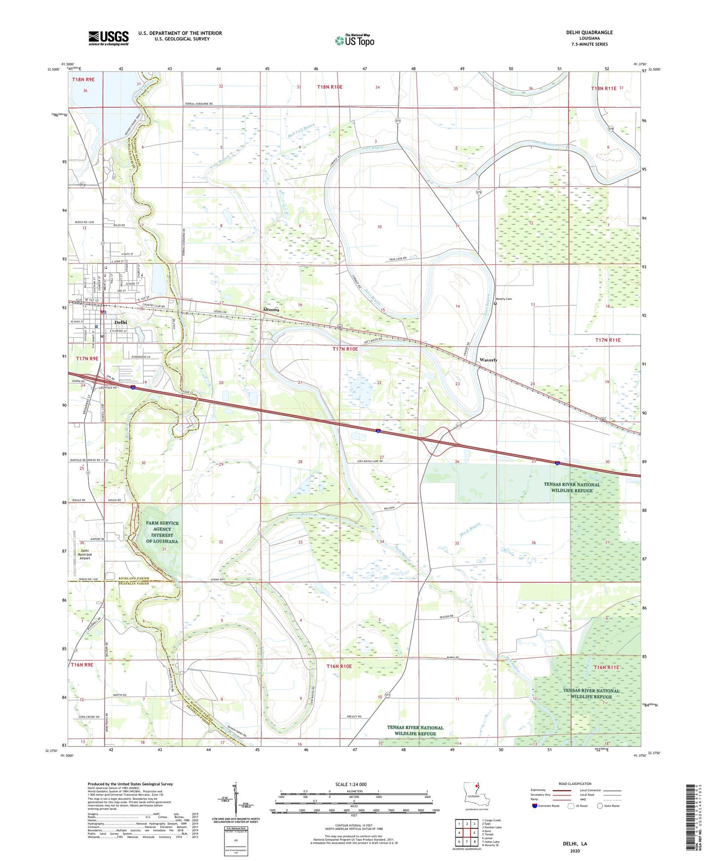
2024 topographic map quadrangle Delhi in the state of Louisiana. Scale: 1:24000. Based on the newly updated USGS 7.5' US Topo map series, this map is in the following counties: Madison, Richland, Franklin. The map contains contour data, water features, and other items you are used to seeing on USGS maps, but also has updated roads and other features. This is the next generation of topographic maps. Printed on high-quality waterproof paper with UV fade-resistant inks.
Quads adjacent to this one:
West: Dunn
Northwest: Congo Creek
North: Epps
Northeast: Panther Lake
East: Tendal
Southeast: Waverly SE
South: Indian Lake
Southwest: Lamar
This map covers the same area as the classic USGS quad with code o32091d4.
Contains the following named places: Altoona, Bull Calf Bayou, Couch Landing, County Landing, Cow Bayou, Delhi, Delhi Charter School, Delhi Compressor Station, Delhi Elementary School, Delhi Fire Department, Delhi High School, Delhi Hospital, Delhi Middle School, Delhi Municipal Airport, Delhi Oil Field, Delhi Post Office, Delhi Town Police Department, Francis Landing, Joes Bayou, Judd Lake, Mack Bayou, Midway Church, Red Hill Church, Scott Landing, Sutt Bayou, Town of Delhi, Waverly, Waverly Cemetery, Waverly Post Office, Zion Pilgrim Number 1 Church, Zion Pilgrim Number 2 Church, ZIP Code: 71232