MyTopo
Lac des Allemands Louisiana US Topo Map
Couldn't load pickup availability
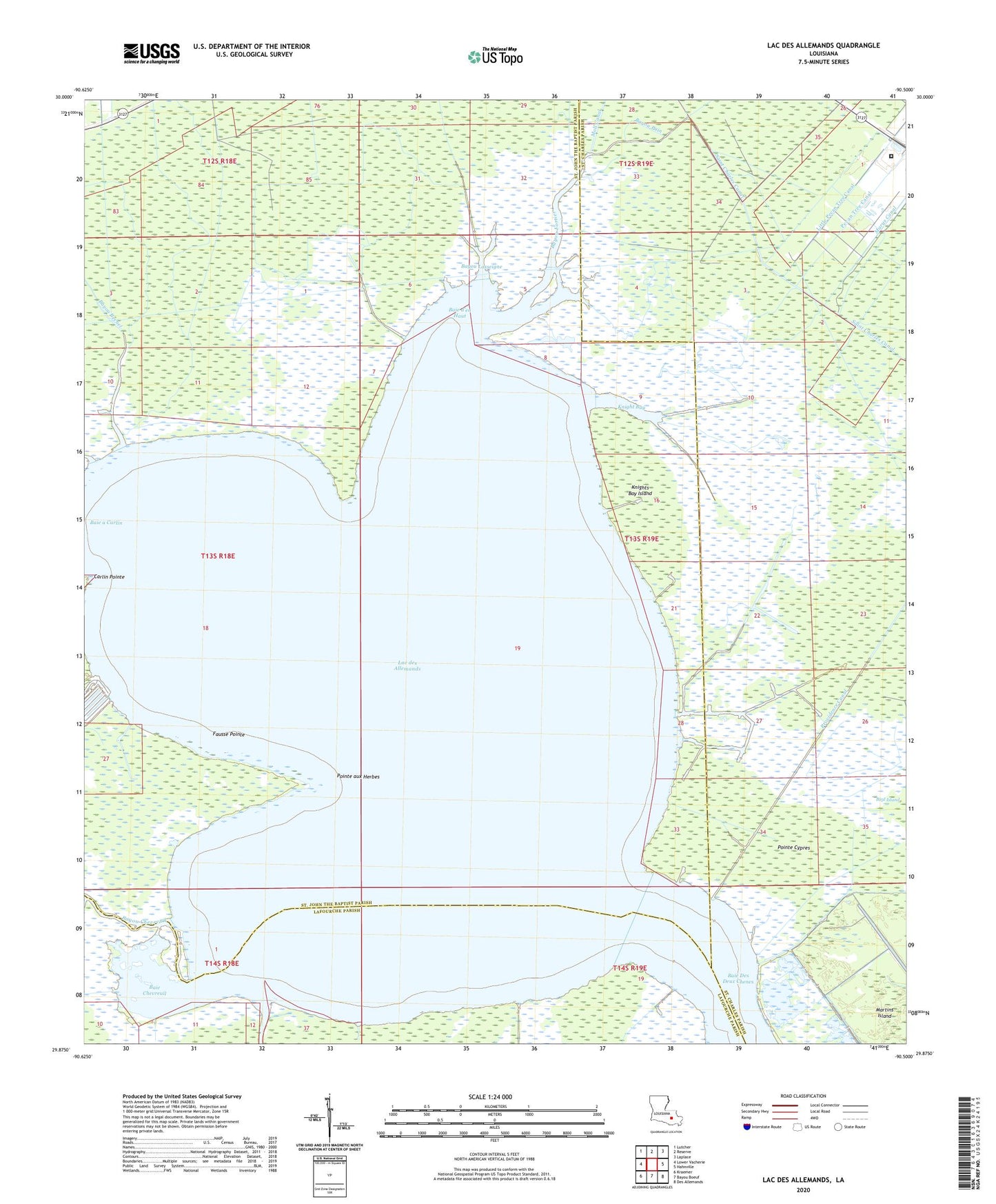
2024 topographic map quadrangle Lac des Allemands in the state of Louisiana. Scale: 1:24000. Based on the newly updated USGS 7.5' US Topo map series, this map is in the following counties: St. John the Baptist, St. Charles, Lafourche. The map contains contour data, water features, and other items you are used to seeing on USGS maps, but also has updated roads and other features. This is the next generation of topographic maps. Printed on high-quality waterproof paper with UV fade-resistant inks.
Quads adjacent to this one:
West: Lower Vacherie
Northwest: Lutcher
North: Reserve
Northeast: Laplace
East: Hahnville
Southeast: Des Allemands
South: Bayou Boeuf
Southwest: Kraemer
This map covers the same area as the classic USGS quad with code o29090h5.
Contains the following named places: Baie a Carlin, Baie Chevreuil, Baie d'en Haut, Baie Des Deux Chenes, Bayou Becnel, Bayou Boeuf, Bayou Chevreuil, Bayou Fortier, Bayou Lasseigne, Bayou Lassene, Bayou Pain, Bayou Rond Pompon, Carlin Pointe, Fausse Pointe, Knight Bay, Knights Bay Island, Lac des Allemands, Lacs Des Atlemands Gas Field, Lake Lucy Gas Field, Little Pecan Tree Canal, Lucy Gas Field, Martin Island Gas Field, Parish Governing Authority District 1, Pecan Tree Canal, Pointe aux Herbes, Pointe Cypres, Pointe Lavin Canal, Providence Canal, Saint Charles Canal, Ward Two