MyTopo
Lost Lake Louisiana US Topo Map
Couldn't load pickup availability
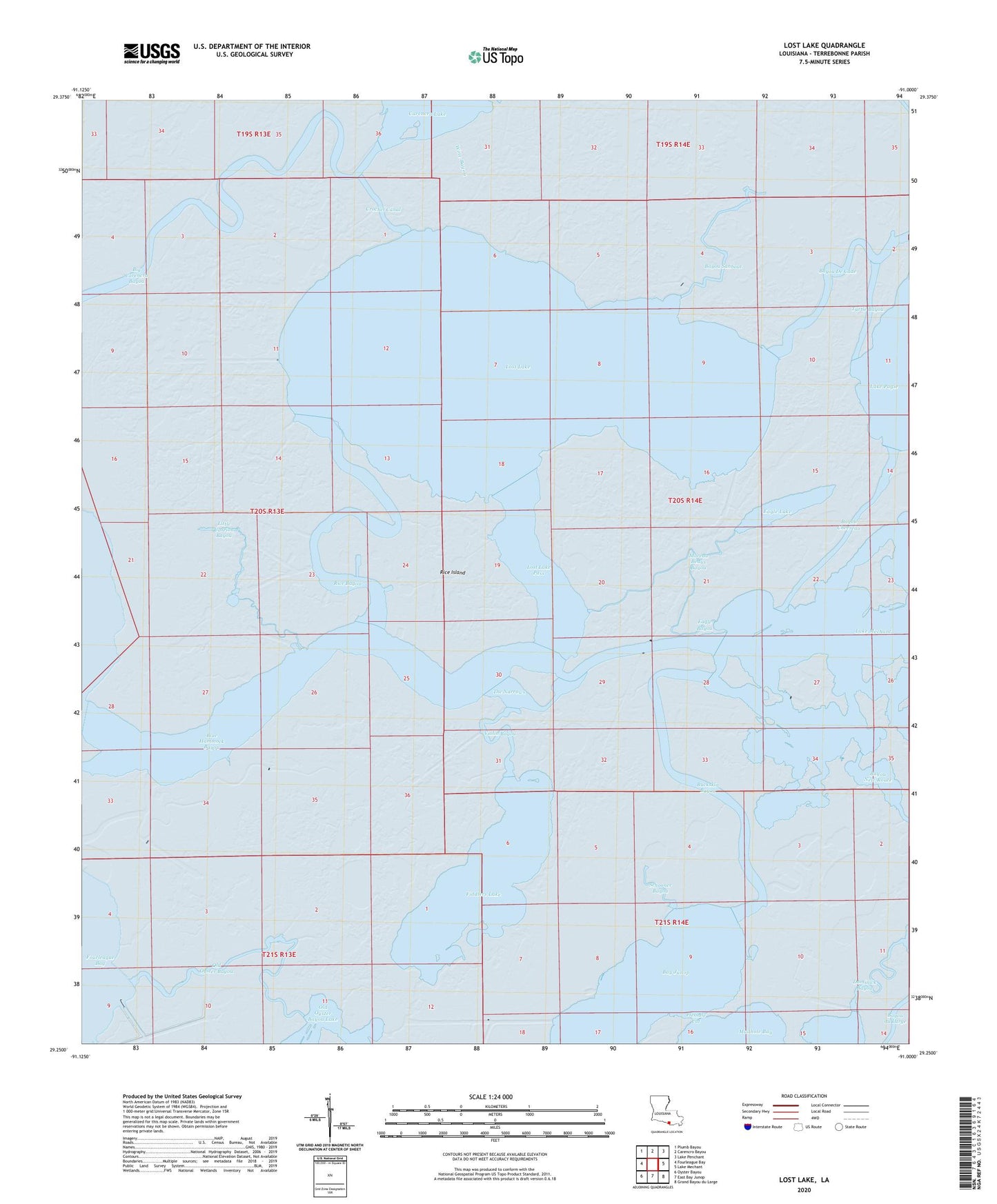
2024 topographic map quadrangle Lost Lake in the state of Louisiana. Scale: 1:24000. Based on the newly updated USGS 7.5' US Topo map series, this map is in the following counties: Terrebonne. The map contains contour data, water features, and other items you are used to seeing on USGS maps, but also has updated roads and other features. This is the next generation of topographic maps. Printed on high-quality waterproof paper with UV fade-resistant inks.
Quads adjacent to this one:
West: Fourleague Bay
Northwest: Plumb Bayou
North: Carencro Bayou
Northeast: Lake Penchant
East: Lake Mechant
Southeast: Grand Bayou du Large
South: East Bay Junop
Southwest: Oyster Bayou
This map covers the same area as the classic USGS quad with code o29091c1.
Contains the following named places: Bayou Chevreau, Bayou Mauvais Bois, Bayou New Route, Bayou Sanbout, Big Carencro Bayou, Blue Hammock Bayou, Buckskin Bayou, Crochet Canal, Eagle Bayou, Eagle Lake, Fiddlers Lake, Fiddlers Lake Gas Field, Little Carrion Bayou, Lost Lake, Lost Lake Pass, Moreau Beaux Bayou, Old Oyster Bayou, Plessale Cut, Rice Bayou, Rice Island, Schooner Bayou, The Narrows, Turtle Bayou, Violin Bayou, Wine Bayou