MyTopo
Mink Bayou Louisiana US Topo Map
Couldn't load pickup availability
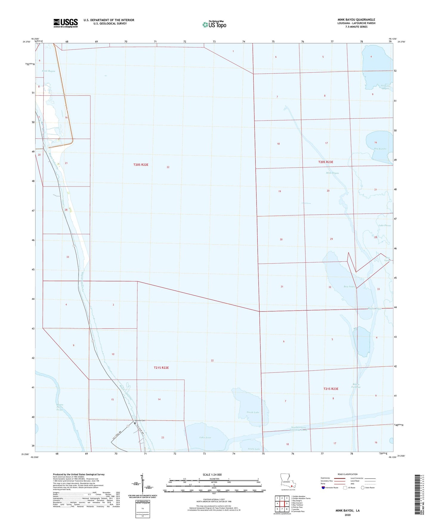
2020 topographic map quadrangle Mink Bayou in the state of Louisiana. Scale: 1:24000. Based on the newly updated USGS 7.5' US Topo map series, this map is in the following counties: Lafourche. The map contains contour data, water features, and other items you are used to seeing on USGS maps, but also has updated roads and other features. This is the next generation of topographic maps. Printed on high-quality waterproof paper with UV fade-resistant inks.
Quads adjacent to this one:
West: Bay Courant
Northwest: Golden Meadow
North: Golden Meadow Farms
Northeast: Bay Dosgris
East: Bay Tambour
Southeast: Caminada Pass
South: Leeville
Southwest: Pelican Pass
Contains the following named places: Bay Diego, Bay Jaque, Bay Jaque Oil Field, Bay Rambo, Bayou Ferblanc Oil Field, Bayou Jaque, Lake Jesse, Leeville Oil and Gas Field, Mink Bayou, North Lake, Parish Governing Authority District 9, Round Lake, Southwestern Louisiana Canal