MyTopo
Morganza Louisiana US Topo Map
Couldn't load pickup availability
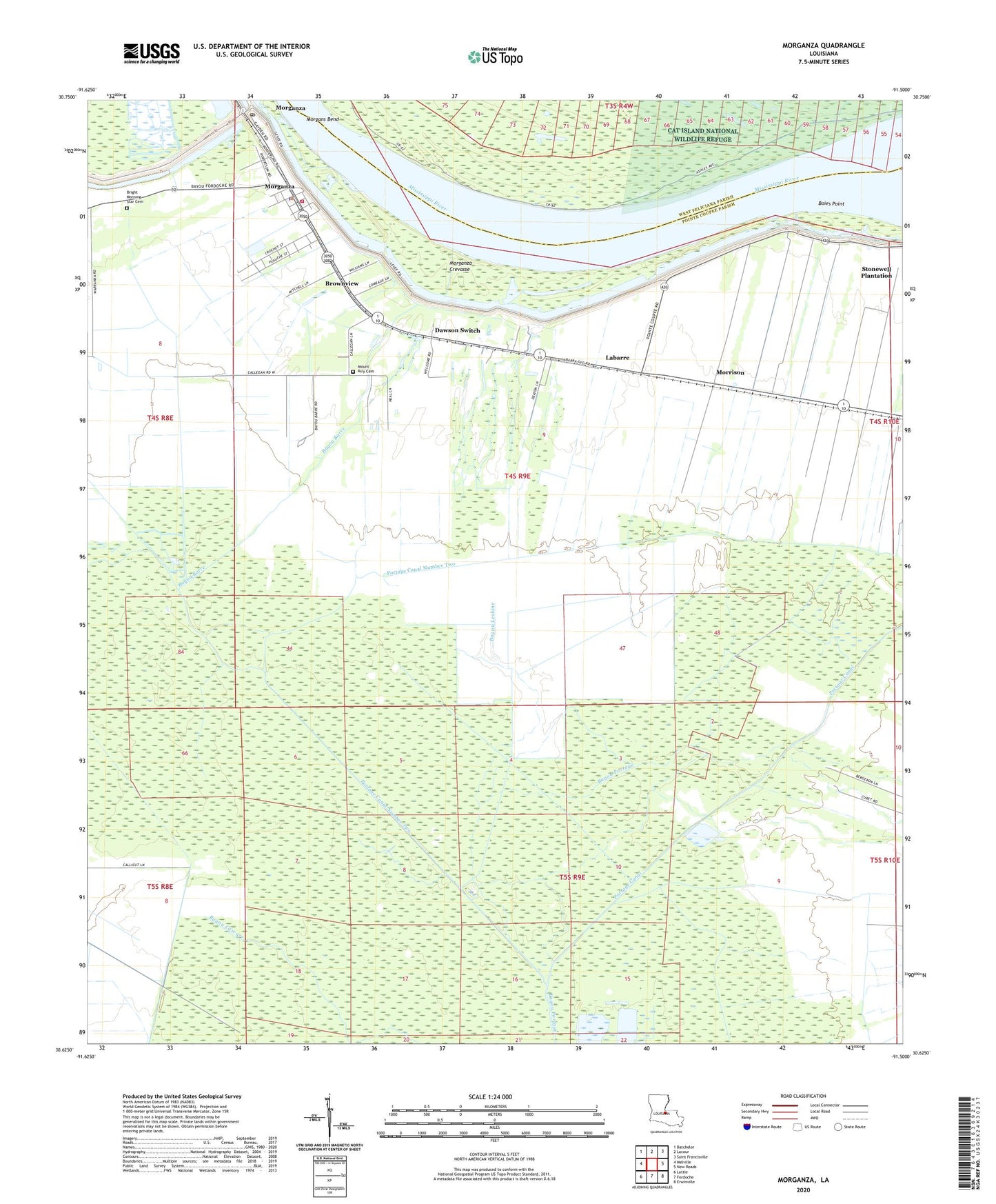
2020 topographic map quadrangle Morganza in the state of Louisiana. Scale: 1:24000. Based on the newly updated USGS 7.5' US Topo map series, this map is in the following counties: Pointe Coupee, West Feliciana. The map contains contour data, water features, and other items you are used to seeing on USGS maps, but also has updated roads and other features. This is the next generation of topographic maps. Printed on high-quality waterproof paper with UV fade-resistant inks.
Quads adjacent to this one:
West: Melville
Northwest: Batchelor
North: Lacour
Northeast: Saint Francisville
East: New Roads
Southeast: Erwinville
South: Fordoche
Southwest: Lottie
Contains the following named places: Angeles Plantation, Bayou Barre, Bayou Leskine, Bethel Baptist Worship Center, Boies Point, Boies Point Revetment, Bright Morning Star Church, Brownview, Brunswick Plantation, Buckhorn Bayou, Dawson Switch, Frederick Spur, George Spur, Judge Digby Gas Field, Kelsey, Labarre, Labarre Elementary School, Labarre Post Office, Louisiana Noname 47 Dam, Moore-Sams Oil Field, Morgans Bend, Morganza, Morganza Crevasse, Morganza Elementary School, Morganza High School, Morganza Landing, Morganza Police Department, Morganza Revetment, Morganza Volunteer Fire Department, Morning Star Baptist Church Cemetery, Morning Star Church, Morrison, Mount Airy Cemetery, Mount Airy Church, New Roads Police Department - Maintenance Shop, Pointe Coupee Central High School, Pointe Coupee Parish, Pointe Coupee Parish Library Morganza Branch, Portage Canal, Portage Canal Number Two, Saint Anns Catholic Church, Samuels, Sixth Ward Church, Stewart Plantation, Stonewell Plantation, Village of Morganza, Ward Five, Ward Four, Wilbert School, Zugg, ZIP Code: 70759